Hi ABraun,
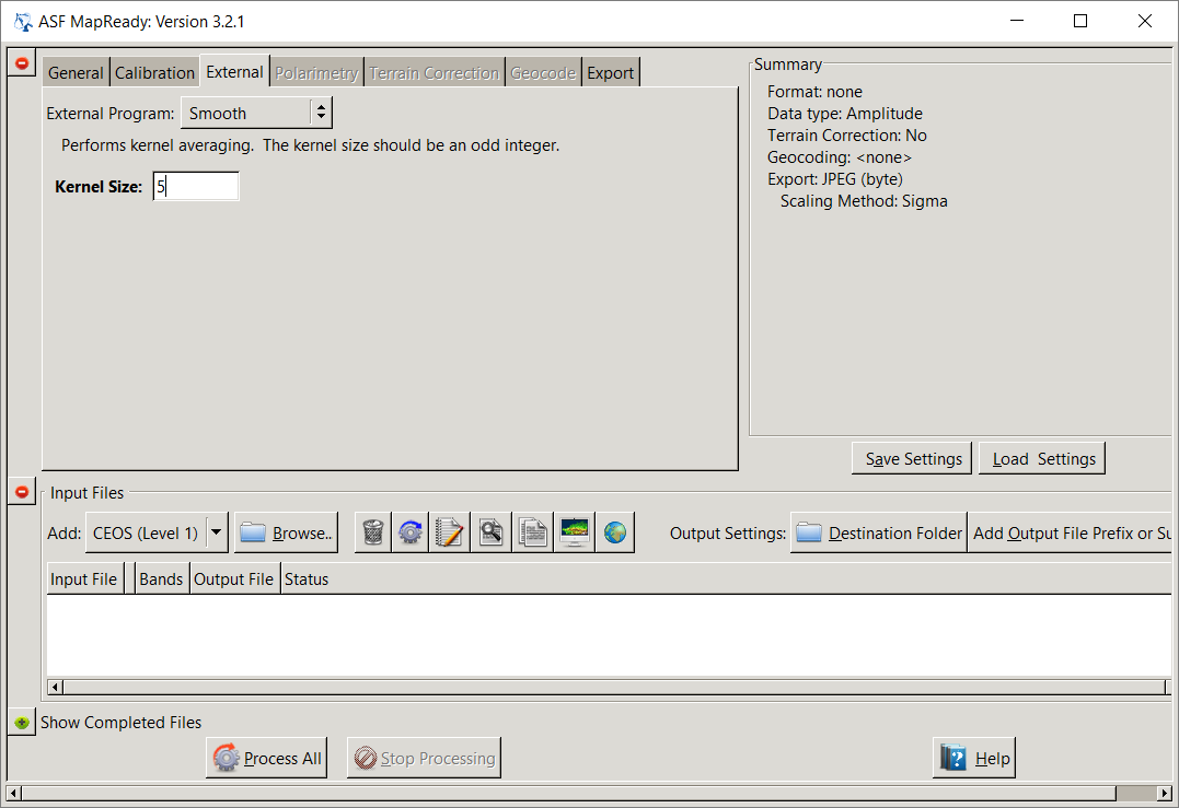
I used MapReady for ALOS-1 L1.5 for Terrain correction, and it worked well, I want to do calibration, speckle filtering and Terrain correction, there is calibration and Terrain correction in MapReady, but there is no speckle filtering option, and the input was the original CEOS file, I performed the speckle filtering in SNAP after the Terrain correction, but it does not give good results, it has to be carried out before the Terrain correction? what is your opinion?
You can either use the MapReady internal smoothing option. It is a bit hidden. You have to chek “run external program” in the General Tab and then select Smooth and a window size:
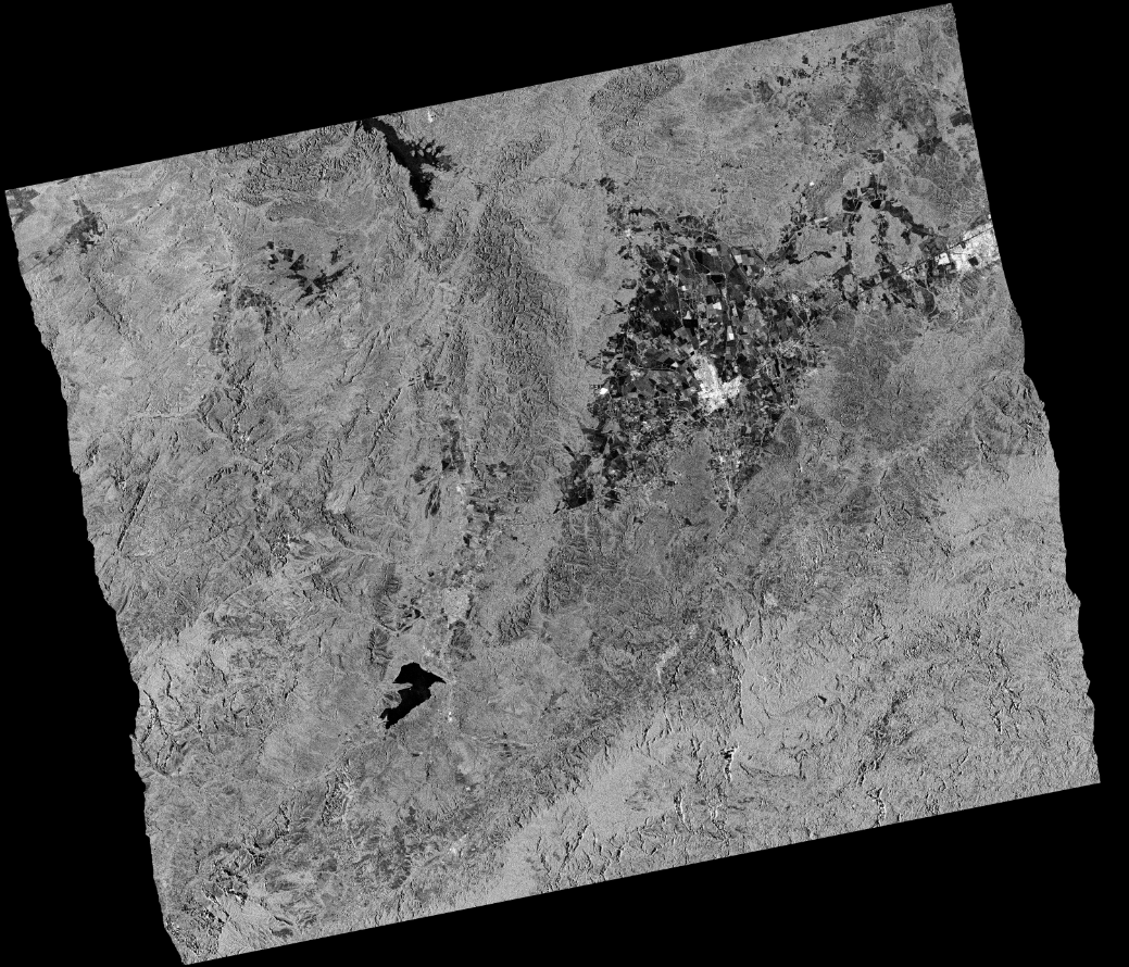
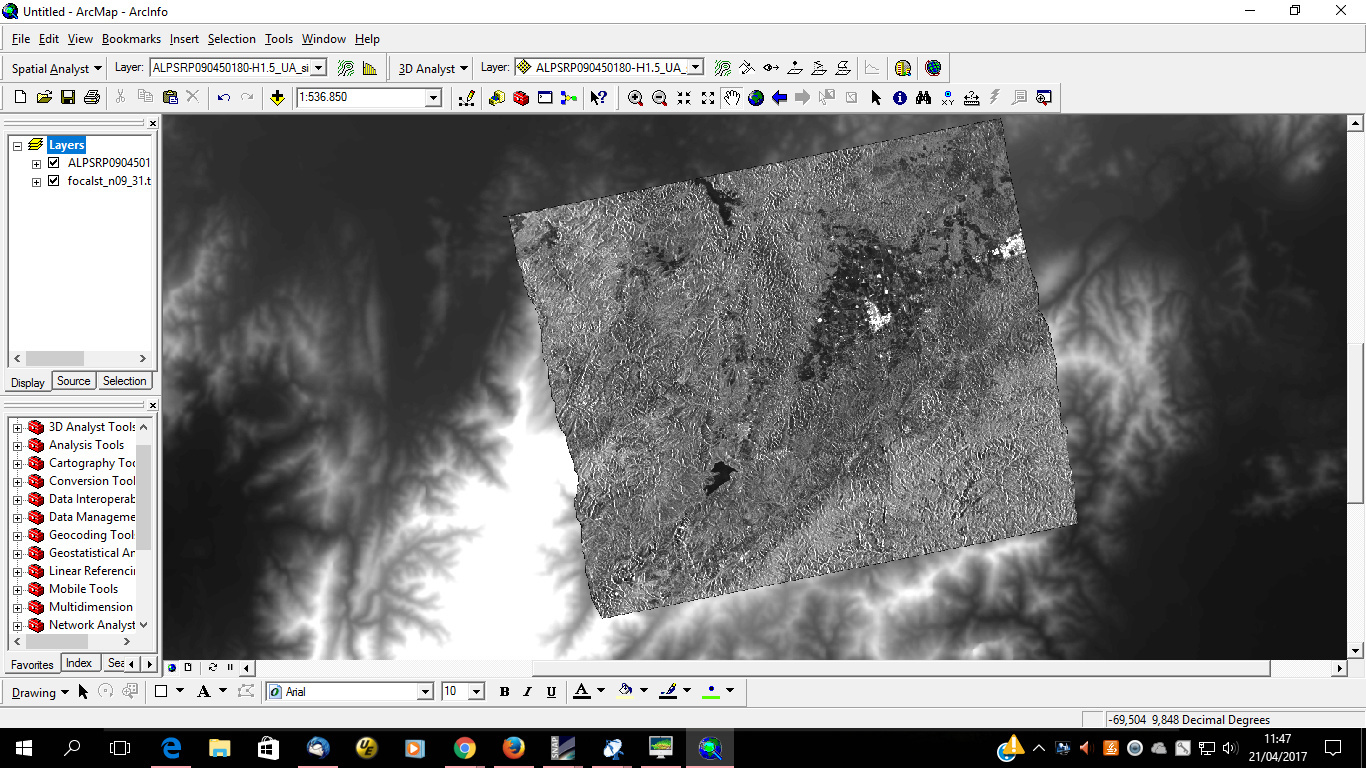
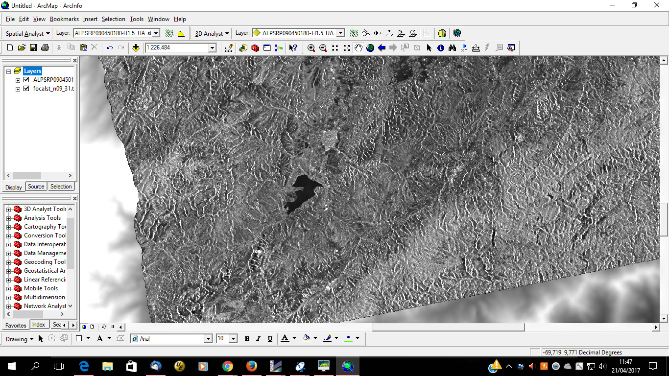
For orthorectification of ALOS PALSAR 1 images is necessary deskewing the data to transfer into a zero Doppler before of apply terrain correction, below, my image without geometric distortions. The processing was applied for level 1.1
Image level 1.5 of ALOS PALSAR 1 processed with Map Ready, the DEM used was SRTM 30m downloaded of Earth Explorer and its processing with Arc Map for voids fill
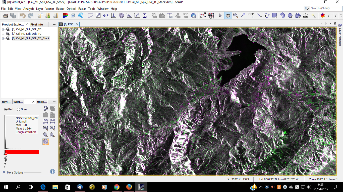
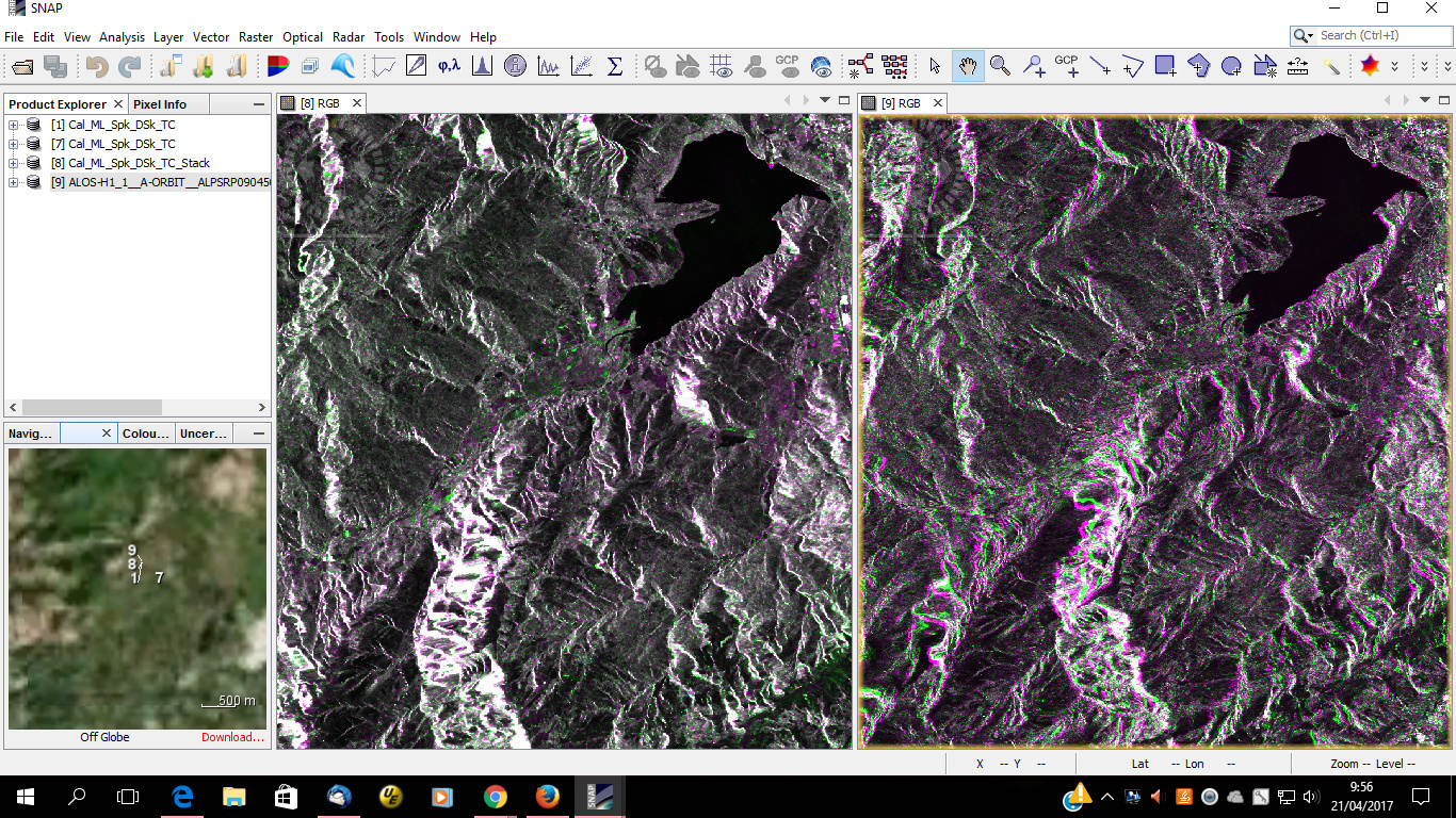
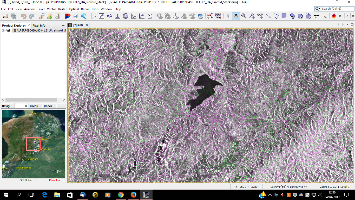
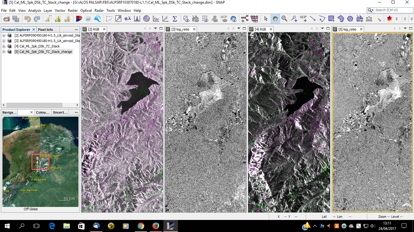
Screenshot with composition multitemporal in RGB and log ratio bands, for an area in Venezuela, the images are ALOS PALSAR 1, in levels 1.5 and 1.1 for change detection, using amplitude and intensity, please take look this, the images 1 and 2 (left to right) are bands extracted from level 1.5 using amplitude; and bands 3 and 4 are levels 1.1 using intensity
Hi all
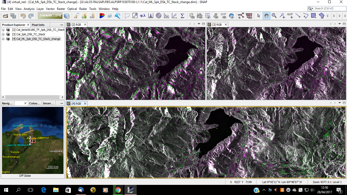
I posted an screenshot with composition multitemporal in RGB, now I see radiometric distortions for this I maked different processings for ALOS PALSAR 1 images level 1.1…
In the top left the image was processed using correction for radiometric distortions (Terrain flattening), filter, deskew and terrain correction plus stacking.
In the top right image was processed using correction radiometric, filter, deskew, terrain correction plus stacking.
Below the image was processed using correction radiometric, multilook, filter, deskew, terrain correction plus stacking.
My question is: Why I not have better visualization with the terrain flattening?