Deskewing and calibrating is fine before coregistration, but multi-looking and filtering resamples your images and changes the actual image statistics. So I would rather do that after the coregistraton.
Depending on your application you could even skip the calibration part. Are you planning to do interferometry?
hai ABraun! thanks for your asnwer, yes i want to do interferometry process. like what you suggest, i tried but the result become like this. the images doesn’t combine when i look at coregistration images. thanks again!
You are trying to coregister ascending with descending. It may technically work but makes no sense in terms of interferometry. Look direction, resolution, incidence angle and track (relative orbit) should be equal.
oh i know, thanks. after i did what you suggest, my interferogram looks like wrong, should i do pre-processing before do interferogram steps? like geometric correction? thanks before!
no, interferometry should be performed in slant range geometry, so this would rather harm your data quality then increase it.
What do you mean by “the interferogram looks wrong”? Can you provide a screenshot?
Did you consider temporal decorrelation? You can check the coherence layer first to see where your data is of good quality (coherence > 0.4).
yes, there is a InSAR stack overview tool which shows you the modeled coherence. But this doesn’t take into account vegetation and other dynamics, just the technical side of coherence.
Hi again Mr. ABraun!
so for several weeks i tried make interferogram using any match imagaries, and the results are like below. the steps i have done is:
deskewing alos
calibrate
coregistration
multilooking
interferogram generate
topographic phase removal
filtering phase
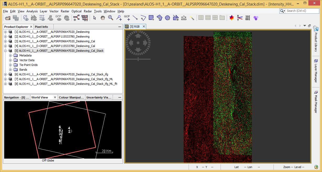
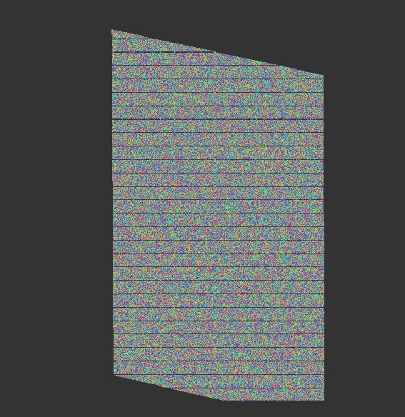
unfortunetly when i did coregistration i think the imageries-pair does not overlap well ( i attached the picture below)
yes, the images are from same track, i checked. then what should i do?
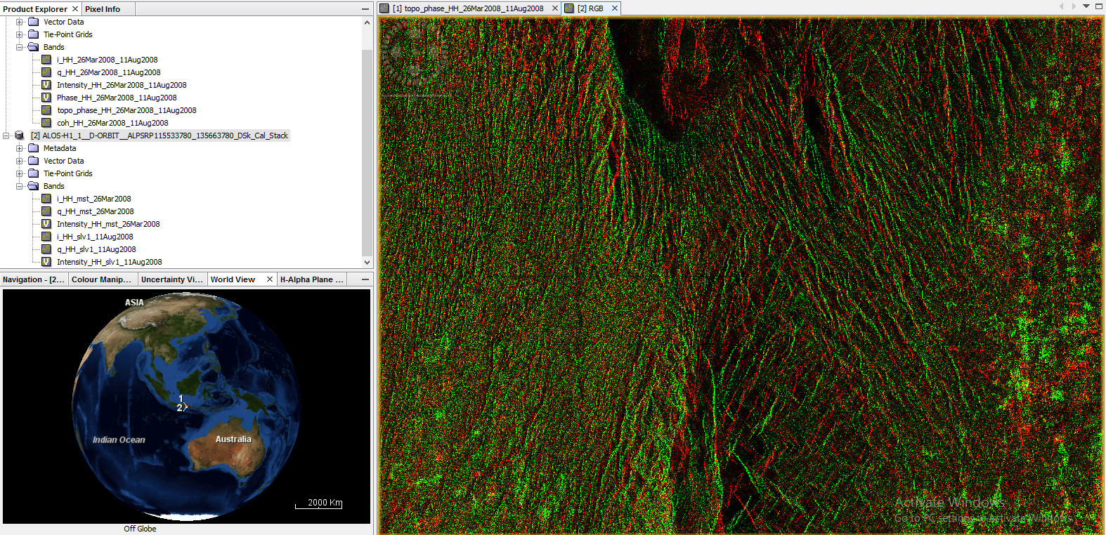
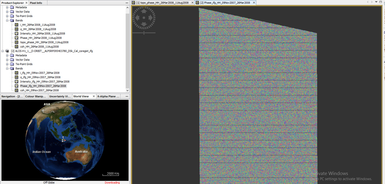
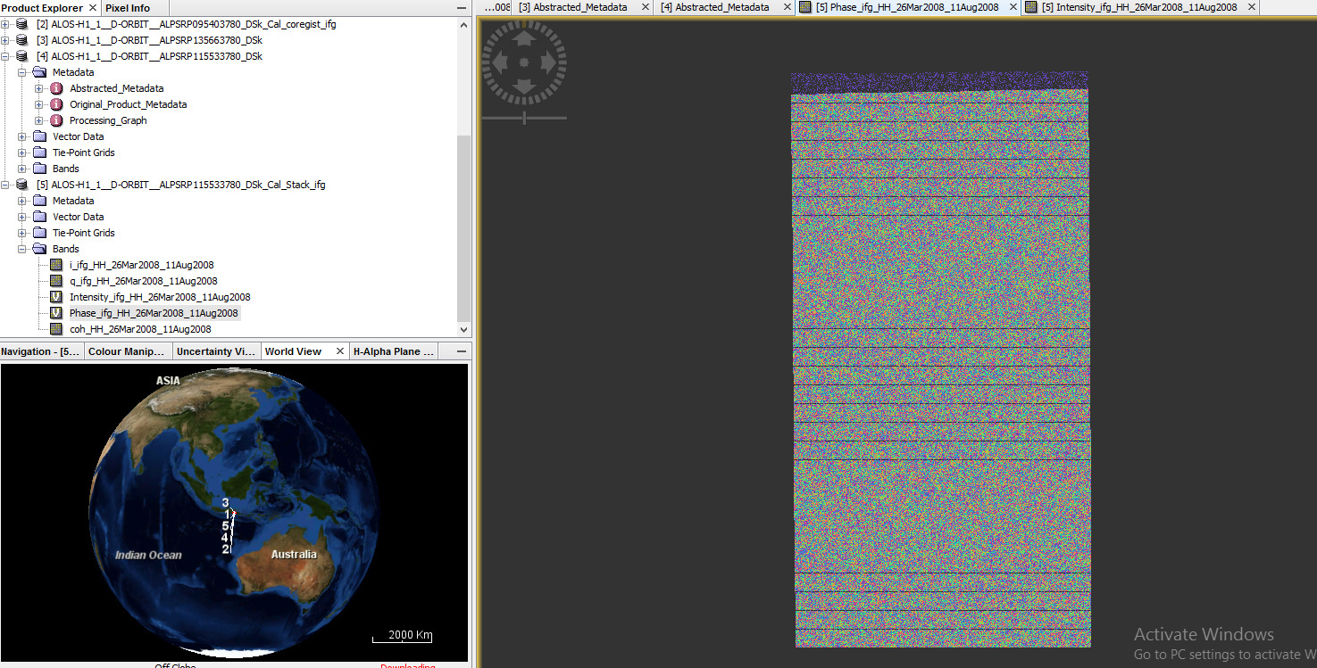
the phase from interferogram is still same like what i asked before ( i tried several data and the result is same) in this picture below:
hi, i still could not solve my problem. maybe the mistake is the pair of images that i used. if the images that would be interferometry pair should above and below, therefore the overlap lower part of the above image and upper of below image?
Thanks a lot!
oh ok, i understand. what i use is in the same frame and path, so the overlap is endlap between both images. When i saw the batch processing (InSAR Graphs) for sentinel1, there is a step apply orbit file. is it needed for alos palsar 1? because when i see that tool in SAR Processing menu, no option for alos palsar.