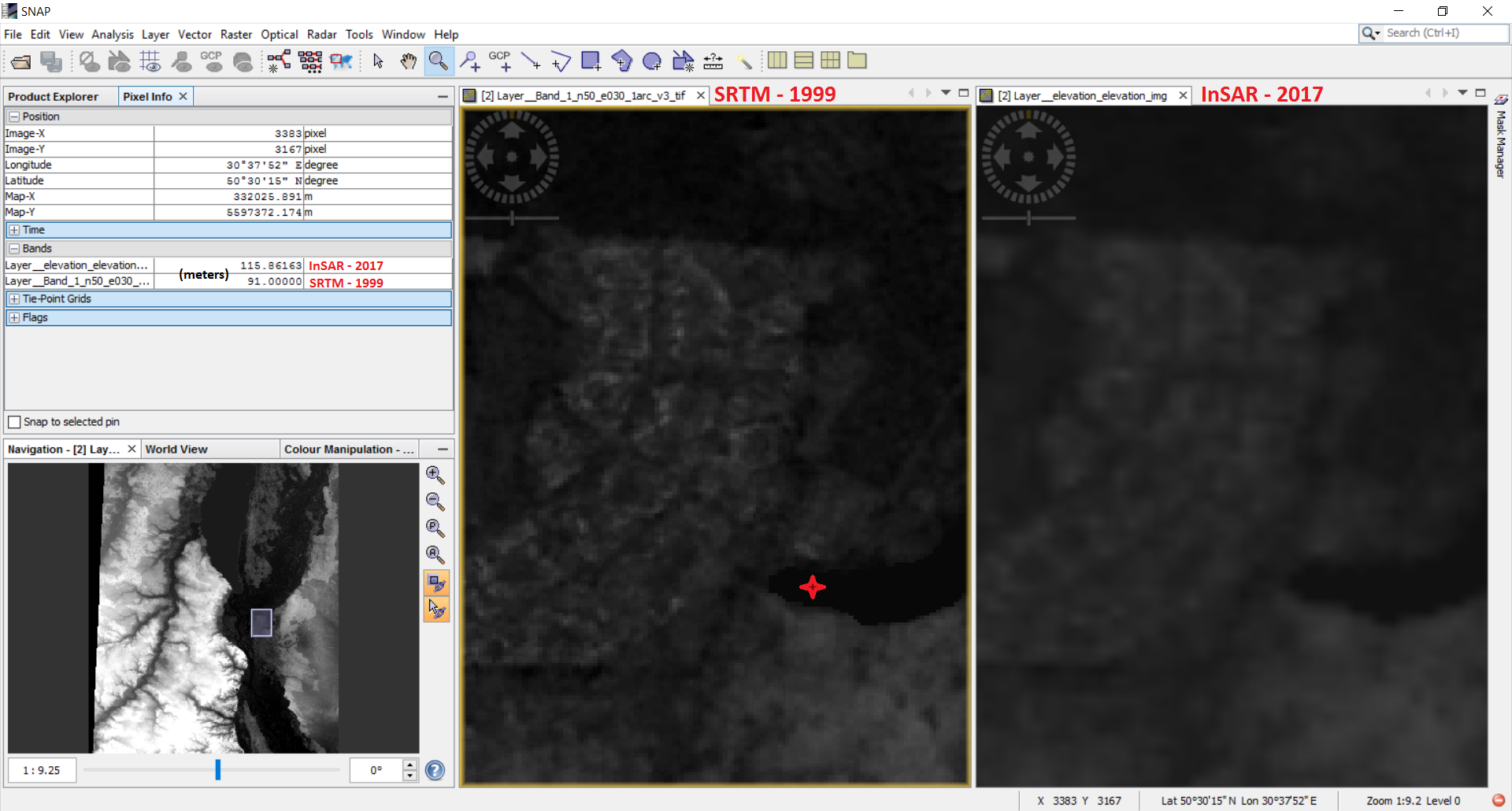
Here I have two DEMs: InSAR elevation obtained after interferometry anf SRTM. I used SRTM 3ArcSec to produce InSAR dem. So, it have to have close value of elevation value. But you can see on this screenshot that the value is different on more than 20m. The value is taken from the pixel corresponding a lake. Nothing have change after almost 20 years - the same lake on the same territory. And such difference appears on all my InSAR DEMs.
Why it could happen: values of two DEMs built from the same source are different on 20m.
Thank you for feedback.