Maybe not related to your question: Why do you reproject after Terrain Correction? You could directly use the desired coordinate reference system in the TC module.
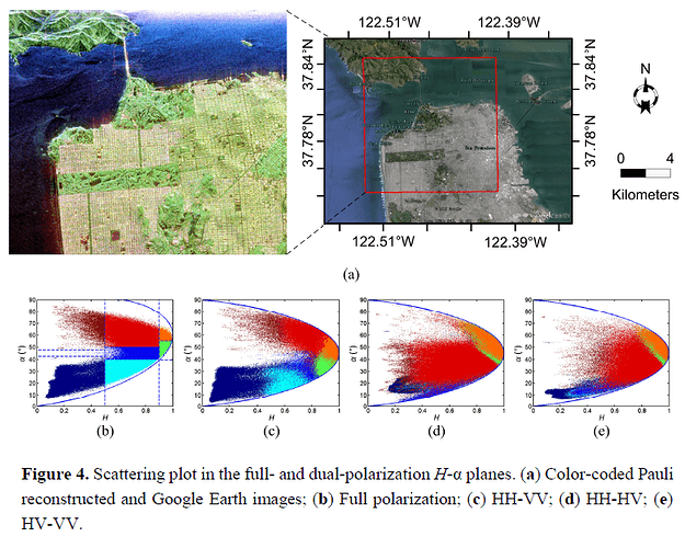
About the result: Sentinel-1 has only 2 polarizations. It is currently discussed if this is enough for a decomposition which was originally based on quad-pol data.
Most studies indicate that the quality is lower than for quad-polarized data:
Sources:
