@cfatras How did you make the subset?
@ABraun at the same step Katherine indicated, it is to say after the backgeocoding and debursting of the data. I used the “Spatial subset from view” tool.
hmm, the coordinates in slant geometry often differ a bit from the actual geolocation but in your case the shift is too large to be caused by coordinate conversion alone. Does the exported image show the content of the blue frame or does it conatin the content of the red frame but shifted to the east?
I first thought it might be the slant geometry but indeed the shift is too important.
The exported image shows mostly the content of the red image, but looking at the location of the corner coordinates it corresponds to the blue one, as seen after on by StaMPS. I hope I’m clear…
@ABraun: I tried it again. I used these two products (stack_ifg_deb and stack_ifg_deb_dinsar), also added and saved the elevation band to the stack_ifg_deb_dinsar product. The dem folder still didn’t appear. I have no idea about that …
Dear Katherine,
I’ m appreciate your detail instructions, it helps me a lot, but I have a question here, should I apply Goldstein Phase filtering or Multilooking to the interferogram before export?
All the best
Fei
@Sharon: I can’t explain that, sorry. The only thing I could recommend would be starting from the beginning again and strictly stick to Katherine’s list.
My problem was solved by the way, mt_prep_gamma works fine and generates the output.
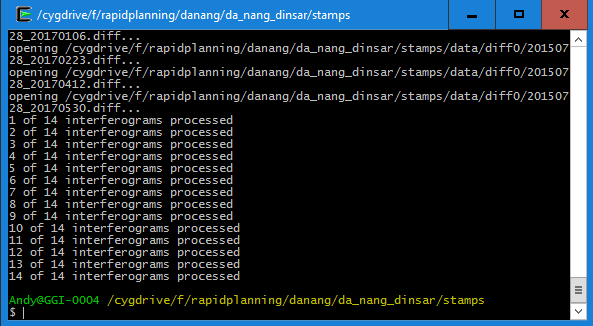
However, I now struggle with the first step of StaMPS:
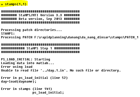
@FeiLiu: Is this the same error you were receiving? I checked annd the file day.1.in doesn’t exist. Can anyone tell me at which step it is created and how it should look like?
Edit: Didn’t work with cygwin and Windows, but worked in Linux with tcsh
1 Like
Hi ABraun,
It’s not the problem I have met, but for unknown reason I think you have run the wrong function in step 1, if you check the source code of stamps.m in line 138, you will find that the parameter “insar_processor” should be “gamma" and you should run ps_load_initial_gamma instead of ps_load_initial, and I think that is the reason why you get the error message.
Hope this helps,
Fei
1 Like
Dear Fei,
I am happy that my work appeared to be useful.
StaMPS works with wrapped interferograms as input. Unwrapping is done with PS at the last stage. So, you should not do Goldstein Phase filtering or Multilooking before export to StaMPS. You can do Multilooking just to exemine your interferograms - this sometimes helps to determine a signal.
Good luck,
Katherine
2 Likes
Dear Fei,
thanks for the hint - you were right. I have a file “processor” that states ‘gamma’ but apparently it was not read correctly and the if statement led to the wrong process. I guess theses are the things that go wrong under Windows because Linux doesn’t show this error. So I’m going to stick to Linux for the future.
Dear Katherine,
Thank you for your reply, I think you are right about Goldstein Phase filtering. But I’m still confused about multilooking , Andy Hooper in his StaMPS PS exercise:http://seom.esa.int/landtraining2015/files/Day_4/D4P2a_LTC2015_Hooper.pdf
he use the multilooking interferograms to do PS, besides, I used to view the parameter of Doris, which in StaMPS is used to create interferograms, it also do multilooking by default when generate interferogram.
All the best
Fei
1 Like
Dear Fei,
Yes, you are right, multilloking in doris is done by default. But as far as know for PS selection original ifgs are involved. Multilooked ifgs are only for veiwing. But this is not for Sentinel. I think yoy may try if you like. Please, let me know if multilooking works with Sentinel.
Good luck,
Katherine
1 Like
Dear Katherine,
Thank you for your advice, I may do the experiment later, and I will keep you updated. 
All the best,
Fei
Sorry for insisting a bit, but did someone have the same issue as mine (coordinate shift)? How did you solve it?
I cannot find any similar issue and have no clue about what is going on…
Hi cfatras,
I think maybe you should use Geo coordinates instead of Pixel coordinates to create subset image. Or there is another tool which may help you, in the menu View->Tool Windows->WorldWind Anysis View, after you create a subset, it will show the region cut from original image in world map.
Here is my example:
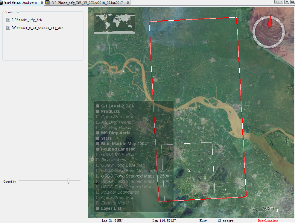
Red box 1 is the original image, white box 2 is the subset image.
Hope this helps,
Fei
1 Like
Dear FeiLiu,
Thanks for your help!
I tried both kind of subsetting, this does not change anything, sadly…
The tool indeed helps, but also changes nothing. Maybe the subset region I’m working on for testing the whole process is too small, but I do not think this might change the issue.
I really do not understand what is going on.
Following on my issue, maybe that might help.
Going from SLC to GRD, the coordinates do not change and the issue remains the same. It is only after applying the terrain correction that the coordinates are finally the proper ones.
Well, for StaMPS the “offset” remains of about 0.015º.
@ABraun : Thanks for your help. I will run from the beginning. But I want to make sure that I need make interferogram before deburst, right? Thank you!
yes, the Deburst operator merges the created interferograms.
I had exatly the same problem.
I decided (arbitrarily) to export to StaMPS images after terrain correction (StaMPS works on the amplitude of the images and terrain correction don’t produces effects on).
If you decide to use my same method, you must use great attention: StaMPS recives in input incorrect heading angle (heading angle is a parameter during step 1) and during elaboration appears an incorrect value. I searched where StaMPS uses heading angle, but I haven’t found functions with explicit call to head angle, so I’m went on. If you find errors/problems/call direct or indirect to functions, please tell me.
My BIG problem is with incorrect results by topo remove, but since I didn’t find a solution, i’m working hard to bypass this.