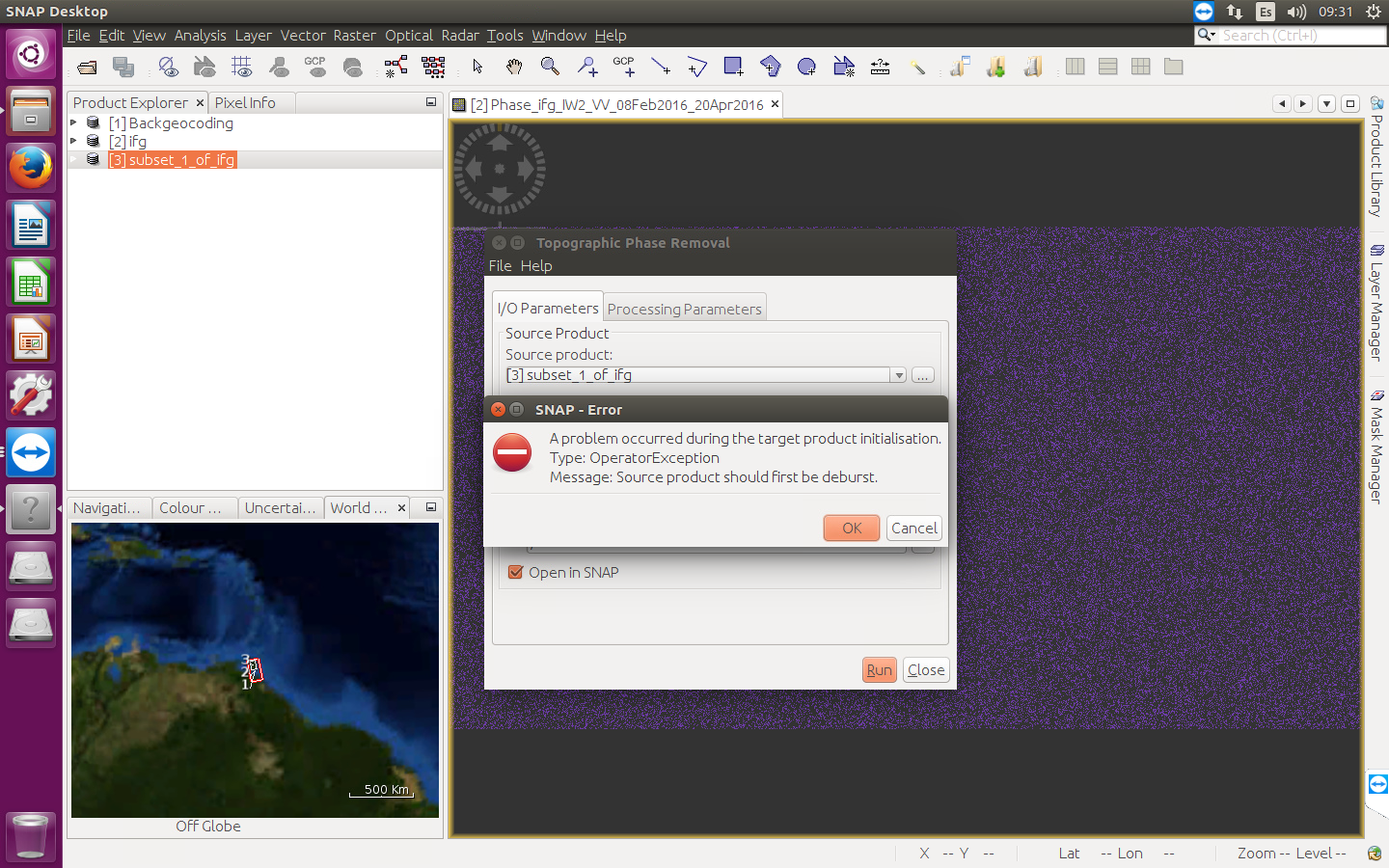
I have found in this two documents that you have to do Deburst after the Interferogram formation.
http://sar.kangwon.ac.kr/s1a/TOPS_tutorial.pdf
It is also suggested to do before ifg and you can do it unless you don’t get any error message.
I have found in this two documents that you have to do Deburst after the Interferogram formation.
http://sar.kangwon.ac.kr/s1a/TOPS_tutorial.pdf
It is also suggested to do before ifg and you can do it unless you don’t get any error message.
Hi @bayzidul
I did the steps: Split— Orbit, all images to Backgeocoding stack, ifg— subset, but when was for to apply topographic phase removal I had the next message 
Dear all
I have edited all the steps and this is more clear now.
Thanks to all
THANKS!!!

Hi @bayzidul
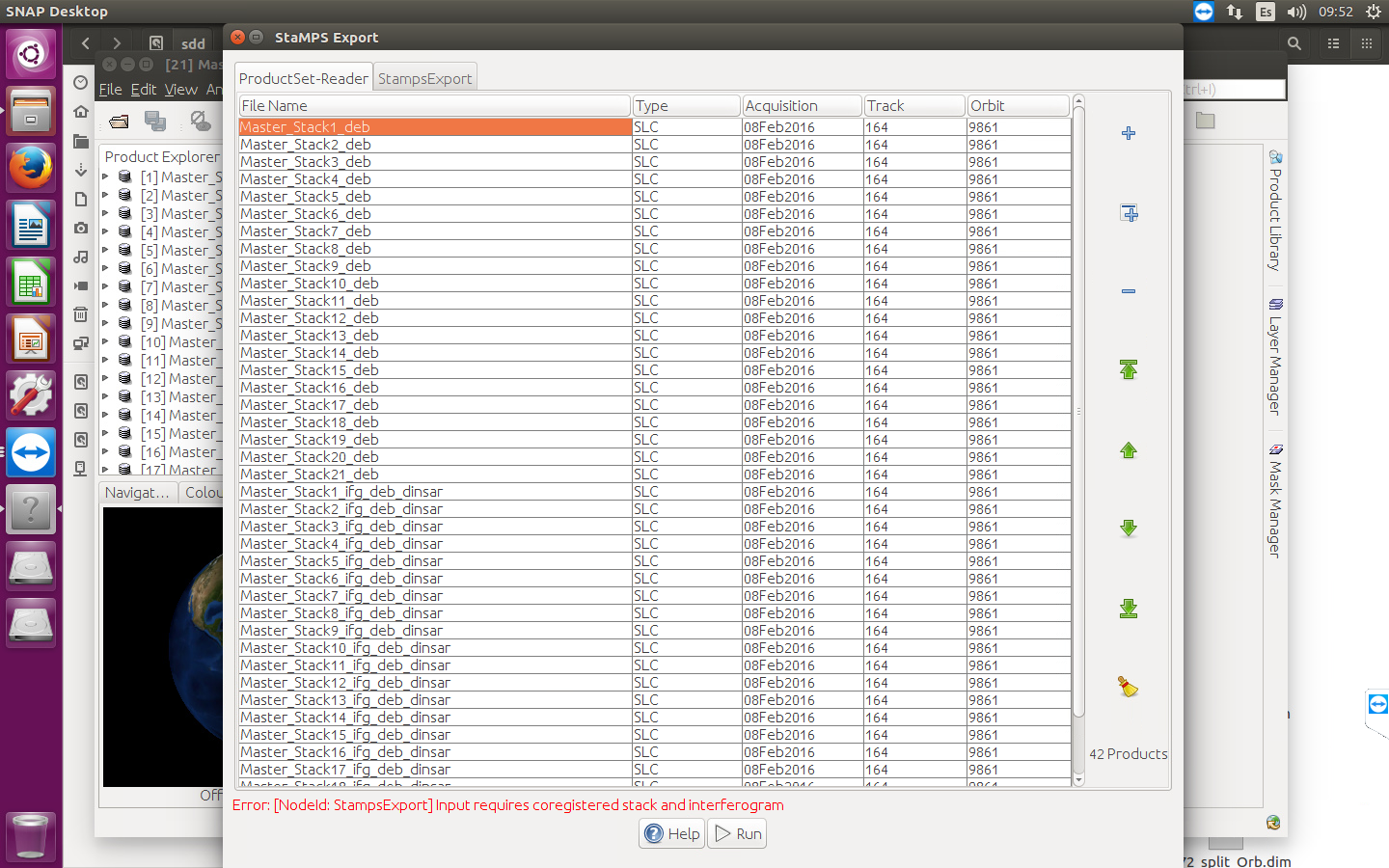
I did the steps from your tutorial, but when I go export for StaMPS I have an error: Input requires coresgistered and interferogram
Please you can help me with this
Thanks for advance
I have never tried this way, but you have to export pair by pair. For instance, add Master_stack1_deb and Master_stack1_ifg_deb_dinsar to export stamps. Each time you will have 4 directories and here you can follow these steps.
Export to StaMPS the two files:
Then next steps…
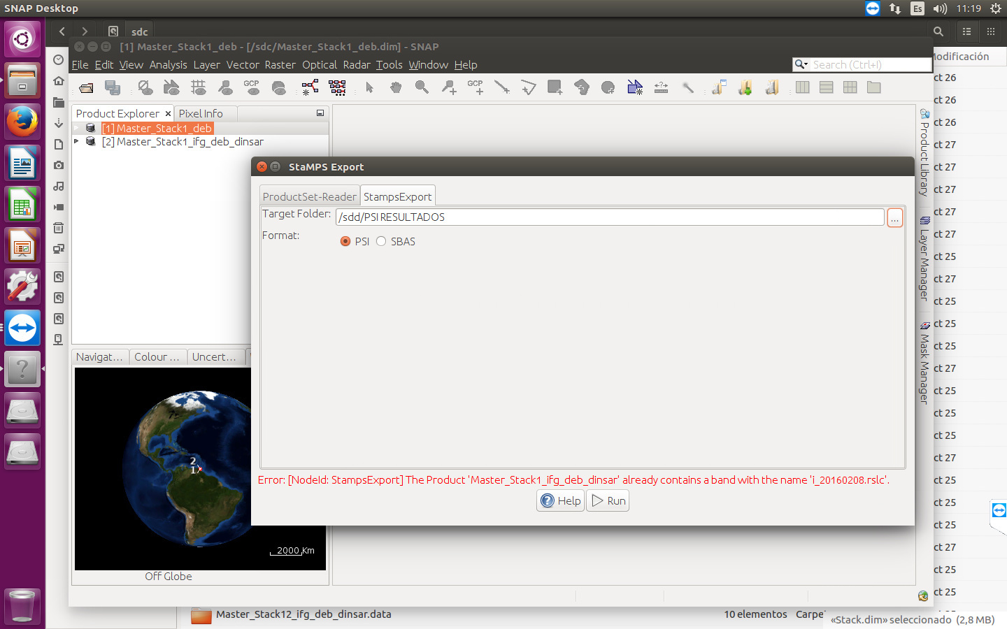
Hi @bayzidul thanks for the fast reply, now I have the following error, thanks again for your support!!!
Hi Katherine,
Many thanks for sharing your experience. It helped me a lot but one thing is still not clear to me, which is the format of the *.lon and *.lat files. Can you please tell me what is the format of the binary file?
Thank you
Hello all;
Any one knows what is the binary format of the *.lon and *.lat files?
Thank you.
As far as I understood it, you just use the export to Gamma format.
Thank you for your comment ABraun;
In fact I am not using SNAP. Just wanted to know the format of these files. However you draw my attention to install SNAP and try to know the format from there.
Thanks
I just presumed that because this is the SNAP forum 
I think the type of the file is LAT file and LON file but in linux I found it is .rslc format.
Dear Katherine,
I follow your step,
but I cannot proceed StaMPS export
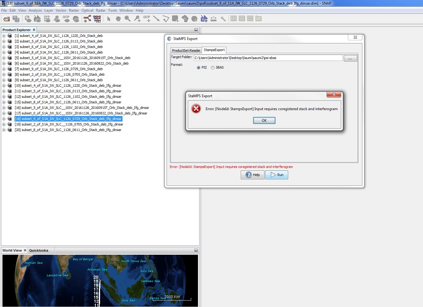
I used 10 Sentinel-1A images, and procceed two images separately into each folder. Deburst, subset of ifg and dinsar(+elev band) into each folder.
Then I called back each file in each folder to apply StaMPS export but Snap said not registered and inferogram
Thank you
@jefriza, for Stamps export, you must use (for example for your subset 4) only the single pair “_deb” and “_deb_ifg_dinsar” .
So you must do 9 different export for 9 subset.
Thank you annamaria,
I will try
In my experience, this appears with snap 5.0 when ifg have different names respect deb coregistrated images. Which version do you use?
You might read all post in this topic: i remember that same issue appears to other members.
I am still use 5.0, not upgrade yet