Dear colleagues,
I’d like to share some good results obtained after creation of interferogram for a landslide event.
In this case SNAP did perfect job.
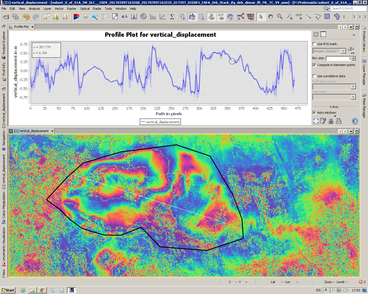
In the upper part is the profile plot taken by the white line. The black shape corresponds roughly to the shape of the area of the lignite mine where the event happened.
Just for clarification - I had to downgrade SNAP to ver.5.0 in order to make the interferograms with ver.6.0 I got errors.