I’m doing some processing using Sentinel 1A SLC IW data, in particular I’m using 2 pairs of S1 data:
First pair: 18 May 2016 and 30 May 2016
Second pair: 29 July 2016 and 10 August 2016
The processing chain I followed per each pair is this: Coregistration, Deburst, Interferogram, Filter (Goldstein), Unwrapping (TOPO) with Snaphu, Phase to elevation, Terrain Correction.
Now I’d like to know why the height values of the two unwrapped images (18May-30May and 29Jul-10Aug) is so different even where the coherence between them is enough high???
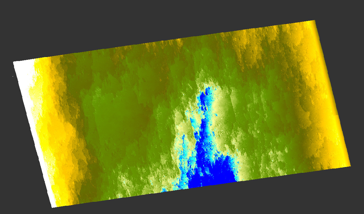
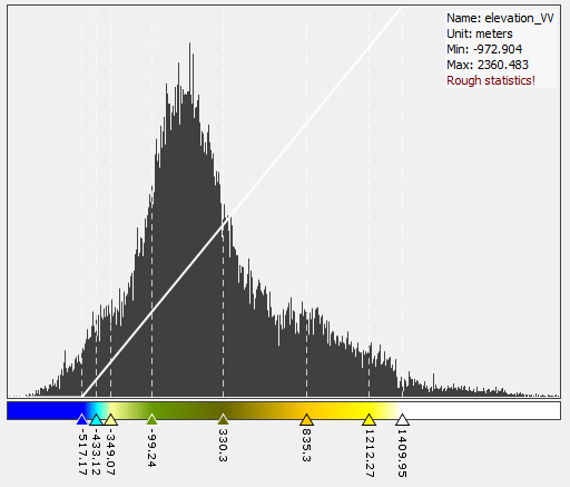
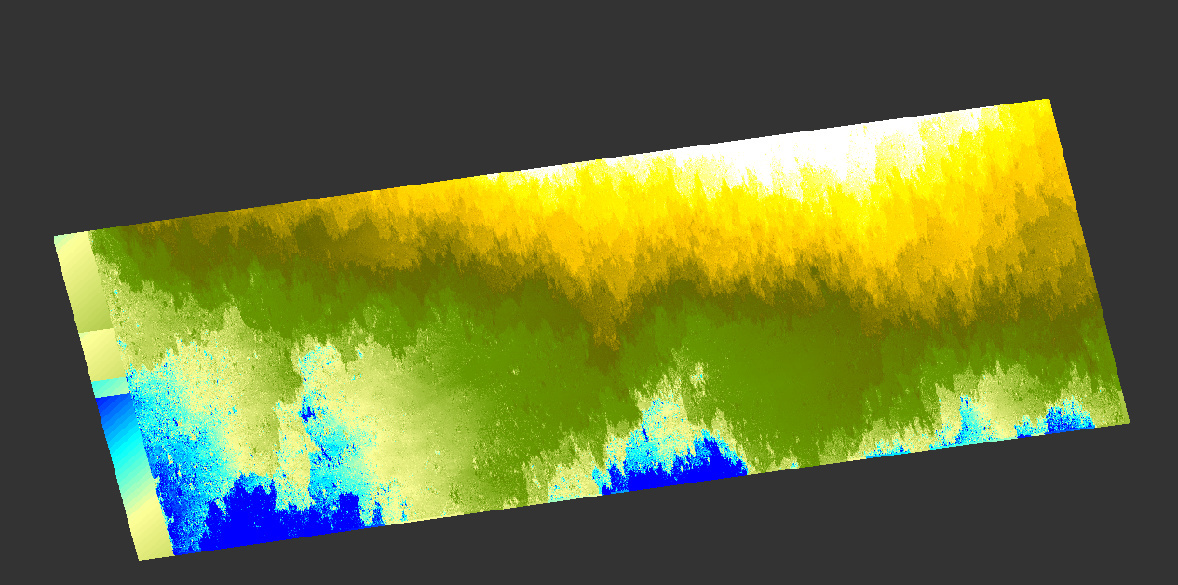
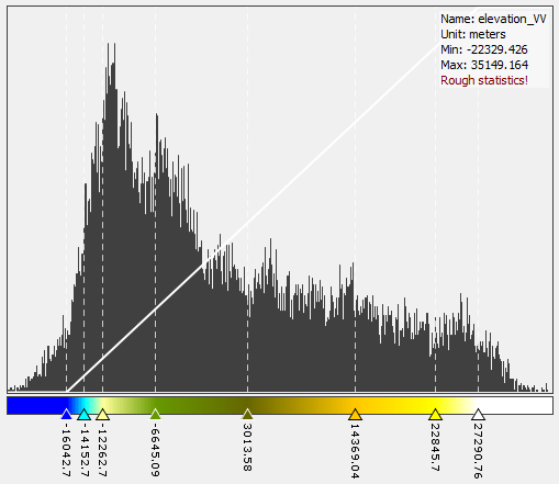
Can you please provide screenshots of the output rasters and their histograms?
Do you mean the elevation is different between both image pairs or different from the original SRTM values?
in a spatial sense I would say yes. Unfortunately, repeat pass interferometry is subject to many error sources which can cause different elevation patterns.
About the absolute values: Phase to height converts the unwrapped interferogram into relative heights. These need subsequently to be adjusted to absolute heights.
Have you tried the Phase To Elevation module? It uses a reference DEM so the absolute heights may be closer together here.
Yeah I’m sorry! What I tried is Phase to elevation, because phase to height processor doesn’t work I don’t know why. I mean, when I run it nothing happen.
same here. A window pops up for a second, then nothing happens.
I saw some people using it here. Would be interesting what is different with their data or work flow.
Yes! Anyway I’m trying another kind of processing: 30 May - 17 Jul - 10 Aug
I think that I had such a difference between the pairs I showed you because they are not coregistrated between them. So the first pair has got a baseline, the second has got another baseline.
I totaly agree with you. The software still under development and I believe this errors should be tackled by developers before moving forward in a new options. So single interferogram should be an indicator of the study area except of atmospheric error. However, in SNAP in addition to the atmospheric error the accumulation of other sources of error makes or gives this trend of elevation patterns . Hope so to get an opinion of @mengdahl
Hi, ABraun.
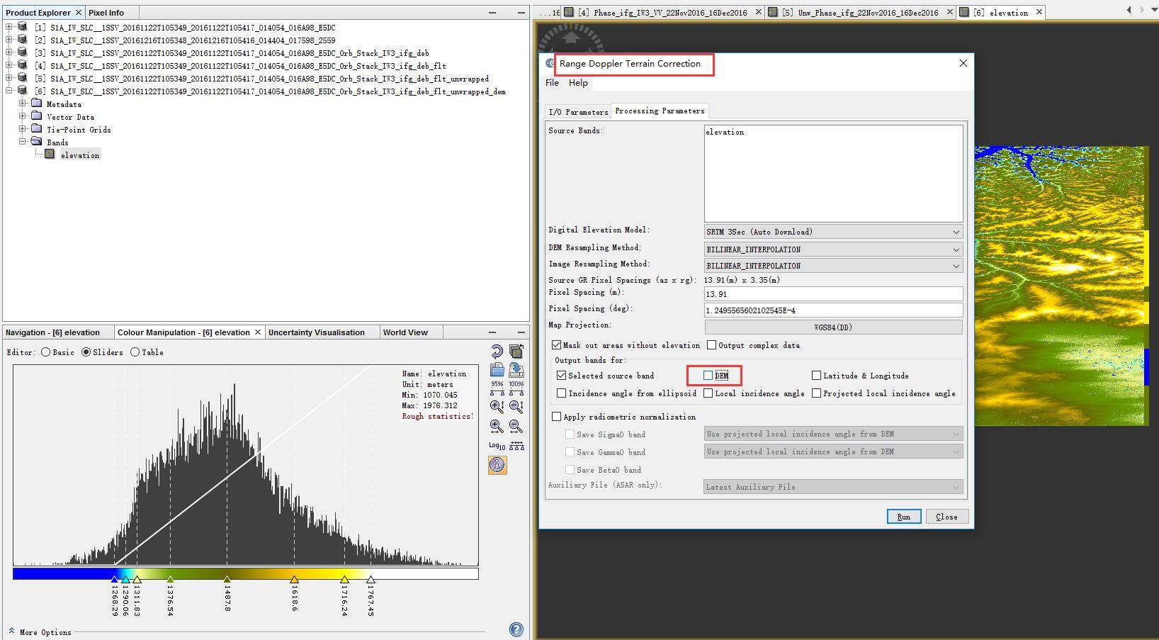
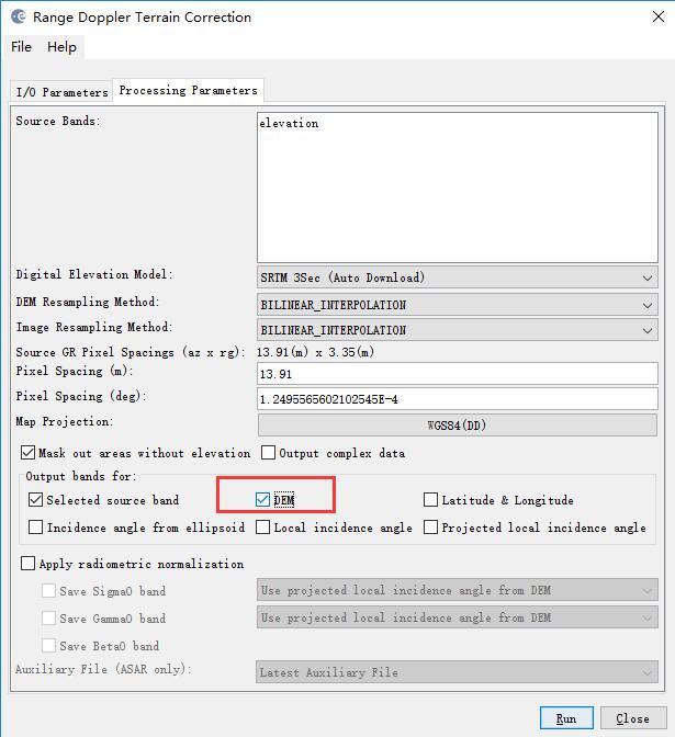
When I was doing the last step of Range-Doppler Terrain Correction to create a DEM from Sentinel 1A IW SLC product, shall I check the DEM item in the panel?
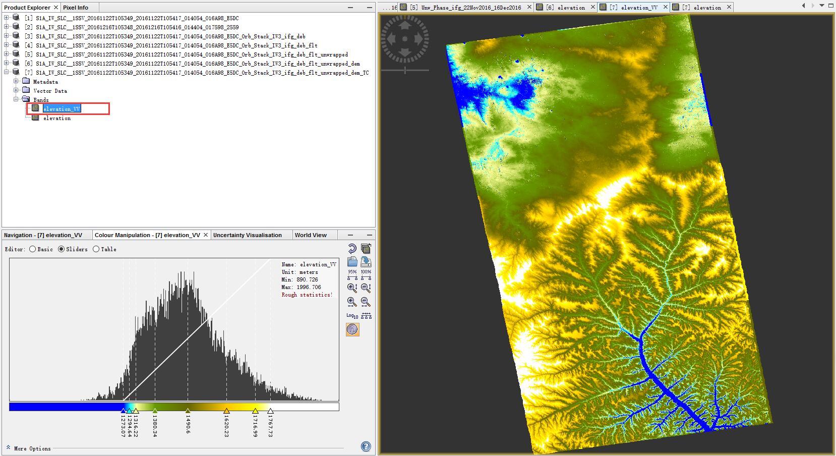
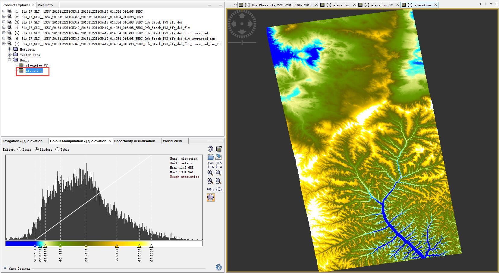
What’s the differences between the two bands ? The band namely elevation looks more smooth. So which band is the final DEM result from the Sentinel 1A product?
You can try the Ellipsoid Correction instead of the range-doppler and compare the results.
This way you will have two reference datasets so to say.
Also a small hint for the projection, try to use metric projections (e. g. UTM) for the terrain correction to get more real result (instead of degrees). This is just a suggestion, depends on your goal how you want to display the results.
yes, a DEM for reference is automatically downloaded by SNAP for the terrain correction process.
As your result depends on the quality of the DEM (I agree to @Suprd), you can also trie the SRTM 1Sec or run it without any reference information using the Ellipsoid correction. I expect the best results with the SRTM 1 Sec however. Chosing a UTM projection (automatic zone) will be of favour if you want to compute a hillshade of your result. This often reveals the true quality as it highlights smaller glitches due to low coherence or radar shadow areas.
Hi @sentinelgyb may i know the step (tutorial) to extract Sentinel 1 to be Digital elevation Model by SNAP. Would you send me to ardisetyo62@gmail.com
Thank you