I’m trying to make a DEM following the steps that I’ve read here in the forum. All the steps are made correctely to snaphu import, but when I try to do Phase to Height nothing happens. I’m using an iMac i5 with 18gb ram.
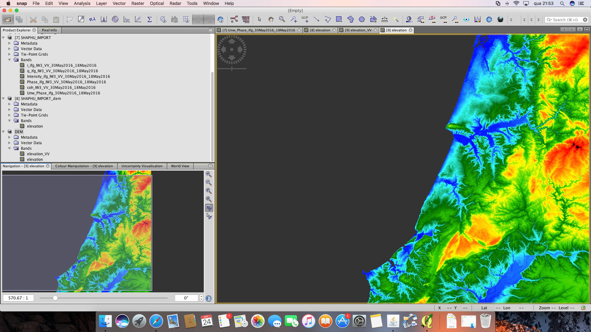
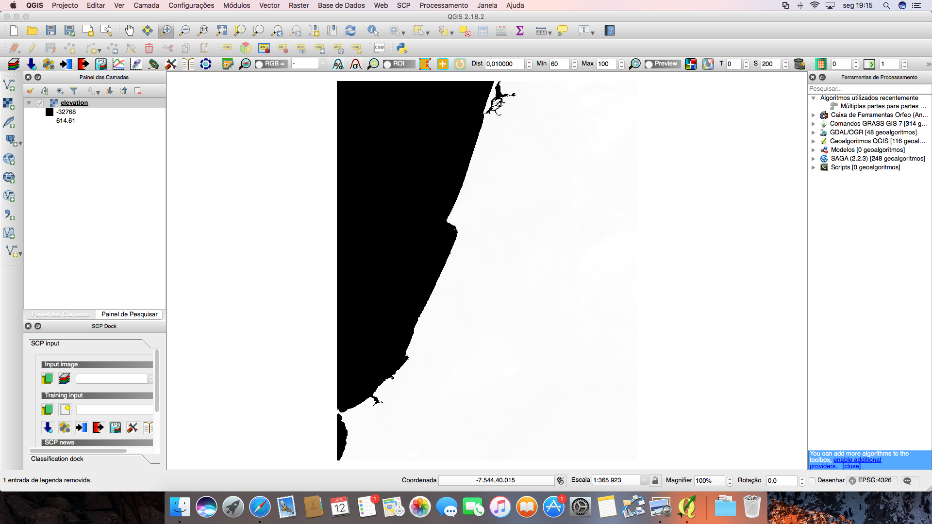
Yes, I have no problem with Phase to Elevation, then apply terrain correction and convert the elevation band to geotiff. But when I open in Qgis only appears two classes. And there is another problem, the negative values are to hight.
conversion to GeoTiff is sometimes accompanied with issues. You can also directly open the img files inside the data folder in QGIS. Try to open the img file of the terrain corrected elevation band.
About the negative values - can you please post a screenshot where the problem becomes visible?