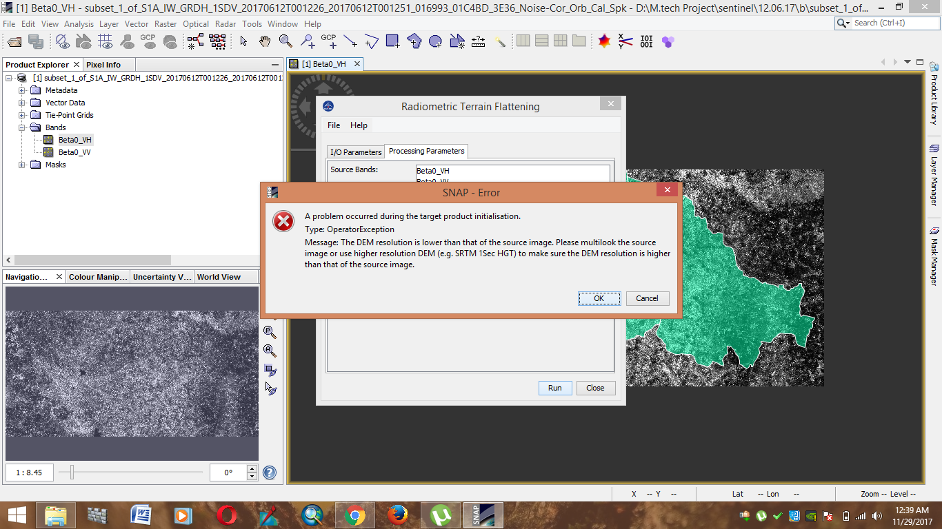
You are right, Terrain Flattening currently only accepts Beta0 as an input.
Maybe you can apply Range Doppler Terrain Correction on your c2 matrix with the ‘apply radiometric normalization’ checkbox selected.
I haven’t tried it in this context but it has similar effects as Terrain Flattening.
Maybe you test with and without and use a scatterplot to see if it has an effect.
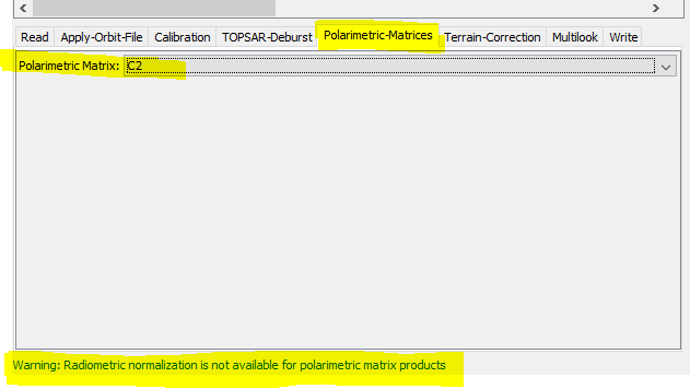
Revisited this today and found that checking the radiometric normalisation (in the TC) section flagged a conflict warning that it could not be used with polarimetric matrix product
@SAR2016 did you code ortho algorithm by yourself or you get it from some online database? Is there any database from where we can python code for SAR processing algorithms?
They do different things:
Terrain Flattening is a correction of radiometric distortions distcaused by topography. It reduces the effect of topography on backscatter intensity.
RD Terrain correction is a correction of geometric distortions caused by topography, such as foreshortening and shadow. It corrects the location of each pixel based on a digital elevation model.
Hello Sir,
I would like to thank you for all your replies till date, they helped me a lot. Just wanted to ask, why have you suggested to calibrate to beta 0(and not sigma 0) in the algorithms that has terrain flattening.
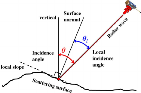
The reason is this: Beta0, also called radar brightness, is the basic calibration of a SAR product. It makes use of an internal calibration constant stored in the metadata. You use it if you don’t have information on the incidence angle (red angle) of your image. The incidence angle is defined as the angle between the surface vertical of the earth (without terrain) and the incoming signal.
Sigma0, the normalized radar cross-section, is an advanced measure of calibration. It takes into account the calibration constant and the incidence angle (which is mostly also known from the metadata).
But if you want to calibrate to Gamma0 which makes use of the local incidence angle (blue angle) you need to have a Digital Elevation model (DEM). The crucial point is that the Radiometric Terrain Flattening in SNAP is based on an algorithm by David Small (http://ieeexplore.ieee.org/document/5752845) which does not use the (local) incidence angle but the area illuminated by the sensor of each pixel. Correcting for the angles before Terrain Flattening would kind of over-estimate the influence of surface orientation towards the sensor. Terrain Flattening therefore needs the basic calibration of Beta0 where the influence of incidence angle is still present.
*NOTE: Since SNAP 8, conversion to Beta0 prior to Terrain Flattening is no longer required, because it has been integrated into the TF operator.
If you are referring to the i_* and q_* bands of a S1 SLC product, I can say that bands are of data type short.
You can see this by selecting the band and then select Analysis / Information from the menu.
Can you pleas tell me about radiometric correction workflow for SLC data? i ve followed your above suggested steps… But after deburst and orbit file correction i could not calibrate to Beta0? exception says calibration should be applied before deburst?