I open ‘subset_calibrated_S1A_IW_GRDH_1SDV_20160512T161044_2_TC.dim’ which I placed on my Google Drive
(https://drive.google.com/drive/folders/0B0VV80YQj6G2Smw4YlJNUHU5LTQ).
Mentioned file is terrain-corrected (since I can’t apply Reprojection on not-corrected file).
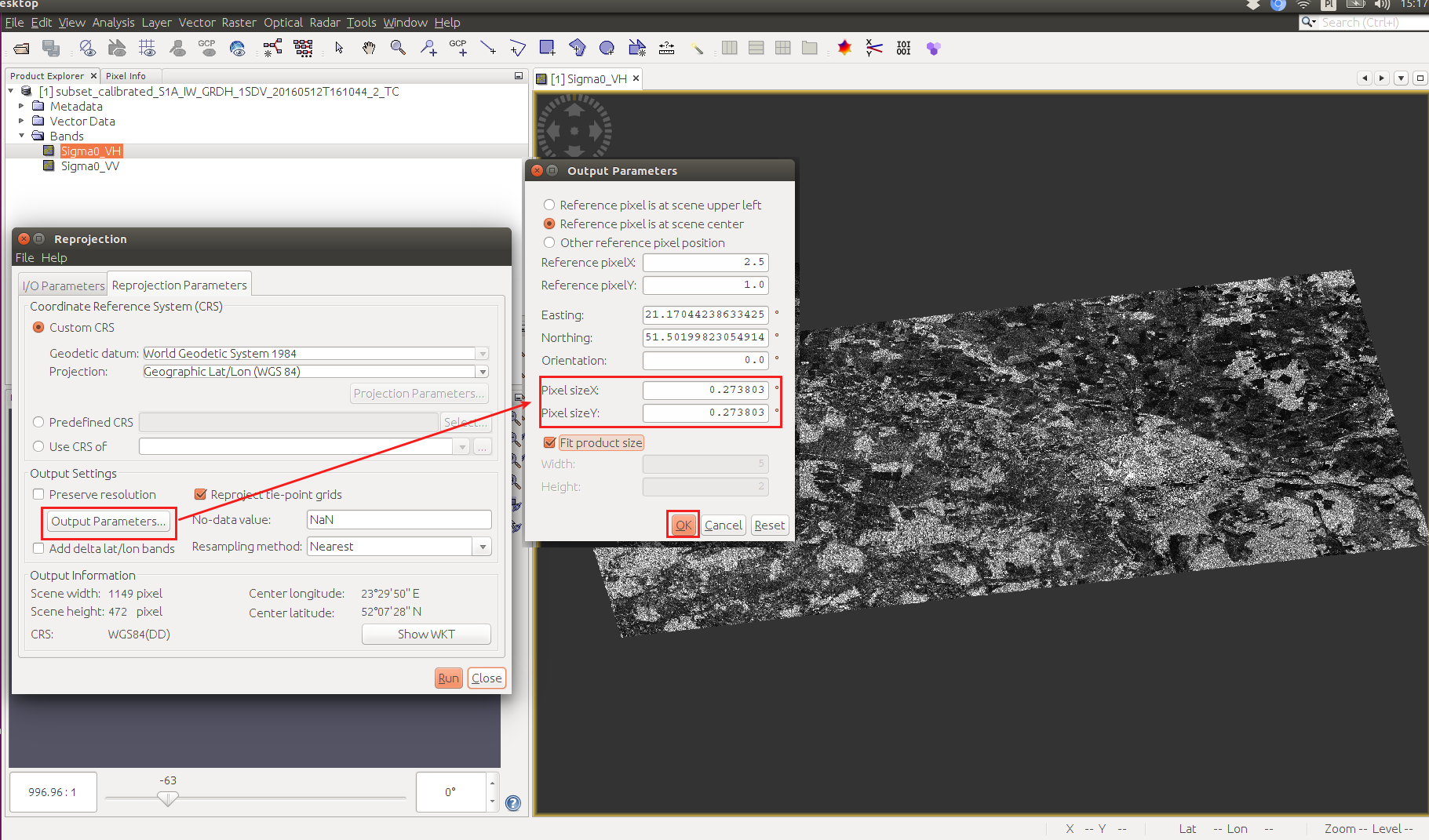
I would like to receive a raster with SMOS resolution from Sentinel data, so I open Reprojection tool and type pixel resolution as 0.273803 (because if I understand properly this value is expressed in geographical degrees):
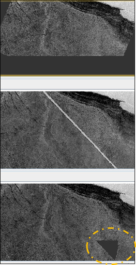
Unfortunately after processing, I am receiving a raster which contains only NaN values.
EDIT
I just noticed that even with default parameters of the Reprojection operator, values in output raster are significantly changed:
I’ve tried to provide smaller pixel size value, but it doesn’t help.
I understand that in such big are there might be some pixels without proper values, but shouldn’t SNAP just omit NaN and provide me any value for each pixel?