Dear Iveci,
thank you very much for your suggestion.
The S1 Slice Assembly operator should be run before the other steps,right?
(Apply orbit file, Calibrate, Multilooking, Range-Doppler Terrain Correction)
Why the Mosaic tool doesn’t perform properly with the slices?
Thanks,
Luca
In a new dataset in Peru with 2 concecutive data, slice on original grd data does not work with the message “you need 2 concecutive data”. However after applyin the slice on the data with precise orbit all was working well.
So, I need to test that in the example where I give the screenshot because may be the Slice problem on some dataset is due to orbit accuracy.
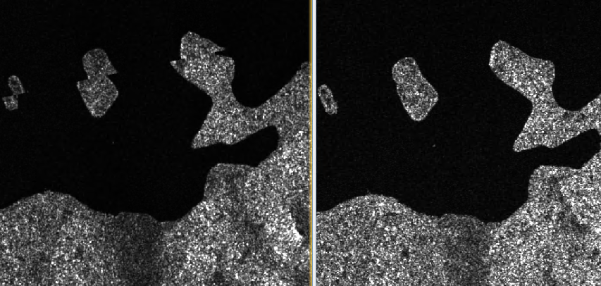
thanks clardeux! I followed your workflow (though I work with GRDH and don’t apply precise orbit and multilooking).
The stripes are gone but unfortunately I have quite unfavorable offsets now.
see screenshot: mosaic on the left with slice assembly and on the right without slice assembly.
OK, again, thanks clardeux, I got it now (I hope):
with S1 GRDH also the orbit needs to be coorected
-> apply orbit file -> S-1 Remove GRD Border Noise -> Radiometric calibration -> S-1 Slice assembly -> Radiometric Terrain Flattening -> Geometric Terrain Correction -> SAR mosaic (with 500 feather pixels and no weighted average of overlap or normalization)
Now the ‘quasi’ horizontal stripes are gone and offsets disappear. I am still fighting with quasi vertical stripes where the mosaic stitches. But will open another question for this.
In order to have smooth transition between neighboring orbits you need, either to increase the border margin limit during border noise removal either (alternatively) just to subset/crop the scenes. Then during mosaic there will be no mixing between real data and non-data (black border) in range.
I tried with widening the border margin but still have singular pixels on the left and right boundaries of the scenes.
Now subsetting: I fear the tool is not batchable because I cannot simply say ‘remove 1000 pixels on left and right side’ but have to specify the new image extent for each single scene.
I am currently testing this and will post further If I find out something. But I would still be happy for other ideas.
Dear all,
I read your discussion and I have same problem.
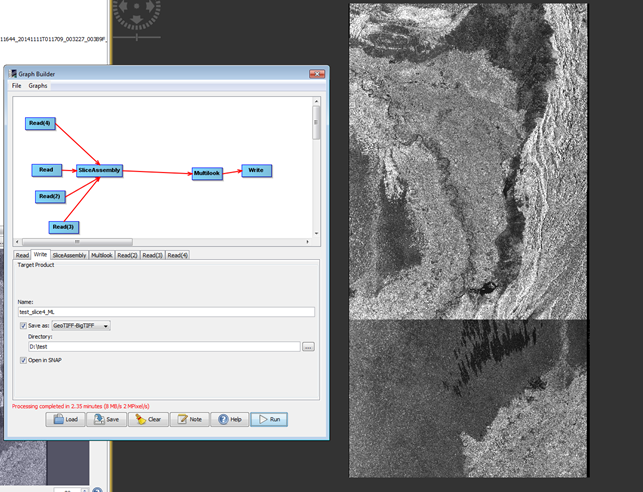
I have tens of consecutive GRDH images in couple of orbits. I use “slice assembly” and “SAR mosaic” at the end. I did not get images in an expected extend, like what Mr @lveci got.
The output dimension is almost half of what it should.
When I add Calibration, Terrain correction, … after ML, still I got same output. The 4 inputs are consecutive image pairs in 2 neighboring Descending orbits, so image should look like square.
example:
Any idea for a proper processing chain to get SAR mosaic?
Is this right? Apply orbit file> Remove GRD border> Slice Assembly> Multi-look >Calibration> Terrain Correction > SAR mosaic
When I apply it, also did not get proper result. Can anyone please help?
Hello,
I have a problem doing mosaic using SNAP with S1A & S1B W1_SCL product , I did all the steps
download, regis, forma, beckgeo, debru, remov, filter ,export, unwrap, import andT correction. The fringes are separated,and I would like to join them to see the whole pattern. I did the mosaic but I get black area between the images.
any suggestions please.
Hello,
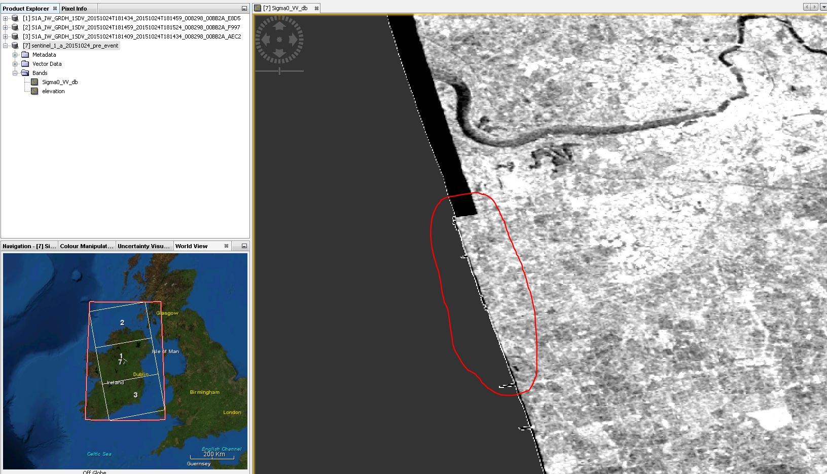
Ive been looking at this issue myself, I have a Graph which currently carries out slice assembly, quite well, but Im running into some issues.
The Image below is an assembled slice based on 3 Sentinel 1 products, I have highlighted the problem area.
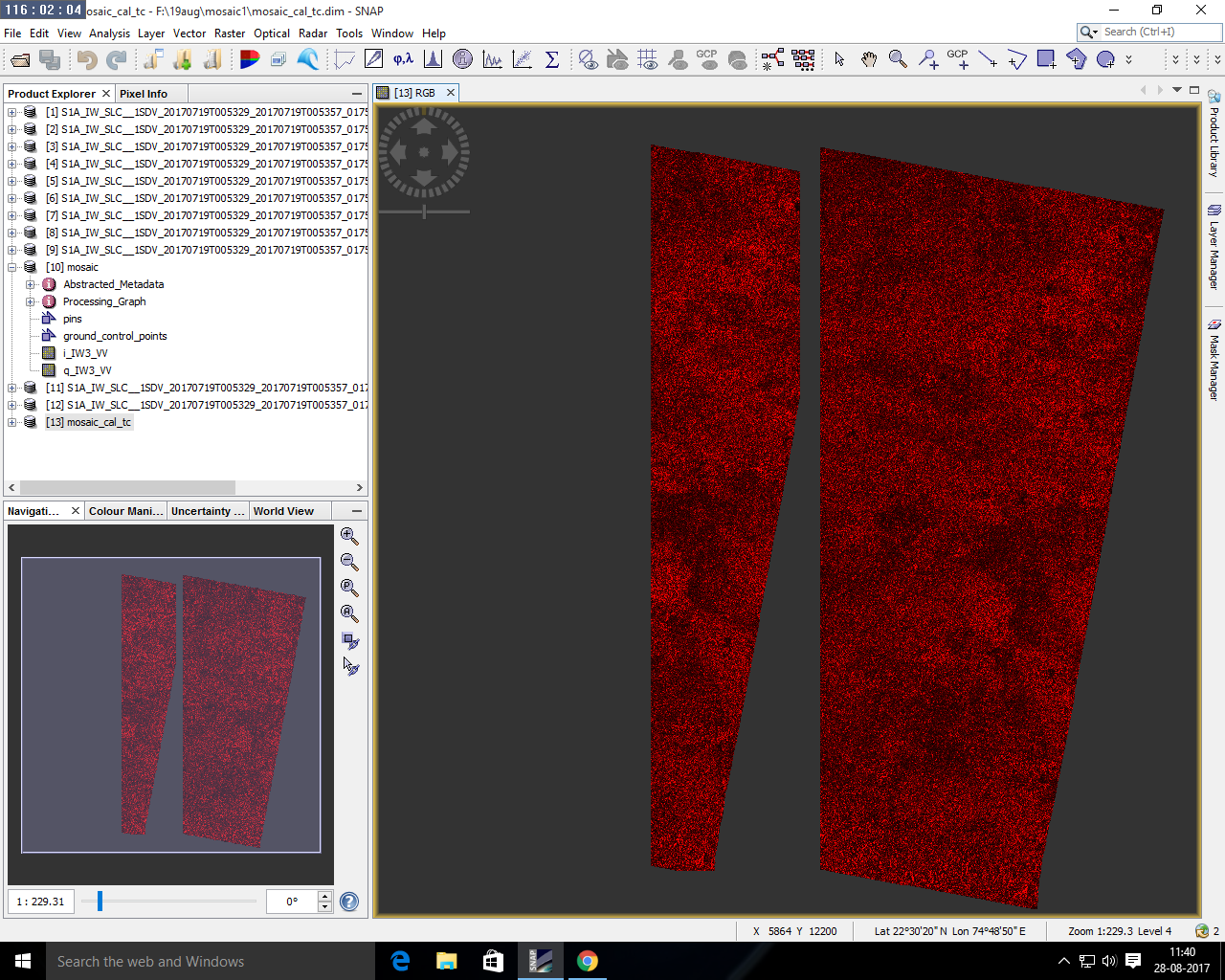
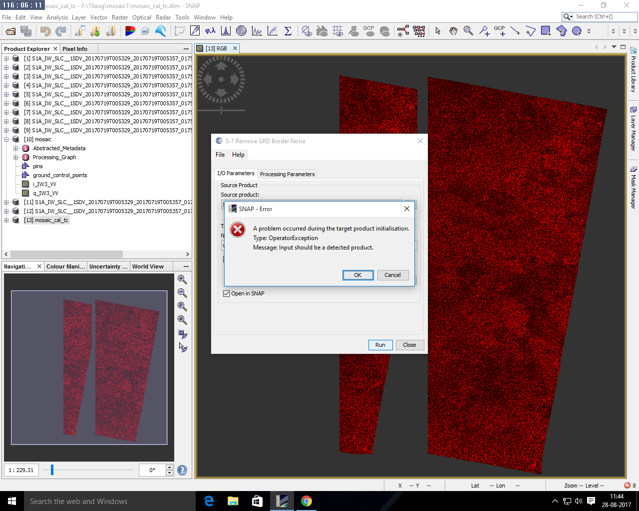
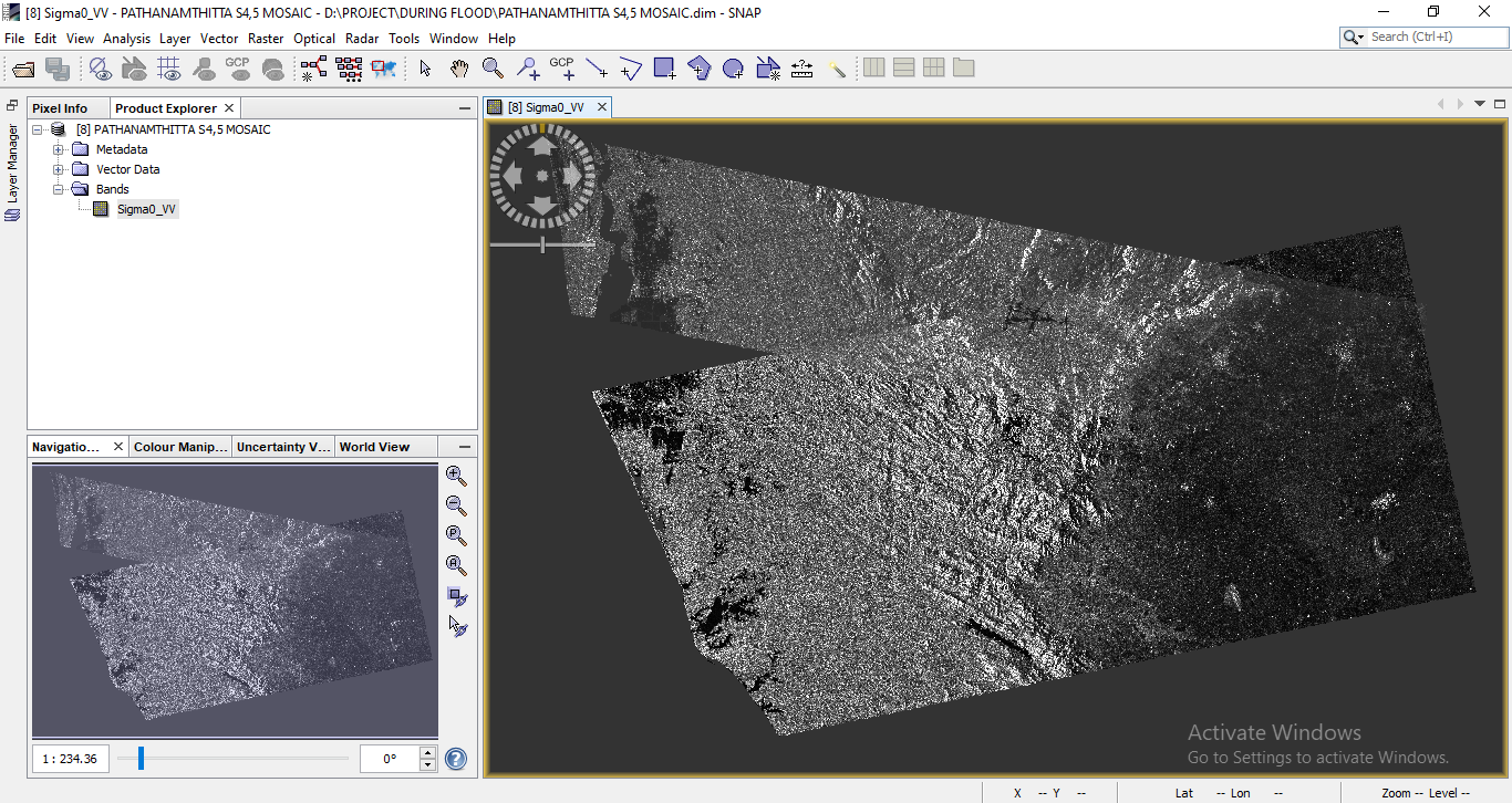
Hi, I am using sentinel 1 GRD products. I want to mosaic the data. I have done Apply orbit file>Border noise removal>calibrate>range doppler terrain correction>mosaic. But I got the output like this. What was the error?
Sir, The vector layer given in this picture is my study area. But in the left side there is a gap between the two slices. But the gap must be filled to mask the study area.
For black margin processing, we propose a method and just got published in Remote Sensing with Matlab codes available in the supplementary of that paper.
Wang, X. and Holland, D.M. 2020. An Automatic Method for Black Margin Elimination of Sentinel-1A Images over Antarctica. Remote Sensing, 12(7) , 1175.