good evening everyone please help me
when I make radiometric and geometric corrections of sentinels images 1 I get half images like this.
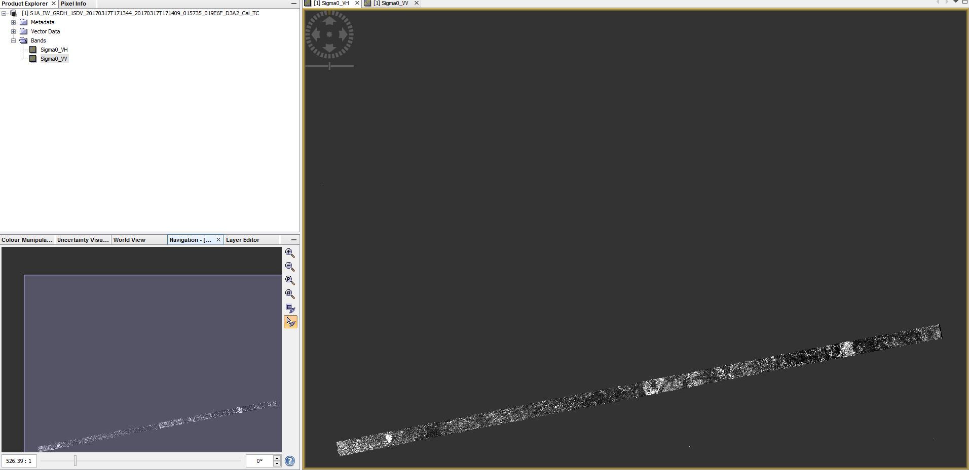
I use the images in zip form.
for radiometric calibration I do radar / radiometric / calibrate
for geometric correction I do radar / geometric / terrain correction / range doppler terrain correction
what is the problem and what is the solution thanks