Dear all,
we wonder why there is so less traffic in this category. Sentinel-3 OLCI data is public since late October last year. But this didn’t produce many questions here in the forum. Is Sentinel-3 data not yet used by the community? Is it’s usage within SNAP so bad or does work just smoothly?
We would like to see some feedback. It would be very nice if you would answer the following poll:
I use S3 data and everything works good.
I use S3 data but haven’t asked my questions in the forum yet.
I already had a look at the BRAT altimetry toolbox which is really interesting. But I didn’t have the time to do it intensively.
Lake level variations would matter to me the most.
Dear Marco Peters,
My reaserches are focused on the aqua-system and cyanobacteria blooms in Lake Taihu which is a lake typical of eutrophic,turbid and optically complex shallow waters.The Thematic Water Processing tools for Sentinel-3 OLCI data are of great importance for me and I have been using these tools almost everyday. I rountinely used FLH,MCI,MPH and C2RCC tools and published papers in Chinese journals.Here are the titles of them:
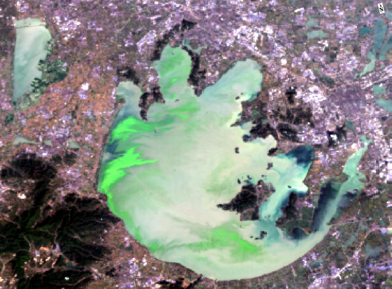
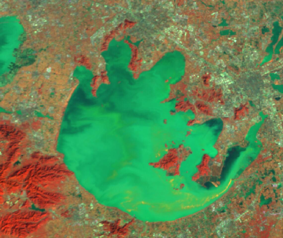
OLCI data are very important for us to routinely (recently almost daily coverage because of the Sentinel-B OLCI data are available) monitoring the cyanobacteria blooms in Lake Taihu. the image resolution, natural color composite, various indices and water color retrieval algorithms specific to auqa-ecosystem,including MPH,MCI,FLH,chl-a from C2RCC show more versatile capabilities than satellite sensors ever before。Now OLCI data become an indespensible data for us , we download the NRT data everyday as soon as possible and examine the spatial distribution of cyanobacteria blooms and surface scums, the information extracted from OLCI is important to ensure the public health of local people who tae the lake as the major drinking water sources.If possible ,please show us more algorithm backgrounds information,details, ATBDs,etc. So we can get better understanding of the tools integrated into SNAP for OLCI data.2018-11-9-S3A-olci for Lake Taihu{upper}2018-12-18-S3B-olci for Lake Taihu{lower}