Hi Mehdi!
Congratulation for your results, could you please tell me how you export your results from StaMPS to GoogleEarth?
Hi Mohannad,
For example, if you want to have kml file of v-d, you need to do the following steps in Matlab:
1- save v-d using >>ps plot(‘v-d’,-1)
2->> load ps_plot_v-d ph_disp
3- >> ps gescatter(‘project_velo.kml’,ph_disp,10,0.4)
4- you can find the project_velo.kml file in the current directory.
For more info you can also refer to page 27 of SAMPS manual.
I hope it would be helpful.
1 Like
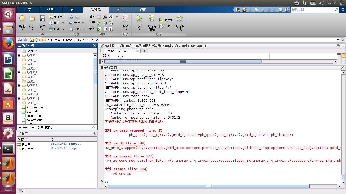
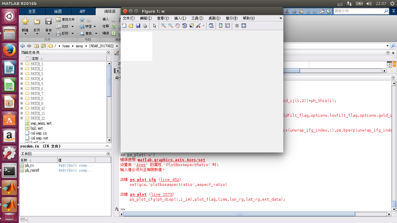
hi,@Mehdi.I use your method metioned above and successfully export to stamps. I use script and .m file changed by FeiLiu. form step 1 to 5,all is ok . but when to step 6,I encountered a problem as below scrennshot. also, ps_plot(‘w’) shows some errors as follows. please help me . btw ,I tested the material provided by hooper , everything is fine. it seems that my exported files are wrong?
Thanks a lot.
error 1 :The subscript index must be a positive integer type or a logical type.
error 2 :setting property 'PlotBoxAspectRatio ’ of class ‘Axes’ : input values must be positive finite numbers
I have no idea, sorry. I’m not that deep into matlab to be able to debug scripts of others.
Extremely hard to guess for most of us I suppose.
Thank you anyway
Hi everyone!
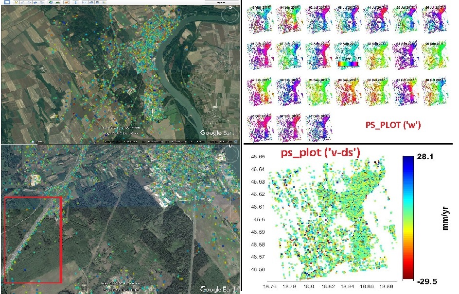
Many thanks for @katherine @ABraun @bayzidul @FeiLiu @Mehdi @alvegavaleri and all the others for sharing their experiences, it was very useful for me to process 24 S-1 Tops IW data using SNAP 6.0 and in Windows under Cygwin 2.877 , StaMPS 3.3 and Matlab 2017.
I followed Katherine steps:
Taking into consideration that in SNAP 6.0 the steps 6 & 7 are included in Interferogram formation step.
But now I have some questions :
-
in my case, does the (+ve) velocities values really imply displacement towards the satellite? (since the master is not earlier than all the slaves). Is there any way to plot ‘v’ for just some of ifg’s ?(for example here the group of Ifg’s which their dates are after the date of the master)
-
How could we export Colorbar to the GoogleEarth with velocities values when use (>> ps_gescatter) in Matlab?
-
is there any way to get vertical displacement value from this relative LOS displacement?
-
I could notice a small shift in the results specially along the high-way in the west part of my study area, is it normal?
3 Likes
very impressive that you managed to get all that under Windows!
About the GoogleEarth export - maybe ViStaMPS is interesting to you: http://vistamps.utad.pt/?page_id=38
2 Likes
hello @ABraun, i got an error when i load data with viStaMPS v.1.1, the error is like this
Error in ==> viStaMPS>pushbuttonSetup_Callback at 131
if ~isfield(vistamps, ‘Setup’)
Error in ==> gui_mainfcn at 96
feval(varargin{:});
Error in ==> viStaMPS at 27
gui_mainfcn(gui_State, varargin{:});
Error in ==> @(hObject,eventdata)viStaMPS(‘pushbuttonSetup_Callback’,hObject,eventdata,guidata(hObject))
??? Error while evaluating uicontrol Callback
i used matlab R2017b linux, do you know how to resolve it?
sorry, I never used viStaMPS by now.
Hi @aziz10
I had also started to use viStaMPS but could not manage to work with it, so I have moved to GMT.
Can you tell me how to use GMT?
@muhannad how do you export stamPS result to csv so it can be opened in google earth or GIS software?
Hi @aziz10
Sorry for my very late reply. You can start following this document.
http://gmt.soest.hawaii.edu/doc/latest/GMT_Tutorial.html
1 Like
Hello,
Thank you for sharing your experience. I’m a new beginner in StaMPS and yours posts were very helpful. But I tried to export to StamPS and I got this error (see below).
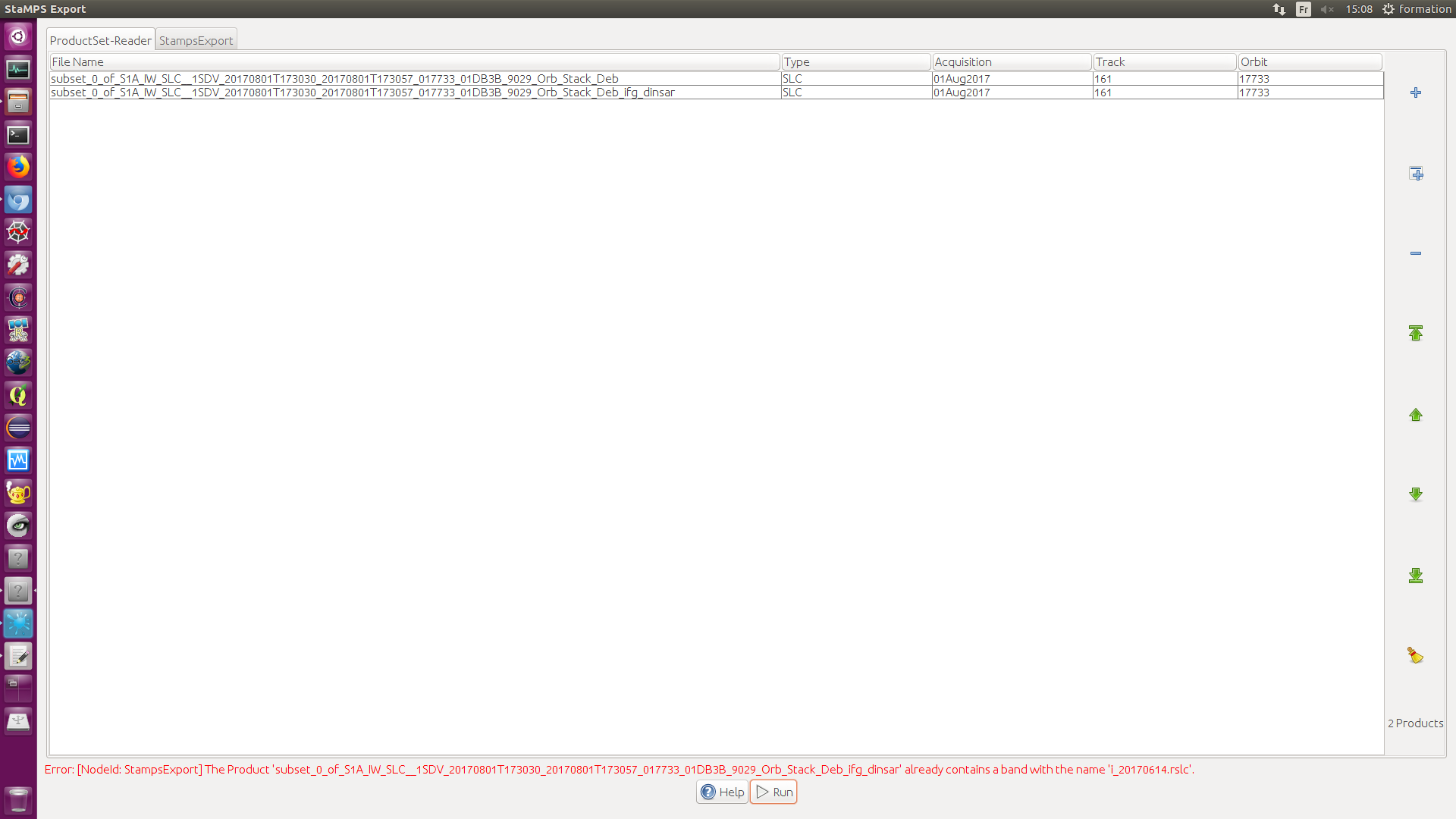
I know you have already met this problem and given some advices to solve it. But it seems I have done everything you said…
Thank you very much for your time.
Guillaume
at which stage did you make a subset?
I would suggest that you use the TOPS-Split parameters to reduce the extent of the coregistered stack to the area you need.
Thanks for your reply.
I made a subset just after the deburst and before applying the interferogram formation. I tried without making the subset too. It takes a long time but I got the same error.