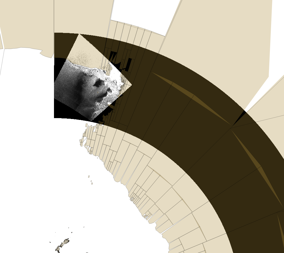
Some time ago I noticed that S1 SAR GRD products around the 180 deg longitudes, when inserted into qgis they look like that:
If you wanted to reproject them to a desired CRS they looked even worst, with very strange artifacts. I came with a solution where the GCPs had be extracted from the geotiff and be written again but reprojected to the target CRS. Then reprojecting them would create a decent image. I did that using gdal library.
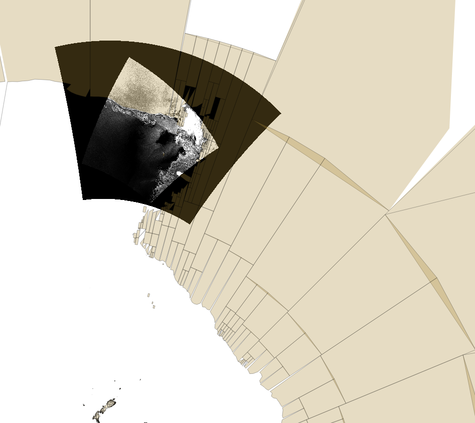
Now I tried to do the same using snappy. I perform a terrain correction which implicitly makes also a reprojection. I noticed that if i use directly the safe file the terrain correction perform like an infinite loop (never ending), and creates huge files e.g. i killed the process after having 7G geotiff file being created. The second test was to use gdal, reproject the GCPs, save the geotiff file, and then use the terrain correction from snappy which I present here:
Is this a known problem or bug for images around 180deg lons? Is there another way to solve this issue? For reference the filename is :
S1B_EW_GRDM_1SSH_20170302T103623_20170302T103723_004528_007E2D_4142.SAFE