I am trying to understand the tie points that are being used by Synergy AOT (T550) data? As per my understanding the SYN products come with tiepoints_olci.nc, tiepoints_slstr_n.nc and tiepoints_slstr_o.nc as tie points. But which one of these is the AOT (SYN_AOT550) using?
The tie-points and the geolocation are actually not related to the AOT data.
If you want to know more about how the AOT is computed you can have a look at the ATBD.
I was actually trying to understand the location aspect of the AOT data. The AOT data must be over some location/region, right? If so, how is the location of the data determined? I guess this is where geolocation.nc comes in.
Also, how do I export any data from s3tbx as georeferenced data? From what I understand, right-click on an image and Export View as Image in GeoTIFF format should export the data as georeferenced tiff. Or am I mistaken?
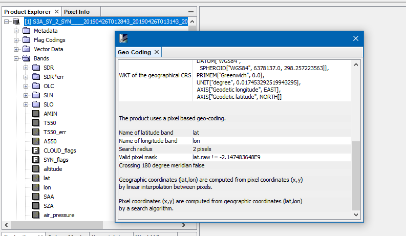
From what you are saying I think that you are opening NetCDF files individually, right?
Better open the xfdumanifest.xml file n SNAP or drag the SAFE folder on the Product Explorer.
Then you can work with the whole data in SNAP and it is geo-located.
Then the export should work, too.
I am actually opening the xfdumanifest.xml file (the product). I want to export LST Level 2 product as a georeferenced GeoTIFF.
So I double-click on LST band to create an image view, and then do a ‘Export View as Image’ with Full Resolution and Full Scene options.
Doesnt seem to be working in my version of snap (7.0).