Hi,everyone.
I made RTC for some Sentinel-1 images and export to the elevation.img.However.I found the pixel values in the elevation image are abnormal.
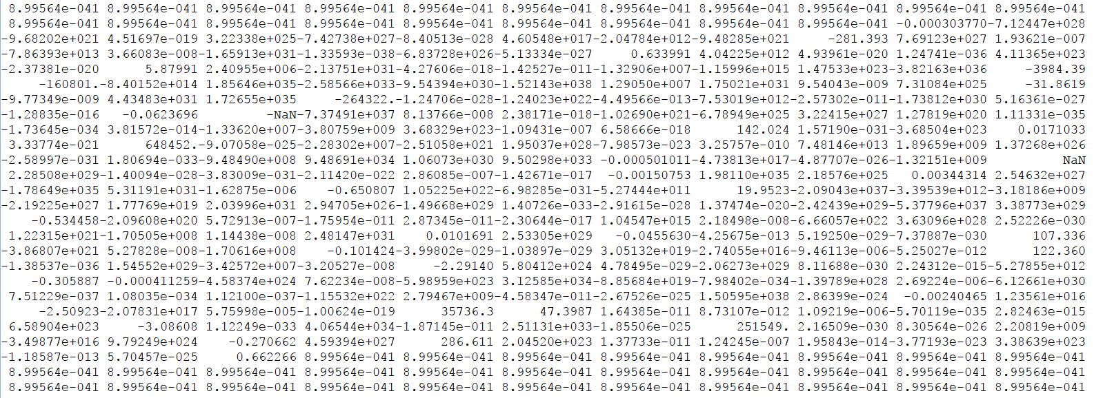
The normal value in land area is above zero, and the value in sea or lake is less than zero. However, the values in IDL output are very high,8.99564e-041,as is shown in the following picture.I didn’t use any math expressions for images.
Thanks for your suggestion.
This is a reason seemingly, I have altered my program, the value of the image in different byteorder is indeed different.Although I haven’t modify all the errors in the program,I still appreciate your expert hints.
If I have other question,I will post here.Thanks very much again.