Hello
I want to calculate the subsidence of a region from 2010 to 2018.
I use Sentinel 1 to calculate from 2014 to 2018, but what should I do from 2010 to 2014(what satellites should I use)?
Is there comprehensive satellite data from 2010 to 2018?
unfortunately, there are only few satellites which are freely available during 2010-2018
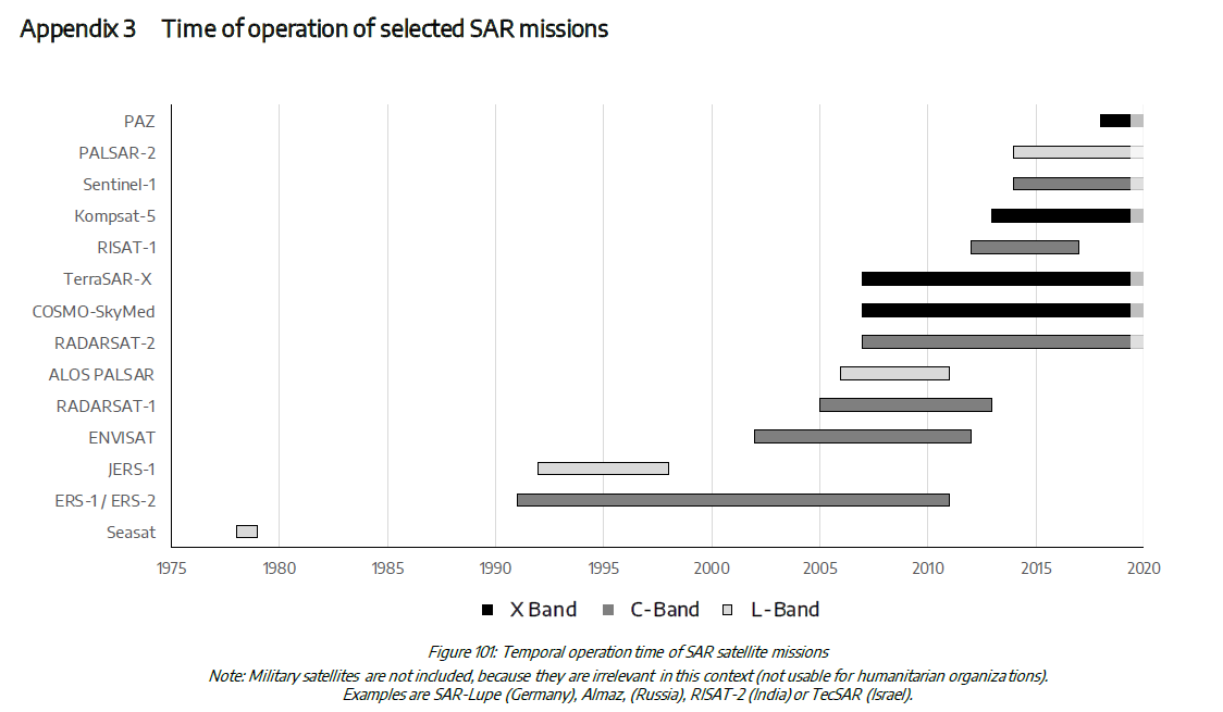
image source
Maybe ALOS PALSAR (parts of the archive are provided by ESA upon registration) could help you:
https://alos-palsar-ds.eo.esa.int/oads/access/collection/
TerraSAR-X, Radarsat-2 and COSMO SkyMed are commercial satellites, but can sometimes be acquired via research proposals.
1 Like