Hi all,
I am struggling to work on images stacks in order to perform change detection. The purpose of my analysis is to find the effects of a wind downburst that damaged some roofs and trees some months ago in a small area near Turin (Italy). From the survey on the field I know some locations of the damages and I would expect to find them on the change detection results (besides I would like to find some damages not seen on the field…). However it doesn’t seem there is a clear correlation between the results and the effects found by the survey. So I am wondering if the scale of phenomenon can’t be detected by S1 images or I did something wrong in the process I followed. An example of the effects on the roofs can be found here:
I considered two GRD S1 images taken at different dates (13th June-7th July 2016). Then I followed this work flow:
Apply Orbit files --> Subset --> Radiometric Calibration --> Terrain Flattening --> Terrain Correction --> Create Stack --> Change Detection
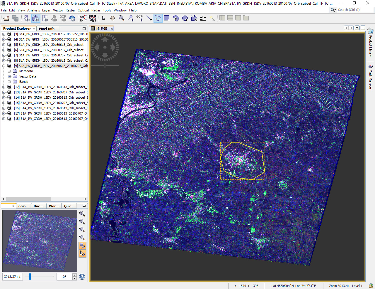
This is the RGB stack (the yellow polygon is the Area of Interest):
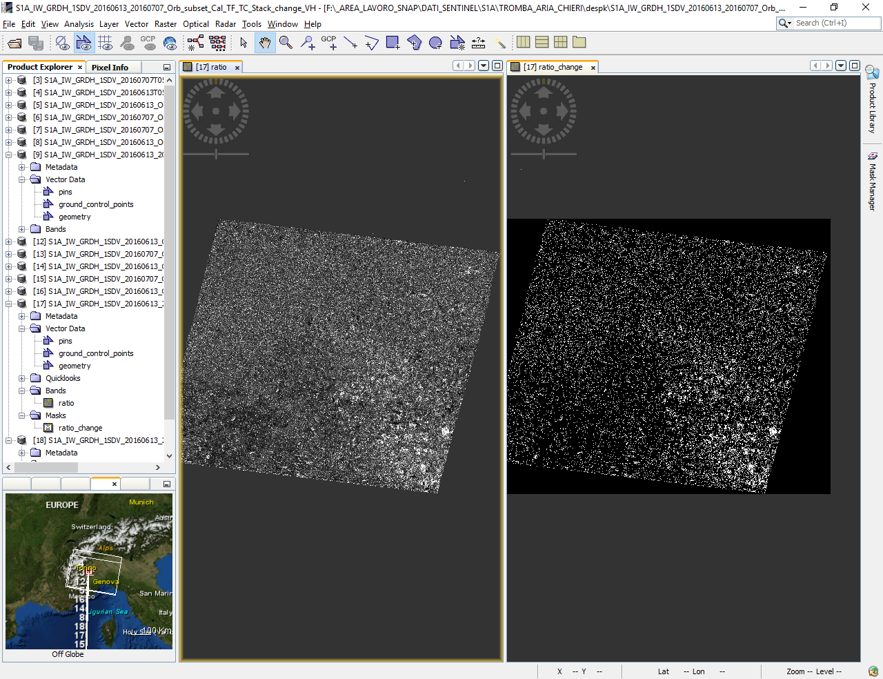
Change Detection results (VH polarization):
Zoom on the AoI
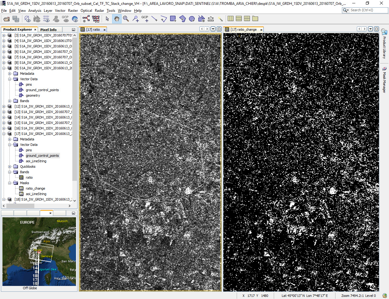
Playing with the threshold of the ratio values doesn’t show me any interesting feature related to damages…
Maybe I should apply speckle filtering before any other step in my work flow? Any suggestion is welcomed.
Thank you in advance
Gabriele
