Hello, I’am currently in the process to make change detection using TerraSar-X data, can someone help me for the Workflow ?
For the preprocessing i’am doing : Calibration -> Speckl filtering -> Terrain correction (Is that enough or i missed some step ?)
Whats the next step after the pre-processing ?
Best regards and thanks in advance !
Thomas
The processing depends on the type of changes you want to detect. Maybe you can clarify this first.
Also, which imaging mode and product level do you use?
1 Like
Thanks for the answer! for now i’am focussing on change that can be visually detected, new road, new fields, etc.
I’am using TSX-1.SAR.L1B product, Polarization channel: HH ,
Acquisition mode: High Resolution SpotLight
High Resolution Spotlight benefits from a region growing filter, so I would test the IDAN Speckle filter after radiometric calibration.
If both images are acquired from the same track you can coregister them first and then apply the change detection operator in SNAP. In the end you terrain correct the changes.
1 Like
Ok I will try it now, and come back to you i have any issues!
Merci!!!
Hey Andreas I made all of the step without touching the parameter these are my result can you tell me if it’s coherant or artefact ?
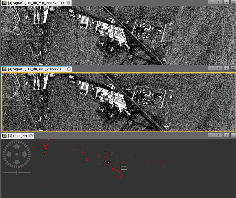
Technically, this looks alright. Can’t tell if it makes sense in your case
Can you explain me exactly the changes i’am detecting, because there is no help in SAR change detection ?
the operator detects changes of backscatter intensity which exceed a defined threshold (below it is considered noise)
1 Like
Thanks I will read some papers on it !!
Hello, after coregistration I have a master and slave image, I converted the data to tiff and displayed my data in Qgis.
I would like to know wiche band need to be band 1 the master or the slave ?
I also would like to know if it’s right that all the red cluster of points are the changes detected, and what are the green blue cluster ?
Thanks in advance for the support, you are a great team !
this is your choice, it just affects the colors of the RGB representation.
The colors indicate areas where both images are similar (black, grey, white) and where they are different. It is just important that you select the same min/max values in the symbology for all colors.
red pixels mean that band 2 has considerably higher backscatter. Depending on what surface this is, you can assig different types of changes here. This requires basic understanding about what is high and low backscatter intensity in an image in general.
1 Like
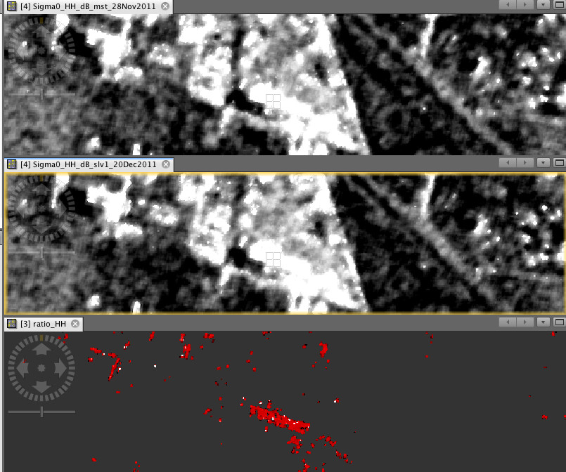
Hello I have a new question, on my previous RGB image you told me that the “red pixels mean that band 2 has considerably higher backscatter”, I assume that the blue pixel clusters represent a negative difference in backscatter intensity.
My question is: does this also represent a change on the ground?
Thanks in advance
backscatter is related to physical characteristics of a surface. So if it is higher in one image, it can have several reasons (depending on the type of surface and the spatial resolution of the sensor):
- a new object has been built, causing highter return due to corner reflection
- the material of an object has changed (e.g. more conductivity because a wooden roof was replaced by metal)
- increased soil moisture (formerly dry soil is now wet
- crop or vegetation growth (bare field is now covered by plants)
- water movement (waves cause higher rougnness).
- combinations of the points above
- …
So in order to understand the RGB image you first have to know what surfaces you are looking at and then interpret the change in backscatter intensity regarding the principles of radar backscattering.
1 Like