Hello,
I have a problem with my Sentinel-1 time series coregistration.
I have downloaded for 2017 all the S1 IW SLC images that I preprocessed to get the S1 IW GRD images.
The preprocessing of the images went well and I get for each image 4 bands:
Gamma VH
Gamma VV
Sigma VV
Sigma VH
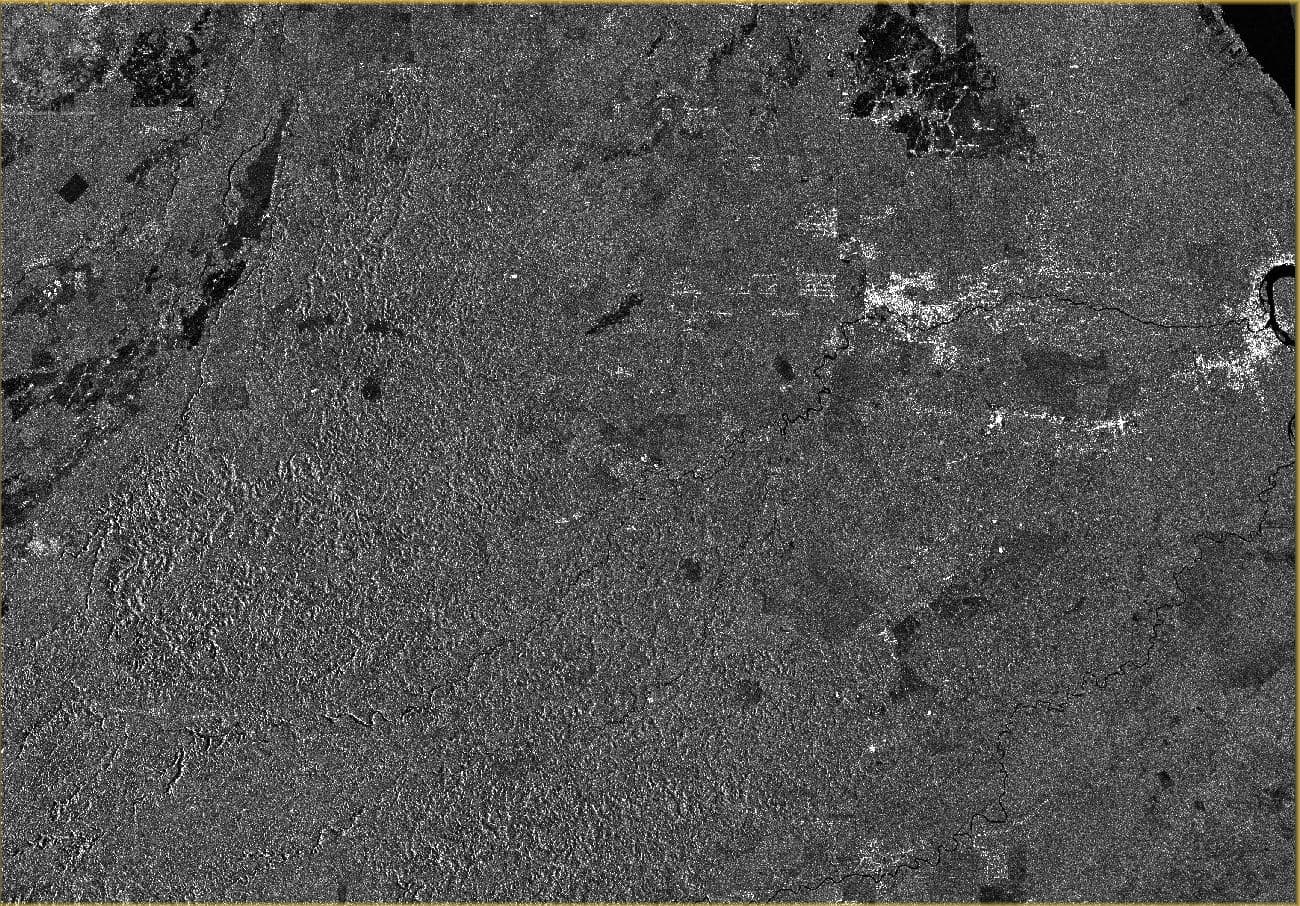
Here is an example of the pre-processed image for December 22, 2017 :
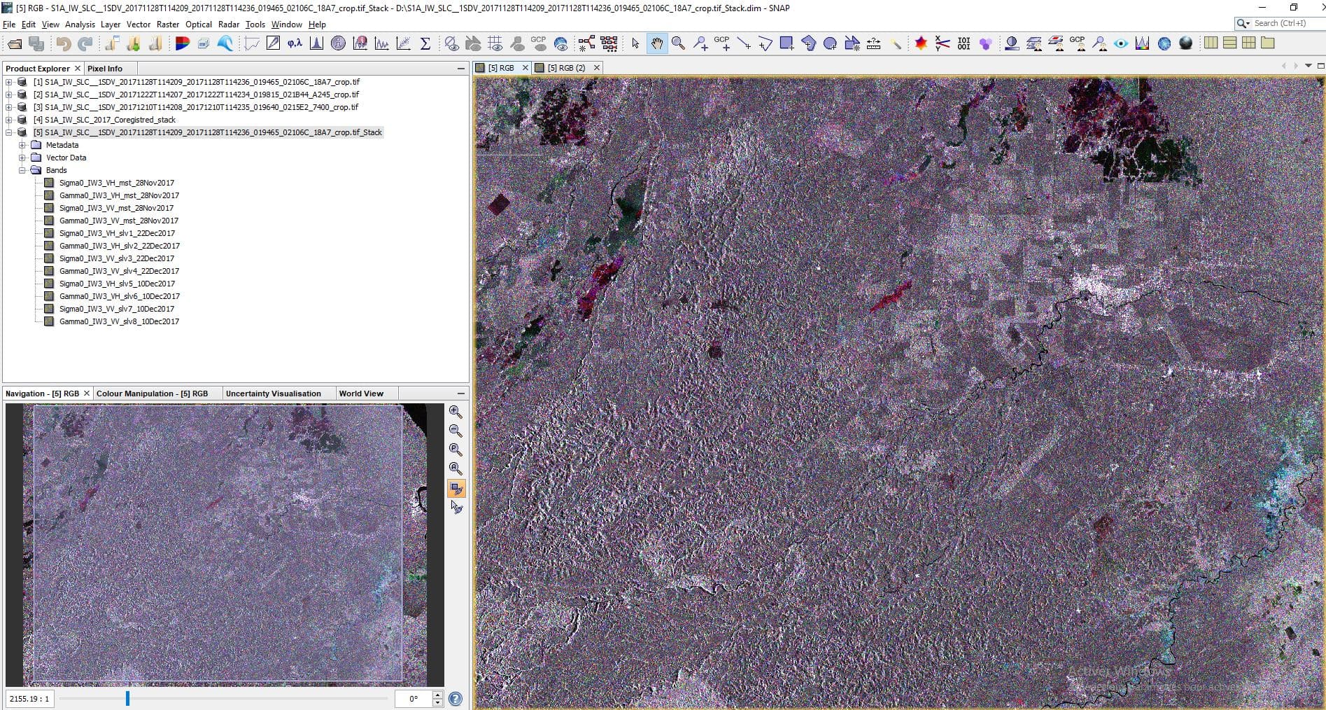
The coregistration was then done but there is a problem:
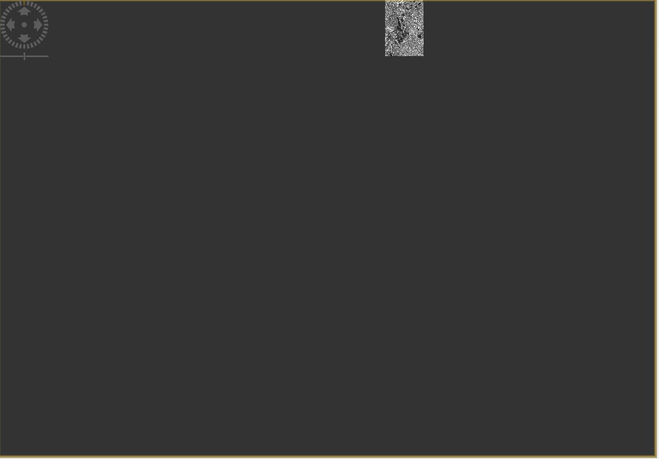
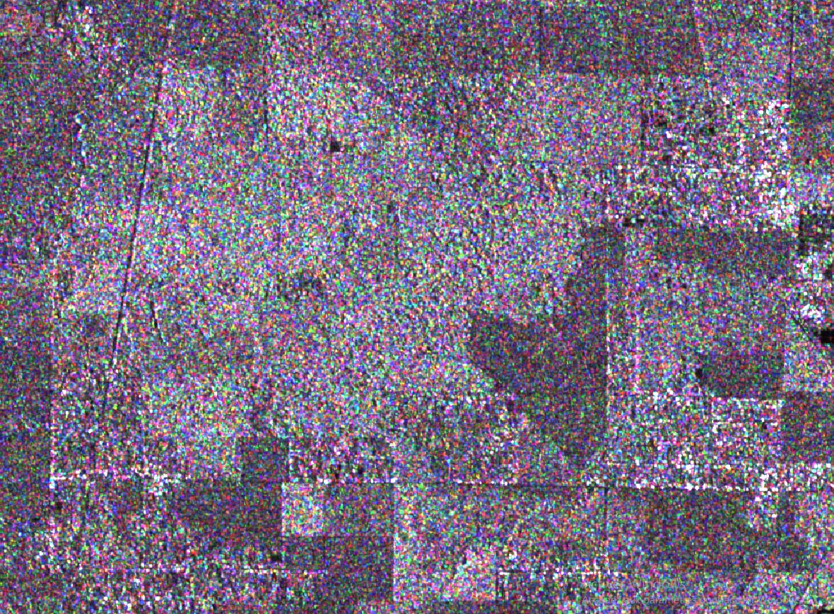
The coregistered Sigma VV band of the second date of the stack is always crop like this :
I tried to do different coregistered stacks but it’s always the second date of the stack (slave 1) for the VV band that causes problems.
Do you have an idea or a solution?
Thanks in advance,
Sincerely.
Hello everyone,
After doing different tests, I still have the problem. What is strange is that when I coregister only two images, there is no problem but when I try with three images, the VV band of the second image date is systematically cropped as on the examples above.
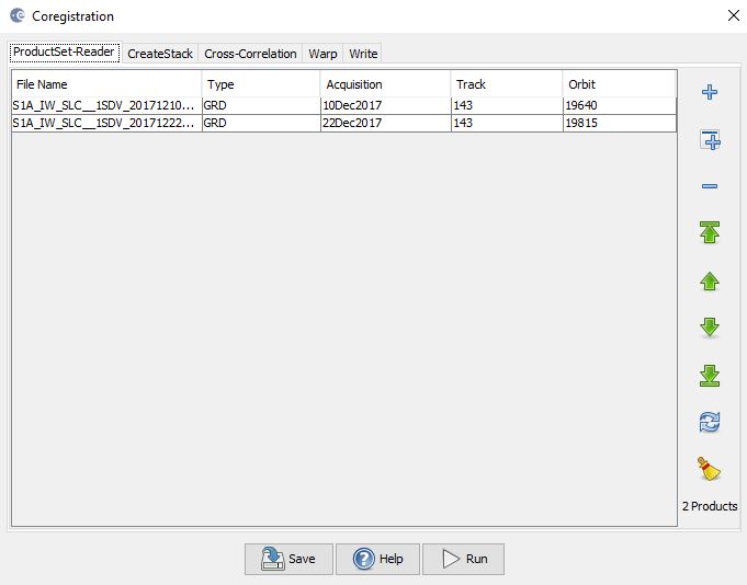
I use the coregistration tool: radar → coregistration -->coregistration
The parameters used are by default except for the resampling type for which I choose bilinear interpolation.
Any help with that ?
Thanks,
Carl
S-1 GRDs are already in the same geometry and can easily be stacked with CreateStack. Check out the tutorial:
ESA S1 time-series tutorial
Hello @mengdahl
Thank you for your answer.
I compared the different dates and I have a difference of a few pixels between the dates which is restrictive for the rest of my work since I want to make annual composites. This is why I want to coregister my images, which seems to work for all the bands of all my dates except the sigma0 VV band of the second date of my stack.
This error occurs as soon as I use more than two dates and no matter what the input parameters are.
Any ideas where the problem may come from?
Best,
Carl
All images from the same orbit track will align perfectly into a stack without coregistration. If you want to work with multiple tracks then you need to terrain correct your stacks separately into the same map projection. Done that way the terrain corrected pixels will align.
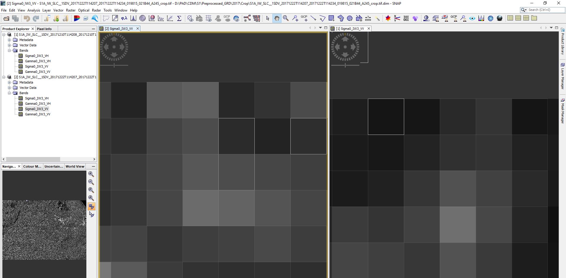
However, when I visualize strips of two different dates I have the impression that there is a shift of a few meters. Could this be due to the visualization?
Concerning the track orbits, are you talking about the track or the orbits?
Thanks,
Carl
Same (orbit) track, 143 in this case. The images should align perfectly.
Okay though, there is a discrepancy even on the raw image metadata… do you have any idea what I can do to fix this?
What is there to fix? The images should align perfectly and you can check it by doing an RGB of the two scenes. Any misalignment will be immediately apparent.
I have the impression that it works, do you have an explanation on the misalignment that can be seen on the images I sent previously?
1 Like
The alignment looks perfectly good to me. With misalignment the borders of areas and objects have single-colour halos of sorts.