Dear all,
we are using SNAP 6.0 to perform the procedure described in the following graph:
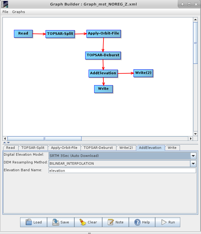
We tested with a stack of products centered on Milan (Italy), relative orbit 168. The name of the product used in the graph is S1A_IW_SLC__1SDV_20160608T052702_20160608T052729_011615_011C21_A944.
The elevation band is not in the correct geographic reference. There is approx. 1-km westward shift of the elevation band with respect to the intensity of the single look complex SAR image.
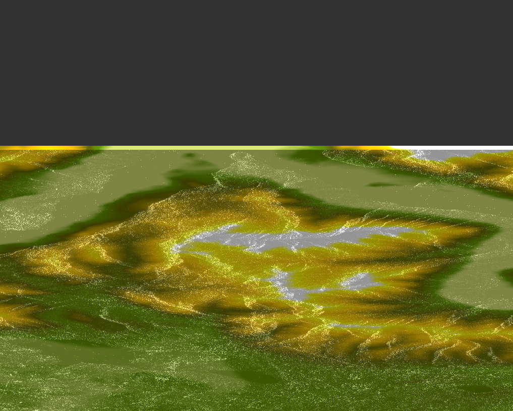
The same shift is also in the terrain corrected DEM. We checked that the DEM in the BigTiff image is shifted and is not correctly geolocated whereas the amplitude image is correctly geolocated.
Any idea about why it happens?
Thank you in advance