Dear Users
I have done a work in which I’d calculate the displacement of 4 points (A, B, C and D) from 4 tracks
with 2 ascending and 2 descending to monitor the AOI .
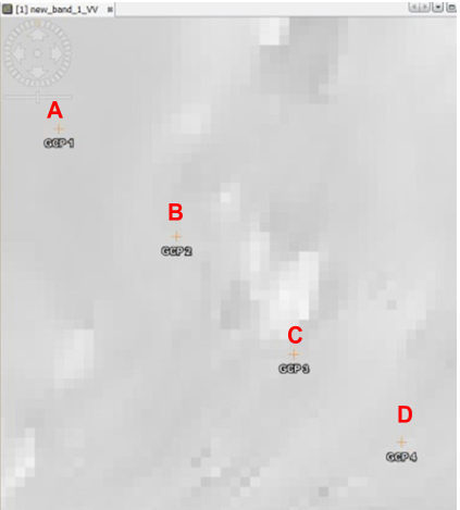
The AOI is in subsidence situation , and it have a rough topography with rugged terrain, mountains and rivers.
the points are in the same level but maybe some of them are in shadow area (NO backscattered signal) for the descending Tracks 1 and 2.
so this table show us the results obtained
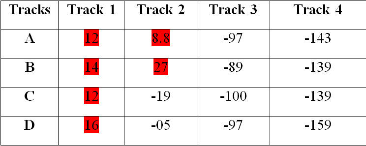
Track 3 and 4 are facing the points
how do you explain this ? am I right in my explanation ?
any further remarks experts ?
Thank you in advance