ENVISAT gecoded and save on geotif
Here what I did:
step1: open Envisat N1
Step2: Radar -> radiometric ->Calibration
Step3: Radar ->Geometric ->Terrain Correction -> Range-Doppler Terrain Correction ->ACE30
->UTM/GWS84
It seem ok, but kmz it shifted.
Do I miss any steps?
Try applying the precise orbits and using the SRTM DEM.
Data is long strip to north pole.
ASA_WSM_1PNPDE20120311_212324_000002693112_00302_52471_1160.N1
Can not use STRM DEM, it is out of bound?
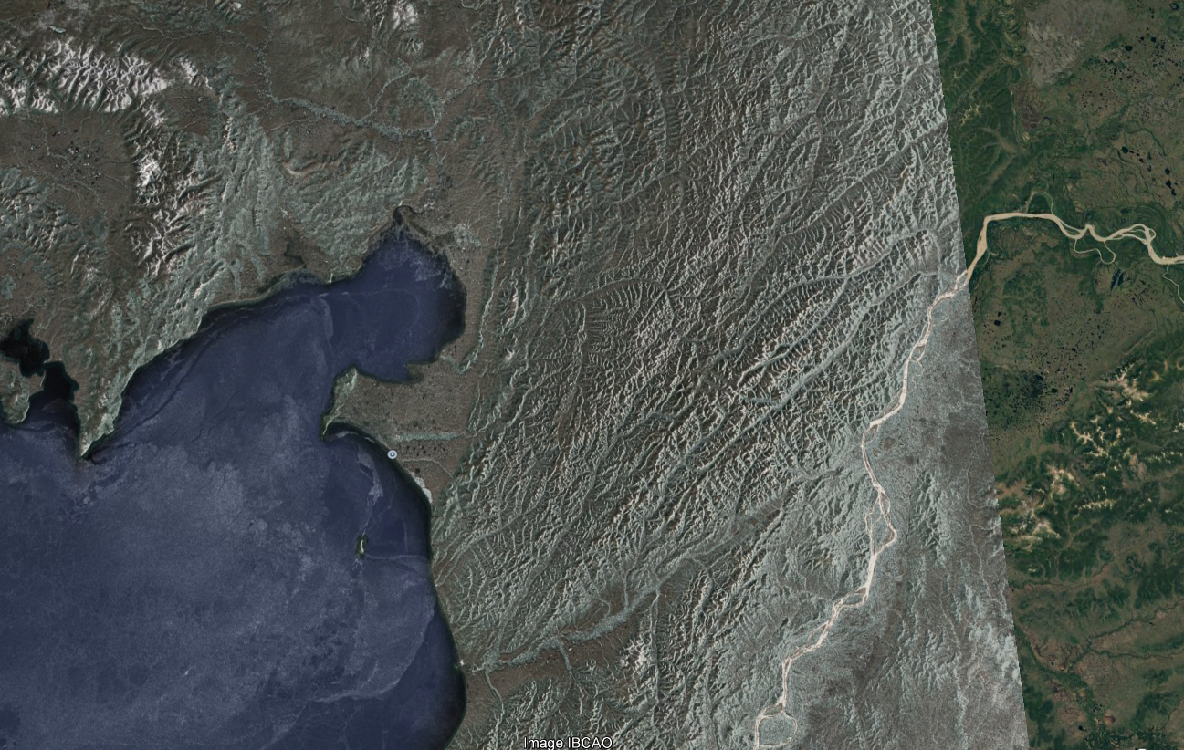
I used GETASSE30 with Lat/Lon projection. The mountains do not look terrain corrected due to the low res DEM but the position on the coast and the Yukon river match Google Earth when exported to KMZ. You should get a much better result with ASTER 1 sec DEM.
I could be wrong but, I think to import images into Google Earth, they should be in wgs84/pseudo mercator (lat/lon).
Thank Iveci, It work perfect.
Another question
In the original backscatter data in this wide swath mode, there are some discontinuities at the beam edges due to 3 different antenna beams that are put together to make this Envisat ASAR scene, which make it looks like there are 3 bands in the image. If the antenna beams are calibrated correctly, the banding problem should go away, is that right?
What step I need to do?