Hello,
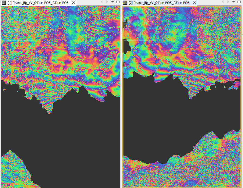
I have a problem with terrain correction in SNAP, with ERS data. After performing terrain correction, the phase is distorted. I noticed this problem only with ERS and Envisat data, not at all with SENTINEL. What might be wrong? Thank you in advance!
Stavroula