hi, would you help me how to estimate above ground biomass from sentinel imagery using gray level co_occurrence matrix
I am not aware of studies where that was shown to be possible.
There are some papers showing positive correlation between texture and biomass.
eg. https://ieeexplore.ieee.org/document/1294615
The GLCM calculation is possible in SNAP from Raster->Image analysis->Texture analysis
1 Like
something similar but also including Sentinel: https://www.mdpi.com/2072-4292/10/6/831
Hi is there any one who help me to correlate forest above ground biomass with vegetation indices
Hi how to do gray level co occurrence matrix from sentinel 1 GRD imagery using SNAP software
You find it under Raster > Image Analysis > Texture Analysis > Grey-Level Co-Occurence Matrix
Thank you very much, I get it.But it unable to do the processing,what preprocessing steps i have to do
Preprocessing of Sentinel-1 is described here: Radiometric & Geometric Correction Workflow
GRD data is sufficient for the derivation of textures. Don’t apply speckle filtering, because it reduces image texture.
Thank you very much!
I have followed all the steps but the final result after doing Range Doppler Terrain Correction is smooth.So is there a way to change to normal image or any other steps to follow?
Can you give an example of what you mean by smooth, maybe with a screenshot?
Which steps exactly did you apply?
Terrain Correction includes resampling of the pixels which slightly changes their values (two neighboring pixels might get changed to one mean value). You can select nearest neighbor resampling during the TC step but this should make not a too big difference.
Otherwise you can increase the radius in the GLCM to derive textures at different scales.
I have followed these steps;
With out (Speckle filtering),and calibrated to sigm0
- Thermal noise removal
- Apply Orbit file
- Calibration to Beta0
- (Speckle filtering)
- Radiometric terrain flattening
- Range Doppler Terrain Correction
But the result is black(smooth) as you can see from the figure.
How does it look after Terrain Flattening?
It unable to do Radiometric terrain flattening on sigma0. But it works on Beta0.
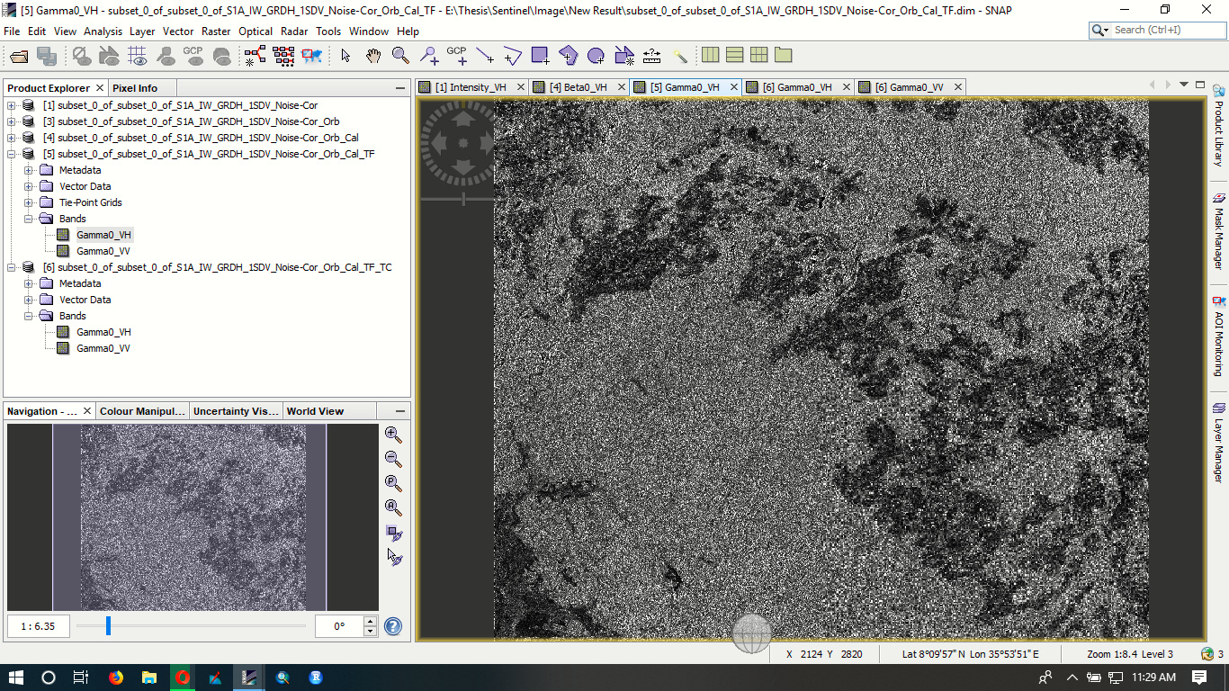
The Range Doppler Terrain Correction result from this TF is the following image which is black.

Sorry,Is there a solution for this problem?
have you tried switching to the SRTM 1Sec instead of 3Sec?
There were problems reported lately regarding the 90m SRTM.
Yes I have tried but still doesn’t work
Hi ABraun, The Geometric correction works on Ellipsoid correction(Average Height Range Doppler. As I read from the manual it works on the average height of the backscatter rather than DEM.Is there much difference between this result and the one which is done using Range Doppler correction? and also is the geometric correction has an effect on the backscatter information(pixel value).