Hello,
I want to export backscattering band from SNAP as TIFF format for further study. The Sentinel-1 GRD was downloaded and processed by the follows:
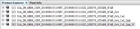
- Apply Orbit File
- Calibrate
- Speckle Filtering
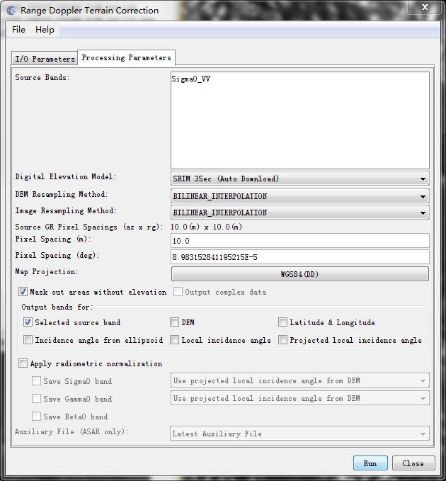
- Range-Doppler Terrain Correction
When the TIFF was opened in ArcGIS, it is error: it’s no valid raster…
When the TIFF was opened in ENVI, it is no pix value.
Are you looking over the ocean? If so just uncheck the “mask out areas without elevation” box.
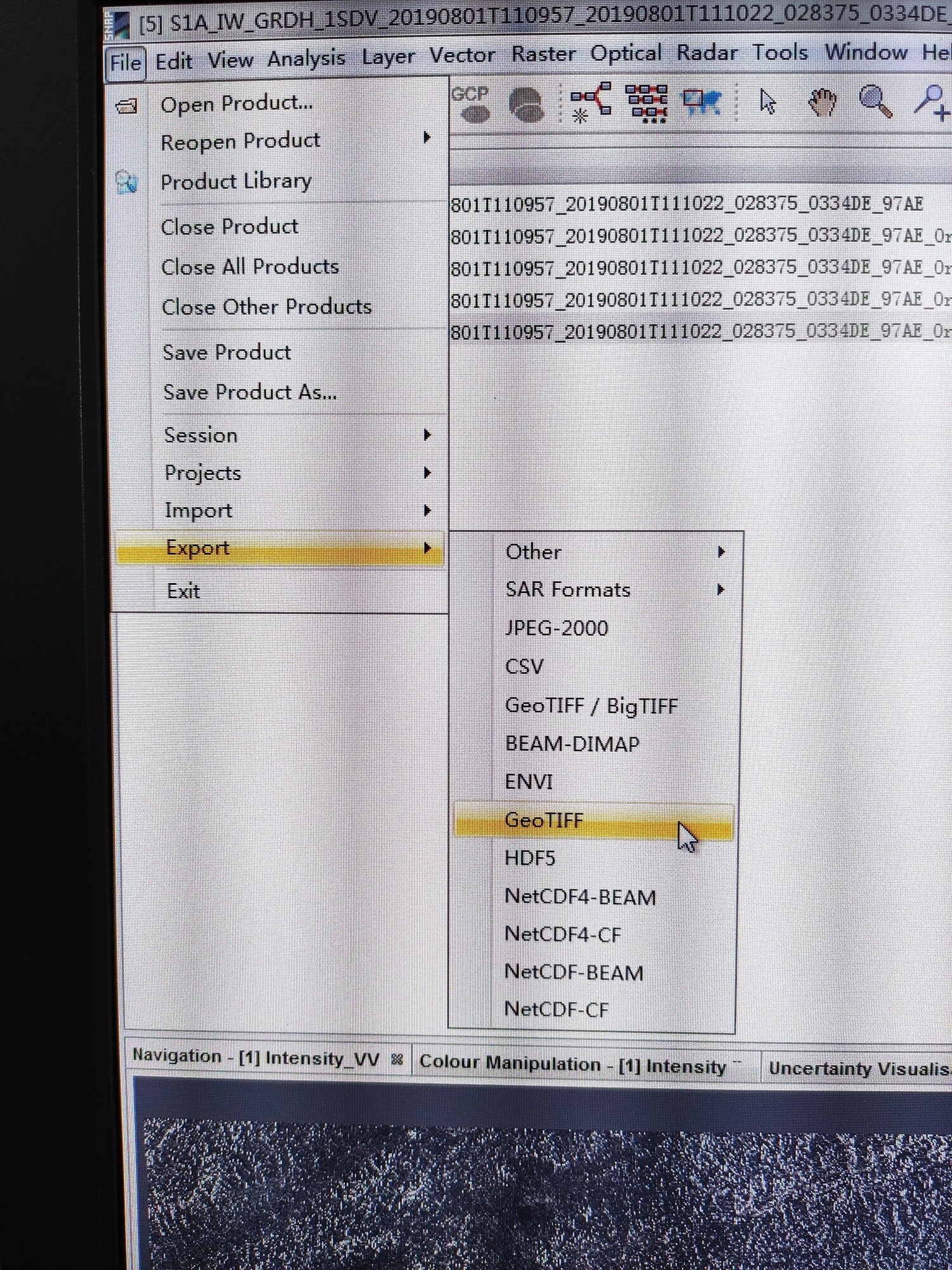
How did you export the image? Why did you not import the .img in ArcGIS instead of using a Tiff?
have you tried leaving BEAM DIMAP as the output format for the Terrain Correction?
It produces a dim file and a data folder. Inside the data folder there is a fully ENVI-compatible img file. Also openable in ArcMap.
1 Like
Thank you. My study area is land. I always thought the Geo-tiff format could be processed in Arcgis and I will try.
The output format for each step is BEAM DIMAP. It’s amazing that I open it directly, thank you very much.
Hello, I opened back scattering band image in ArcMap, and the rang is 0.01-36. However, in some studies the backscattering is negative. Did I process wrong? Or is the sigma value of the Sentinel-1 not backscattered ?
Did you calibrate to Simga0?
Radar backscatter can either be in power scale (Simga0) or log scale (Sigma0db). The latter has a different range of values. Please have a look at the chapter “Conversion to db scale” of this tutorial:
Synergetic use of S1 (SAR) and S2 (optical) data and use of analysis tools (page 9).