if you want to add rasters to existing products in SNAP you first import them and then use the collocation tool. Vectors can be imported through a separate import. It is important that these external data have the same projection (coordinate reference system) as your data in SNAP.
Please explain your problem a bit more. How have you imported the data and what exactly is empty?
You can use additional screenshots for illustration.
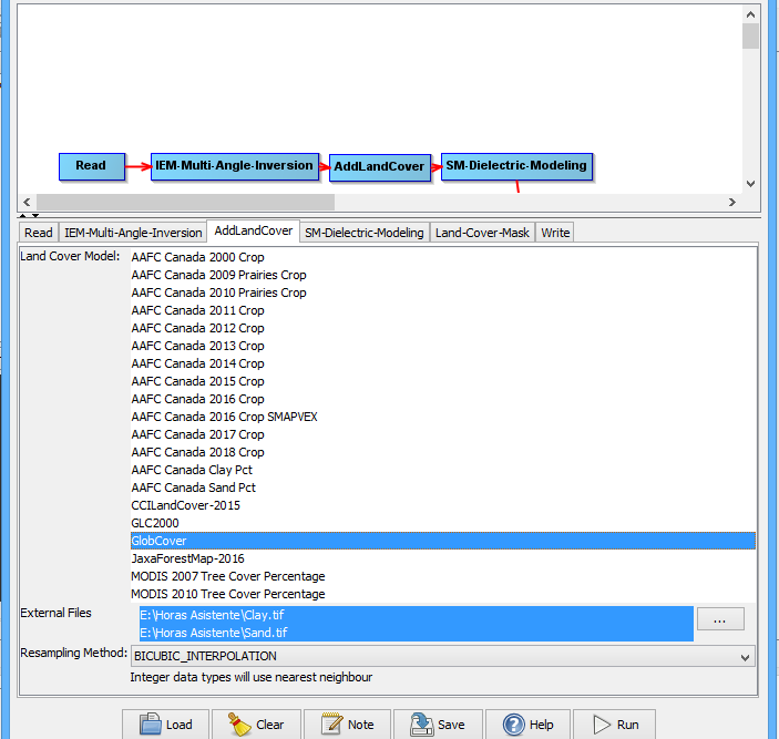
Ohh sure, I want to calculate Soil Moisture using Sentinel-1 with IEM Multi-Angle Inversion, but when I select AddLandCover, I using “GlobalCover” and add the data of Sand and Clay -both in the same projection- but I search the data in the directory of the PC. Later when the process end the results are empty.