lin
January 28, 2019, 7:10am
#1
Hi,
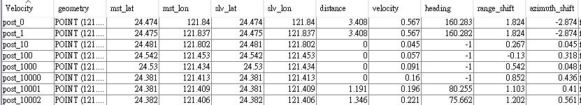
I am using offset tracking to calculate the AZO and trying to change the coordinates from azimuth-range to N-E, but when I open the velocity table as follows:
I am not sure that if the definition of heading is same as I knew.
qglaude
January 28, 2019, 10:59am
#2
From my understanding it is from North, in clockwise order
You can also use the range and azimuth shift and use the platformHeading of the sensor in the metadata
S1A_IW_GRDH … -> Metadata -> Original_Product_Metadata -> annotation -> s1a_iw_grd… -> product -> generalAnnotation -> productInformation -> platformHeading
lin
January 28, 2019, 4:07pm
#3
Thanks for your reply! But I am not sure if the heading means the direction of offset?
qglaude
January 29, 2019, 8:06am
#4
It is the the direction of the offset.
From the codes, you can check it :
/*
 * Copyright (C) 2016 by Array Systems Computing Inc. http://www.array.ca
 *
 * This program is free software; you can redistribute it and/or modify it
 * under the terms of the GNU General Public License as published by the Free
 * Software Foundation; either version 3 of the License, or (at your option)
 * any later version.
 * This program is distributed in the hope that it will be useful, but WITHOUT
 * ANY WARRANTY; without even the implied warranty of MERCHANTABILITY or
 * FITNESS FOR A PARTICULAR PURPOSE. See the GNU General Public License for
 * more details.
 *
 * You should have received a copy of the GNU General Public License along
 * with this program; if not, see http://www.gnu.org/licenses/
 */
package org.esa.s1tbx.insar.gpf;

import com.bc.ceres.core.ProgressMonitor;
import com.vividsolutions.jts.geom.Coordinate;
import com.vividsolutions.jts.geom.GeometryFactory;
show original
and
/*
 * Copyright (C) 2014 by Array Systems Computing Inc. http://www.array.ca
 *
 * This program is free software; you can redistribute it and/or modify it
 * under the terms of the GNU General Public License as published by the Free
 * Software Foundation; either version 3 of the License, or (at your option)
 * any later version.
 * This program is distributed in the hope that it will be useful, but WITHOUT
 * ANY WARRANTY; without even the implied warranty of MERCHANTABILITY or
 * FITNESS FOR A PARTICULAR PURPOSE. See the GNU General Public License for
 * more details.
 *
 * You should have received a copy of the GNU General Public License along
 * with this program; if not, see http://www.gnu.org/licenses/
 */
package org.esa.snap.engine_utilities.eo;

import Jama.Matrix;
import org.apache.commons.math3.util.FastMath;
import org.esa.snap.core.datamodel.GeoPos;
show original