Dear all,
I have hundreds of L2_LAC files and I want to export them to net-cdf format. I wonder if there is a batch operation?
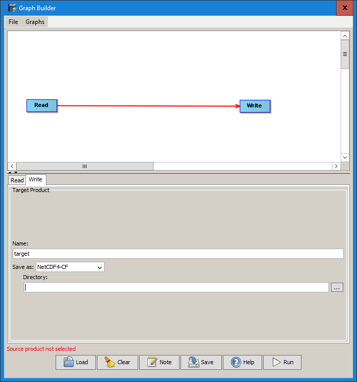
- Create a graph XML with Read > Write (as NetCDF4-CF)
- Apply the graph XML in the batch processing tool
Here’s a short explanation on how it works: https://www.youtube.com/watch?v=S_vNXg5fovQ
I assume you used HDF5 output format as an example. To avoid confusion: NetCDF4-CF is available as an output format and is well supported by current 3rd party tools. At level-2 the grids are swath data so navigation in NetCDF4-CF uses the longitude and latitude bands (some GIS software may require projected grids).
thank you @gnwiii - you are completely right. I mixed up the abbreviations and have edited my post from above.
Dear ABruan,
Thank you very much for your suggestion and I have made it!  The batch processing tool is really a great tool~
Thanks again!