I need the steps applied to create the interferogram in SNAP 6.0 and the phase developed in SNAPHU
these are the steps:
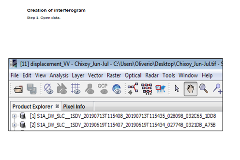
Step 1. Open data
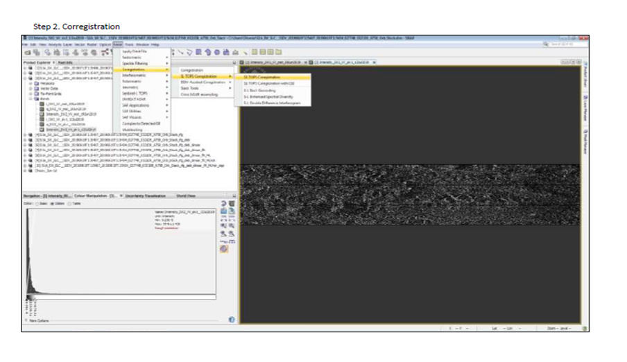
Step 2. Corregistration
Step 3. Interferogram formation

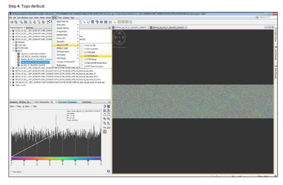
Step 4. Tops derbust
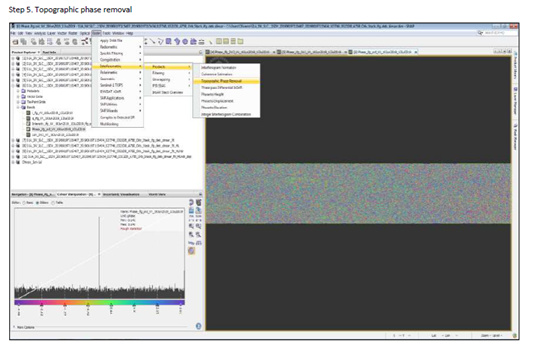
Step 5. Topographic phase removal (DinSAR)
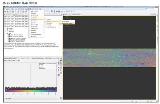
Step 6. Goldstein phase filtering
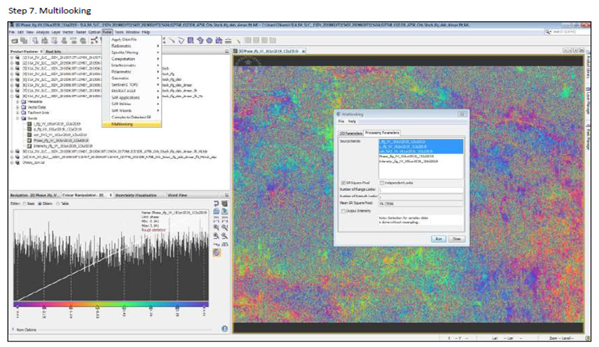
Step 7. Multilooking
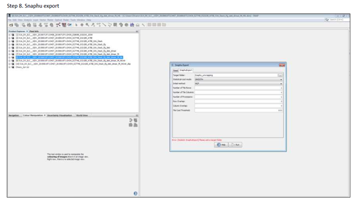
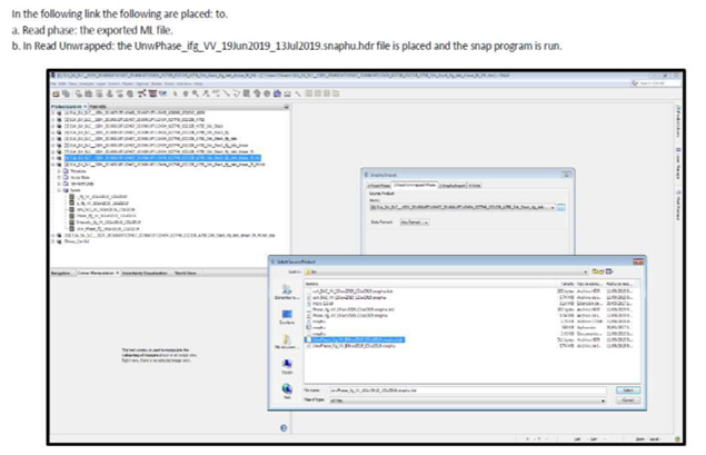
Step 8. Snaphu export
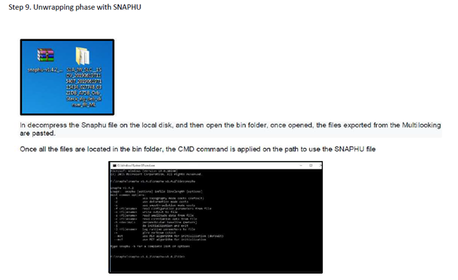
Step 9. Unwrapping phase with SNAPHU
Step 10. Import unwrapping with SNAP
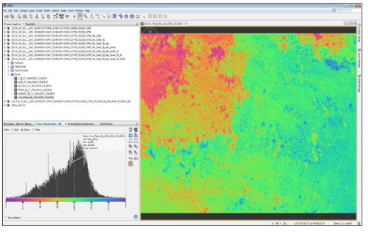
Step 11. Unwrapped phase result
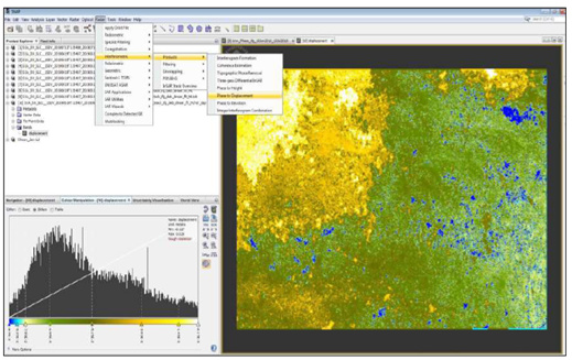
Step 12. Phase conversion in displacement
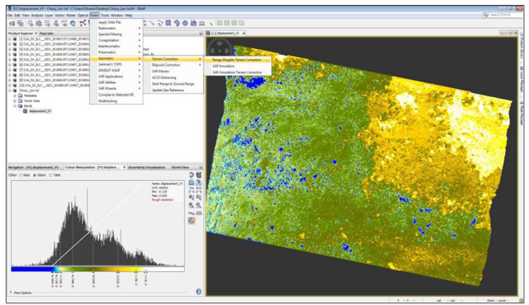
Step 13. Range doppler terrain correction
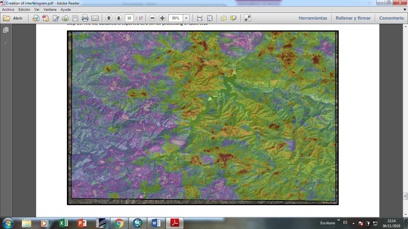
Step 14. The file obtained is exported as a tiff for procesing in QGIS 3.10
From the steps applied i ask for your opinion and the answer according to your experience for the following questions:
a). If the water does not discriminate in the interferogram, how do you eliminate the effect of coherence in slow waters?
b). If the band can identify areas identified by the potential for water erosion and wind erosion in areas without vegetation cover?
c). If the interval time of 1 year can be taken as a reference for surface deformation or subsidence?
Regards,
Paau, Oliver
ingenieriaenambienteyenergia@gmail.com
Guatemala, Centro America.