I have a problem importing the files to SNAP.
So, I have binary files, I tried to import but it is not supported in SNAP. Then I convert to Geotiff using QGIS3. It can be open, but later I cannot do any further anlysis because it is said that :“the input sh0uld be SAR Product”. I have read that any file extraction should be done first in SNAP so the metadata is not loss. But due to the condition that my original file is binary files, I have to convert first. Does anyone have a clue, what should I do to solve this problem?
Kindly help.
These data were pre-processed IDL/ENVI and GAMMA software.Those contain everything, The pre-processing was done completely. I only need to extract the backscatter value and do classification afterwards. I got these products from third person.
I see. SNAP is able to import a lot of formats but there are limits for individually pre-processed files because the metadata structure often does not match.
What do you mean by “extract the backscatter value”? At which step in SNAP do you get the error message " “the input sh0uld be SAR Product”?
So I am gonna convert DN to NRCS, normalized radar cross sections. But it got error, I check the metadata was lost. A lot of information are missing.
And I just do trial with radiometric, geometric calibration, but the message error “input should be sar poduct”. I think the metadata is the main problem here.
What do you suggest, if I have binary data and want to process in snap?
However, without metadata on the geocoding, the Terrain Correction won’t work as well.
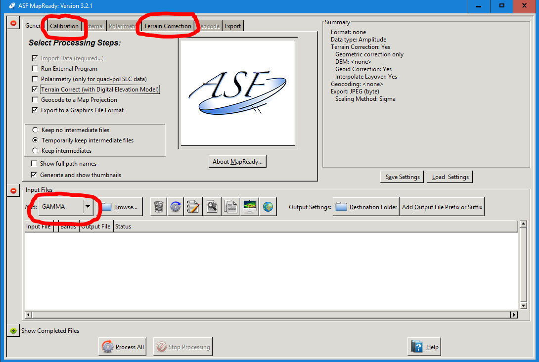
Maybe you can try ASF MapReady: https://www.asf.alaska.edu/data-tools/mapready/
It can import multiple data products (including bin from GAMMA), perform calibration and terrain correct the data with a DEM.
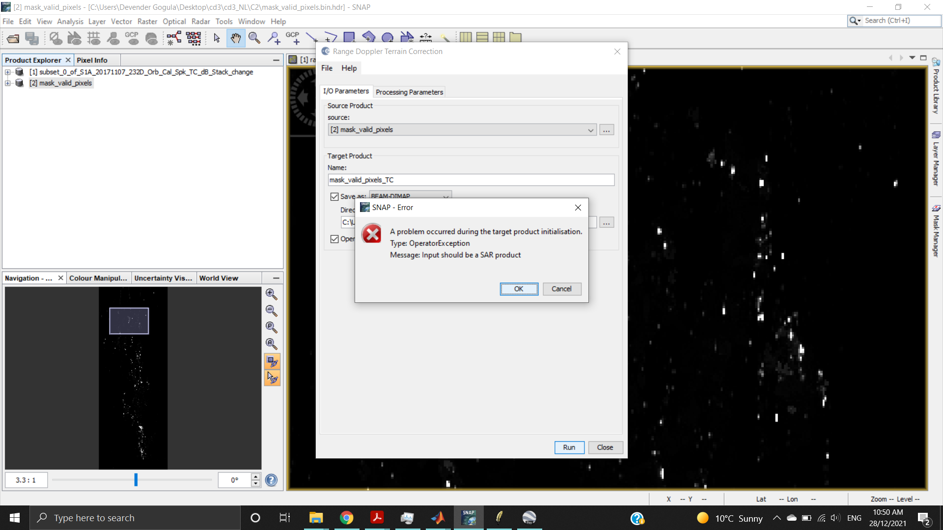
You can’t use the mask as source for the terrain correction. It does not contain the necessary metadata. you need to use one of the many supported SAR data products.
The product that I am processing is GRD
while generating Pol matrix it is asking for SLC only
In the youtube link, subset is done through graph. But i have already processed after doing subset earlier.
Is there any other way that you can suggest.
I think it doesn’t really matter which steps are applied, but the graph allows to export to this specific format which feeds into PolSARpro. I am not aware of another way, but there might be several.