i noticed it, that some of the S2L2A SCL files contains invalid pixel values, like 12, 13 or 14. I remeber, that the valid range is 0 to 11, but I checked the official documentations of the sen2cor 280, and haven’t got any new information about the pixel values of the SCL file. The valid range is still 0 to 11.
Do you have any information, or suggestion regarding to this problem? Sorry if it’s a well-kown problem, and it’s have been discussed before in another topic, i haven’t found related topic.
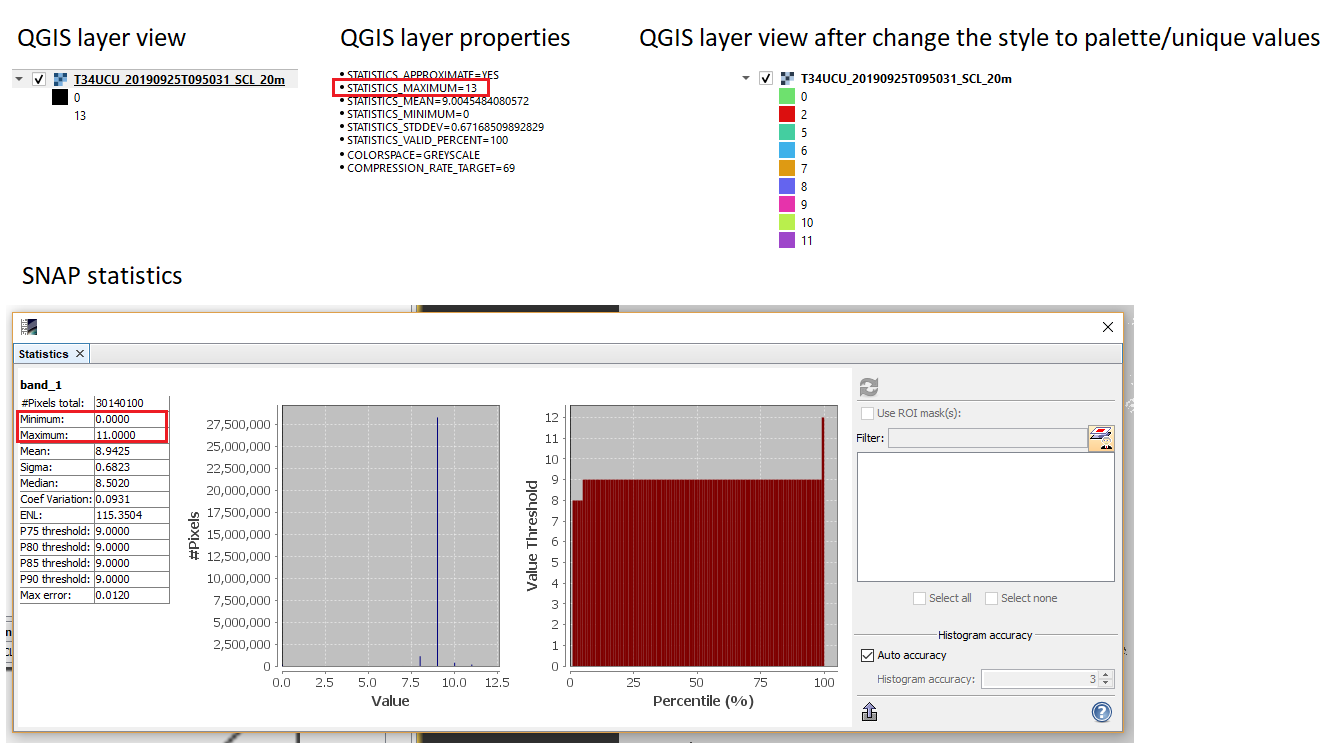
thank you for you reply! When i drag and drop the SCL file into QGIS, on the layer tree i see that, the layer values are in the 0 to 13 interval (top left image). When I check the layer properties, the Statistics_maximum value is 13 as well (top middle image). When i check the statistics in SNAP, i got 0 to 11 values for the SCL band (bottom image). If i change the stlye of the layer in QGIS from default to palette with unique values, i get classes between 0 to 11 (top right image). If i calculate a raster, with “values are greater than 11” condition, i got exclusively 0 values. So, it seems there are no invalid pixel values at all, only something wrong with the QGIS layer view and layer properties view, and that was a bit missleading.