I’m trying to make an interferogram from two ERS images, however the coregistration is taking a long time because I need to use a very large number of GCPs. I tried using subsets of the two images to speed things up, but I was unable to add them to the table in the coregistration window. I was wondering if it is not possible to coregister (and ultimately generate an interferogram from) subsetted SAR data?
I doubt that it’s really possible. There are some steps after the Coregistration and such steps like the Terrain correction cannot be made on the subsetted image
If you applied orbit files on your raw data I see no problem in subsetting them and using the subsets for coregistration.
And you can also perform Terrain Correction on your coregistered stack as well.
Hi All,
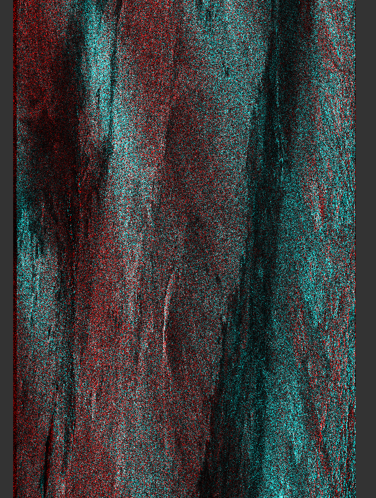
Thanks for getting back to me, I applied orbit files before subsetting, and I managed to run the coregistering tools on the subsets (after saving them), but I never got as far as making interferograms or applying topographic corrections because the results were strange - this was the best I was able to get using DEM assisted coregistration with XCOR:
yes, your screenshot indicates that coregistration wasn’t successful. Despite of the processing time, did you try coregistering the whole images (after orbit file application)? This increases the chance that matching registration points are found.
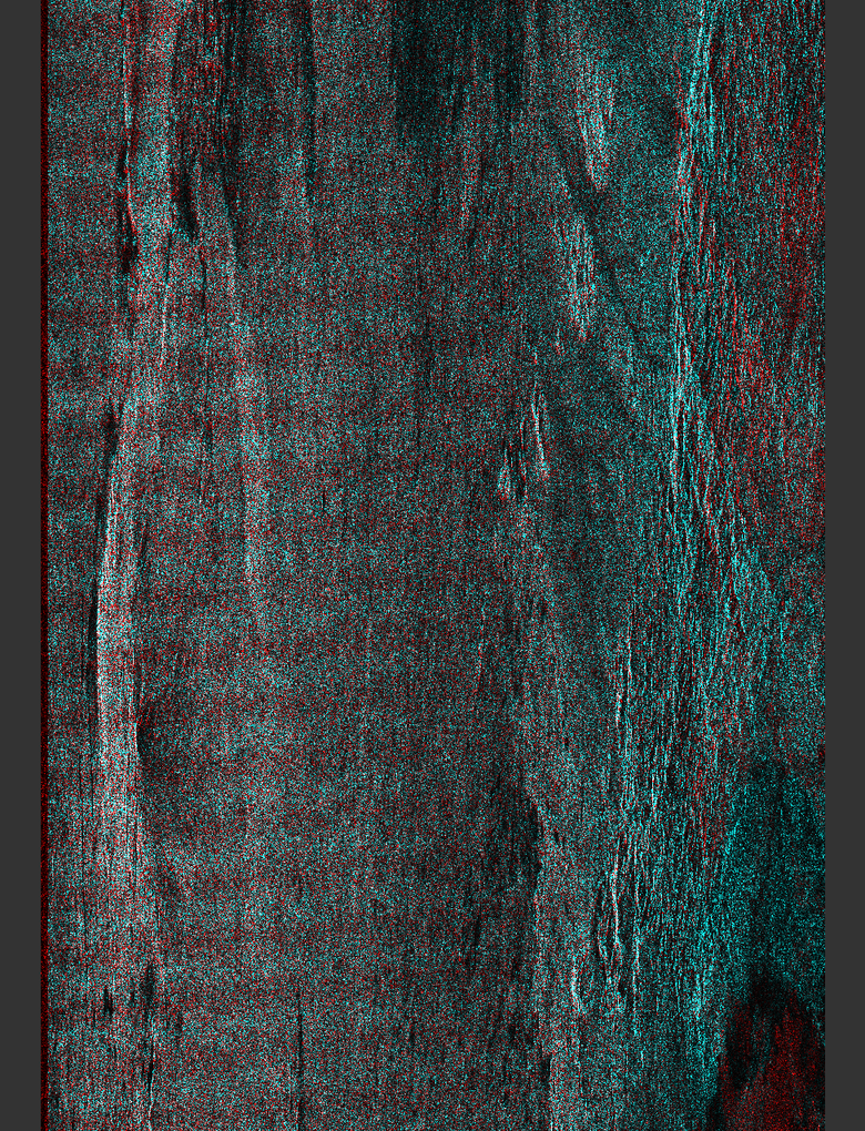
Here’s an example coregistering the full images (after orbit files applied), with default options (standard coreg. not DEM assisted), except number of GCPs increased to 20,000:
The two original files are:
SAR_IMS_1PNESA20031128_074311_00000017A090_00049_44993_0000.E2
SAR_IMS_1PNESA20090306_074529_00000018A145_00049_72548_0000.E2
Hard to tell from the screenshot but doesn’t look correct.
How many GCPs remained? A txt file should have popped up which shows the reduction of valid GCPs.
I think the problem could be the data - the latter image was acquired with ERS-2 in Zero Gyro Mode (ZGM) with degraded pointing accuracy, see this PDF for info:
Use Coregistration operator instead of DEM Assisted Coregistration. Also use 256 or 512 for “Coarse Window Width” and “Coarse Window Height”. See if it helps.
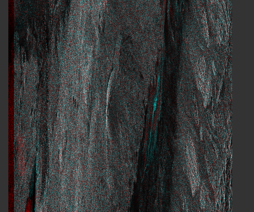
Thanks for your help, I wasn’t aware of the doppler frequency problem. The difference for the two images I used above is -1380.45Hz (with Bperp of -57.28). I tried coregsitering two images with a much smaller fdc of 85.80 Hz (but a large Bperp of -1014), and the results look a lot better:
Do you mean ‘show residuals’ on the warp tab of the coregistration window? I’ve tried checking that, but I don’t get any pop up window / text file when it finishes. (I’ve tried this on both snap 5 on Linux and snap 6 preview 4 on windows). Sorry if I’m missing something obvious here!
Yes, thanks for the links! (For anyone else, I found the GCPS by opening view->tool windows-> radar-> InSAR stack, selecting the stack file in the product explorer and selecting coregistration residuals in the tool window. Note for some reason, if the stack file is expanded in the product explorer it doesn’t seem to recognise it as a stack file and won’t show the residuals, at least on snap 5.0 on linux).
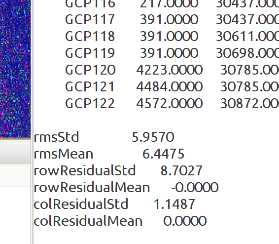
For the successful coregistration with the low doppler frequency difference, I get 122 GCPs and the following statistics:
Does this seem reasonable?
Thanks for having a look! I guess I just have to be more careful choosing ERS pairs to keep the fdc difference low. Going back to the original question, I tried coregistering a subset of the low fdc pair and that worked as well.