Hi everyone!
I have pre-processed a Sentinel-1 GRD tile. The steps include: Thermal Noise Removal, Calibration, Speckle Filtering and Terrain Correction. I’ve used the 1 arc second DEM.
However the hills don’t look correct. Anyone know why this is?
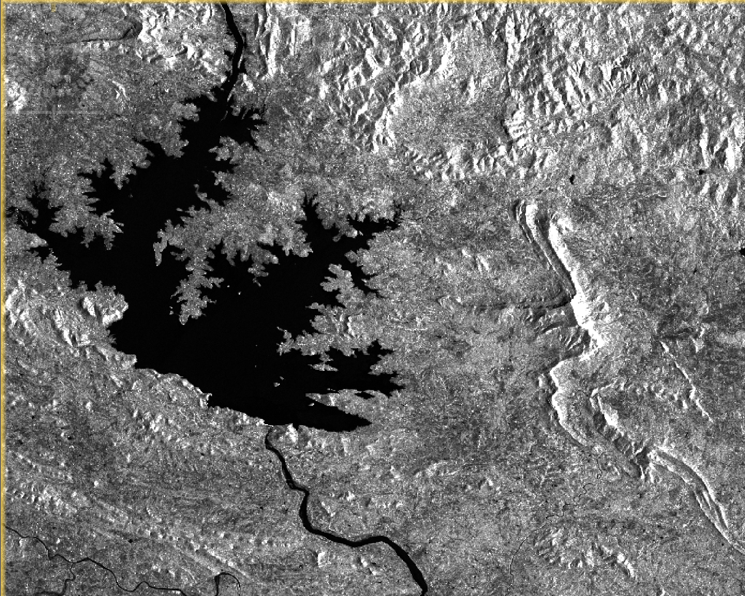
Hi everyone!
I have pre-processed a Sentinel-1 GRD tile. The steps include: Thermal Noise Removal, Calibration, Speckle Filtering and Terrain Correction. I’ve used the 1 arc second DEM.
However the hills don’t look correct. Anyone know why this is?
Range Doppler Terrain Correction only corrects the geometric distortions caused by the looking angle. The radiometric effects are still present, e.g. over-illumination of slopes facing the sensor.
To compensate for these effects, you have to include Terrain Flattening:
Thank you Braun!
I will try it.
ps. It is not recommended to put terrain flattening and terrain correction in the same processing-chain for performance-reasons.
Hi,
I’m working with snappy. Would this mean these are the steps:
If so, how would I merge the two outputs before converting to db?
Thank you.