Hello! I have a mask from QGIS Sentinel 2 and I want to use it in SNAP Sentinel 1. There is a small gap between the Sentinel 1 image and the Sentinel 2 mask. How can I have the same coordinate system for both? Thank you!
Can you please share a screenshot of the offset of the mask in the Sentinel-1 product?
How was the Sentinel-1 produc pre-processed? You have to select UTM coordinates in the Range Doppler Terrain Correction step.
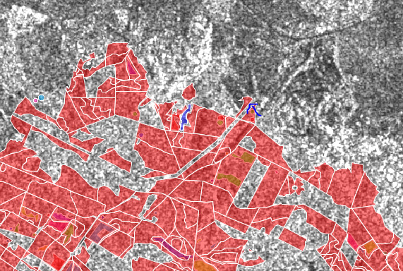
I made an arrow where the space in the masked area should be
I applied Ellipsoid correction with Geolocation Grid because the original image was reversed as in a mirror. For Map Projection I put Lambert-93, as the mask geo coordinate
The fact that the image is flipped is not a problem, it was simply acquired in an ascending orbit. Simply apply Range Doppler Terrain Correction instead of Ellipsoid Correction and select SRTM 1Sec HGT (AutoDownload as DEM and UTM (Auto) as target coordinate reference system. This will increase the geolocation of your data because it takes into consideration topographic distortions. This is not done by Ellipsoid Correction.
I tried other processing in Terrain Correction. I left a few hours to finish, but nothing happens, I have the same window where it appears that the process is loading continuously
this is a known problem, please install the latest updates.
FAQ: A process related to digital elevation models is taking forever to finish
1 Like