On the computer with RAM 16 Gb was all steps on “Offset Tracking Tutorial” are executed
for two images:
- S1A_IW_GRDH_1SSV_20160805T004806_20160805T004831_012458_01376C_99F7
- S1A_IW_GRDH_1SSV_20160829T004807_20160829T004832_012808_01431E_01B3
after performance of “Apply Orbit File” received two files: - 1A_IW_GRDH_1SSV_20160805T004806_20160805T004831_012458_01376C_99F7_Orb
- 1A_IW_GRDH_1SSV_20160829T004807_20160829T004832_012808_01431E_01B3_Orb
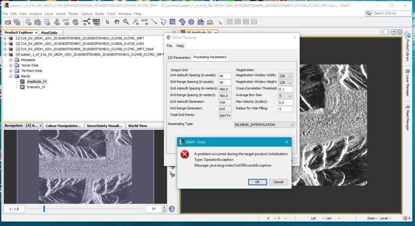
then I open in the SNAP window only images 1 and 2 and I start “DEM Assisted Coregistration”, using SRTM of 3 Sec and then “Create subset image” an “Offset Tracking” as a result appeared a mistake
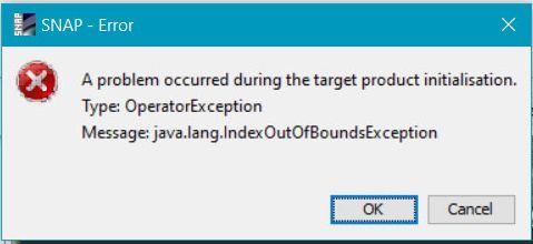
In what reason of this mistake?
Why after coregistration with use of DEM, the image in window will be turned on longitude, that is the right side has to be at the left and vice versa?