Hi,
I find that OLCI geolocation appears to be off compared with MSI images and I wondering if I am missing an important step here?
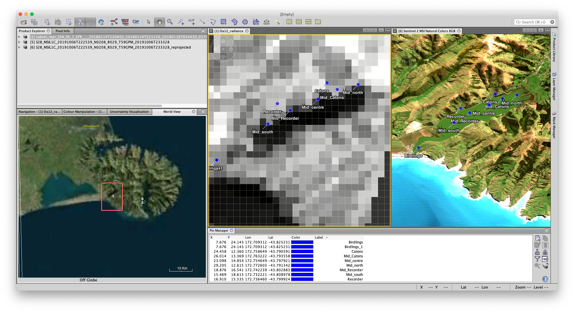
I reproject images to WGS84 Lat/Lon and place some pins in both OLCI and MSI images. The pins appear to be ‘on land’ instead of in the lake in the OLCI. While it is a bit hard to see at OCLI resolution, I have found misalignment also in other images from this and other locations.
I started with OL_1_EFR files and tried reprojecting in both SNAP GUI processing and got (xml attached) and the issue persists with both methodologies.
The MSI image is reprojected using the GUI.
Thank you!
<graph id="Graph">
<version>1.0</version>
<node id="Subset">
<operator>Subset</operator>
<sources>
<sourceProduct>${sourceProduct}</sourceProduct>
</sources>
<parameters class="com.bc.ceres.binding.dom.XppDomElement">
<sourceBands/>
<region>0,0,0,0</region>
<referenceBand/>
<geoRegion>POLYGON ((172.71336364746094 -43.76435089111328, 172.77517700195312 -43.76435089111328, 172.77517700195312 -43.85231018066406, 172.71336364746094 -43.85231018066406, 172.71336364746094 -43.76435089111328, 172.71336364746094 -43.76435089111328))</geoRegion>
<subSamplingX>1</subSamplingX>
<subSamplingY>1</subSamplingY>
<fullSwath>false</fullSwath>
<tiePointGridNames/>
<copyMetadata>true</copyMetadata>
</parameters>
</node>
<node id="Reproject">
<operator>Reproject</operator>
<sources>
<sourceProduct refid="Subset"/>
</sources>
<parameters class="com.bc.ceres.binding.dom.XppDomElement">
<wktFile/>
<crs>GEOGCS["WGS84(DD)",
DATUM["WGS84",
SPHEROID["WGS84", 6378137.0, 298.257223563]],
PRIMEM["Greenwich", 0.0],
UNIT["degree", 0.017453292519943295],
AXIS["Geodetic longitude", EAST],
AXIS["Geodetic latitude", NORTH]]</crs>
<resampling>Nearest</resampling>
<referencePixelX/>
<referencePixelY/>
<easting/>
<northing/>
<orientation/>
<pixelSizeX/>
<pixelSizeY/>
<width/>
<height/>
<tileSizeX/>
<tileSizeY/>
<orthorectify>false</orthorectify>
<elevationModelName/>
<noDataValue>NaN</noDataValue>
<includeTiePointGrids>true</includeTiePointGrids>
<addDeltaBands>false</addDeltaBands>
</parameters>
</node>
</graph>