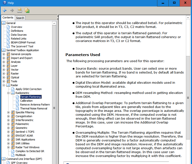
What are the additional user inputs involved in case of Radiometric Terrain Flattening?
-DEM No Data Value
-DEM Resampling Method
-External DEM Apply EGM
-Additional Overlap Percentage
-Oversampling Multiple
Did you see that these are documented in the help?
DEM Resampling Method, Additional Overlap Percentage, Oversampling Multiple
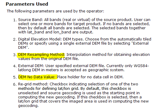
External DEM Apply EGM
EGM stands for Earth Gravitational Model (https://en.wikipedia.org/wiki/Earth_Gravitational_Model) Can be checked for more precise estimation of the earth’s surface.
1 Like