Dear friends
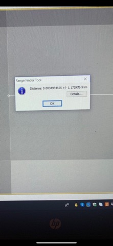
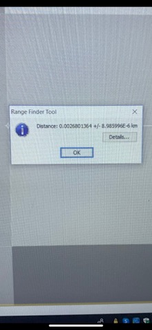
I have a question about spatial resolution of TanDEM-X data. Actually, I opened a TanDEM-X data and I measure its pixel in two different locations;
One in center and it was: 3.…meters
One in side and it was: 2.6…meters
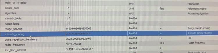
Then I went to metadata and I saw these numbers:
Range-spacing: 0.90940……meters
Azimuth_spacing:2.4174……meters
So, now I have some questions:
- Why when I measure pixels in different location, then I have different amounts?which one is better to report?
- Why range-spacing and azimuth spacing are different than something I measure by ruler in SNAP?
- Actually, when I downloaded data, it has a overview that they wrote its resolution 3.134243488405855meters. so how this is possible?
Would you please guide me?