B) But the pixel size in the SNAP interface is
Pixel Size = (0.000179663056824,-0.000179663056824)
This pixel size in degrees corresponds to 20m and 15m (latitude of this scene is 40deg)
IDL> print, 0.000179663056824d0112000
20.122262
IDL> print, 0.000179663056824d0112000cos(40.!dtor)
15.414547
Why is the resolution in SNAP TC output window (A) different from the resolution in degrees (B)?
Hey,
Hopefully someone will finally take a look at this.
I also have a problem with Range-Doppler terrain correction.
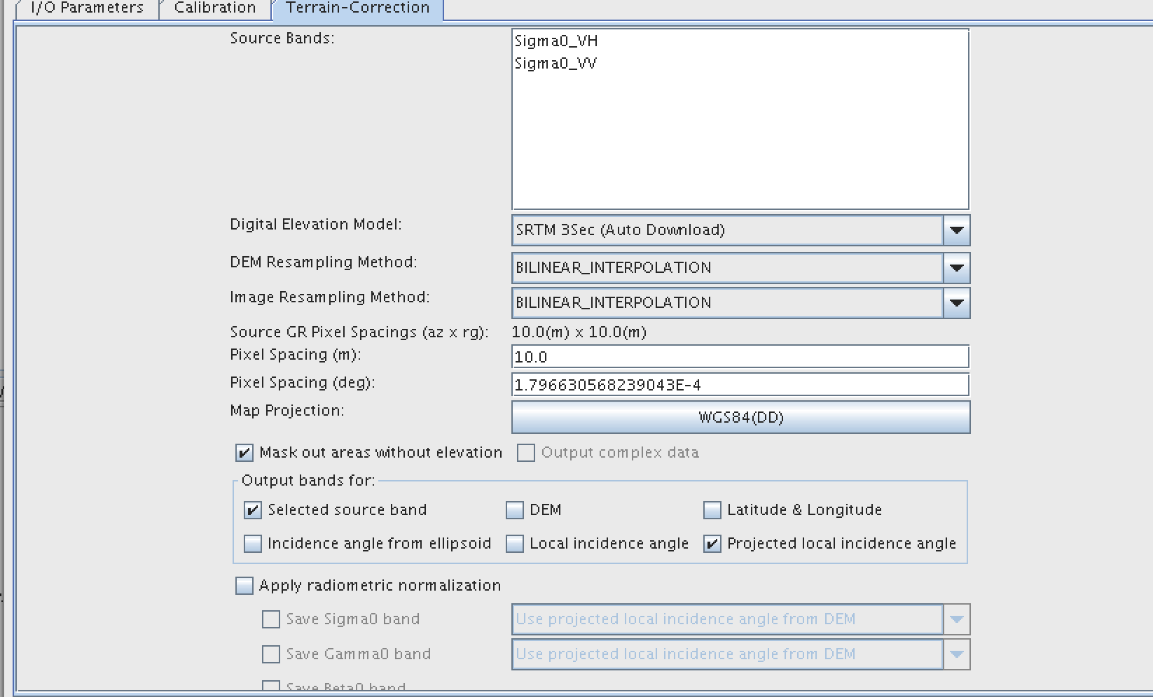
I set Pixel Spacing (m) to be 10.0, but in corrected image I get pixel size of cca 0.0070168683 +/- 2.3526247E-5 km.
Input pixel size for R-D Terrain Correction are truly 10 m.
The same problem happens both with SNAP GUI and Python with snappy.
Is there an answer and a solution to this?
Please somebody correct me if I am wrong… but decimal degrees do not correspond directly to ground measurement as Earth is not totally sphere, due to that, the larger latitudes you are, the Earth radius is factor that can make the spatial resolution to change…
Could you convert it into UTM coordinates (with proper zone), just by reprojecting one product and check later the spatial resolution? I do not normally compare decimal degrees with meters directly exactly due to that…
The conversion between “pixel spacing in meter” and “pixel spacing in degree” in the Terrain Correction UI is not a rigorous one. It simply assumes the earth is a sphere. The idea is that the user can select the pixel spacing either in degree or in meter whichever is convenient. If the user select pixel spacing in meter, then it will be converted to degree using the simple earth model. And the pixel spacing in degree will be used as the pixel spacing in terrain corrected image. But if rigorous conversion is needed, it can be done using the latitude in the center of the image.
Hi…I looked about this glitch on the net and tested many solutions, but I can’t solve this one.
You can see on the second screenshot my problem. In daylight, it’s impossible to see but during the night, all my tree are like ghosts.
To be sure that is not an alpha problem (part of a lightcolor taken by the alpha channel) I replaced leaves map by a full black color and full alpha (with just a black border just in case). This not solved my problem (see first screenshot - open image in full screen).