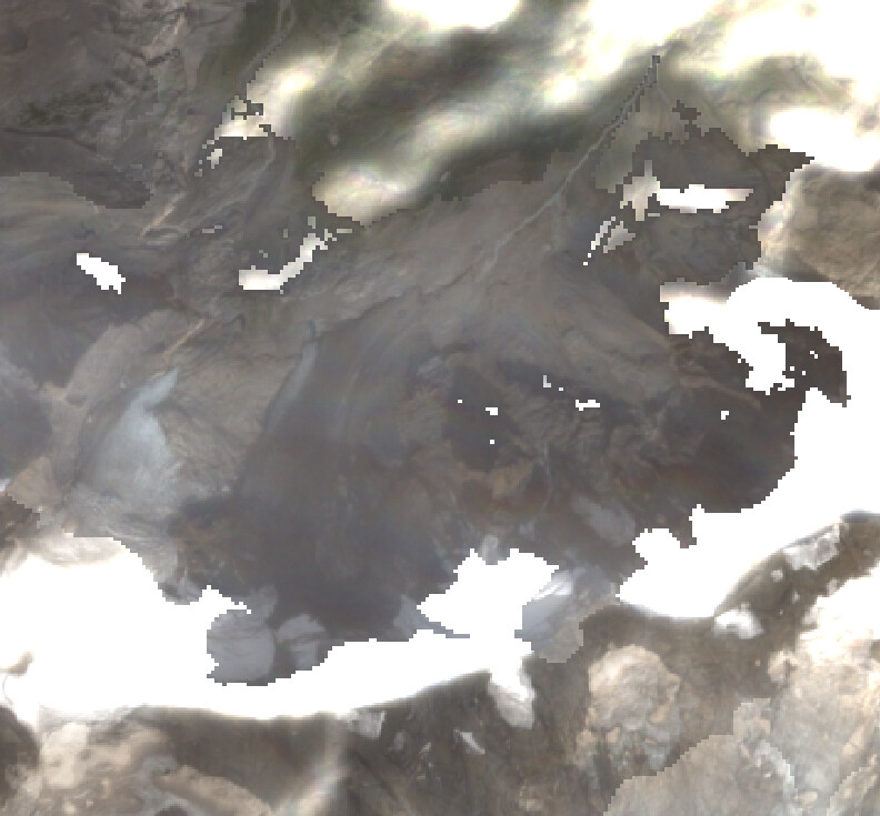
I was creating the RGB image for a S2B-L2A data and I observed that the data has very strange boundaries as though they have been manipulated manually. I am attaching a part of the observed anomaly. I was wondering if this is an issue with the data, if so why? Thank you
Scene details: S2B_MSIL2A_20220913T101629_N0400_R065_T32TMS_20220913T144542
Downloaded from Copernicus hub.
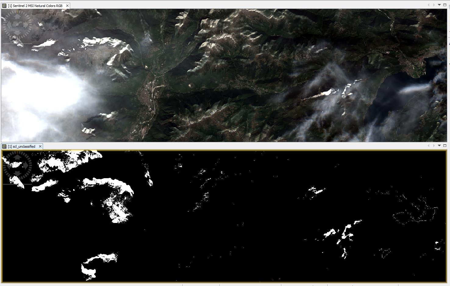
I believe what you are seeing in these baseline 04.00 products is described in Section 5.1 of the L2ADQR for November 2022; issues with the coarse resolution of supporting CCI auxiliary data causing issues in semi-transparent clouds.
If this isn’t the case, I would suggest that an email to the Copernicus Helpdesk would be the best option; this would activate the Level-2 expertise investigation.
@Jan@marpet
Thank you that was indeed correct. There exists a thin cloud over snowy regions causing the distortion.
I believe if I download the L1C image and use sen2cor for correction it can help in giving more realistic images.
Is my understanding correct ?
The effect you see, “(…) the data has very strange boundaries as though they have been manipulated manually. (…)”, is a combined effect related to topographic correction and scene classification.
The L2A processing baseline is defined so that L2A products are corrected from the effect of topography.
The topography correction is generally disabled for pixels identified as clouds in the scene classification. In the case you selected as illustration, the part of the image that looks “normal” is not corrected from the topography whereas the part that looks too bright is over-corrected from topography. There is no simple way to mitigate this effect.
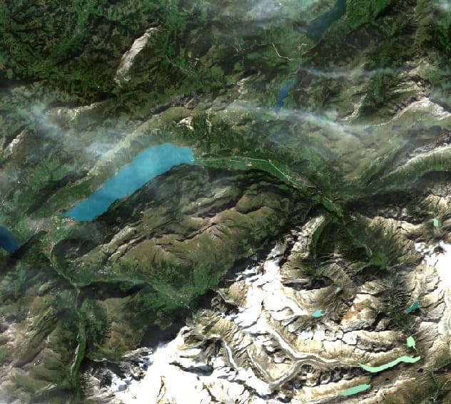
One solution you have is to run Sen2Cor version 2.11 with the terrain correction disabled by setting the following parameter to False in the L2A_GIPP.xml: <DEM_Terrain_Correction>FALSE</DEM_Terrain_Correction>,
as described at the end of section 2.2.8 of the Sen2Cor Software User Manual: “(…) Since Sen2Cor 2.7.0: to decouple the DEM processing between scene classification, AOT and terrain correction a new configuration parameter has been inserted in the L2A_GIPP.xml. Setting <DEM_Terrain_Correction> to ‘FALSE’ will disable the terrain iteration for the terrain corrections, whereas scene classification, AOT (and WVP) are still calculated using the DEM information.”
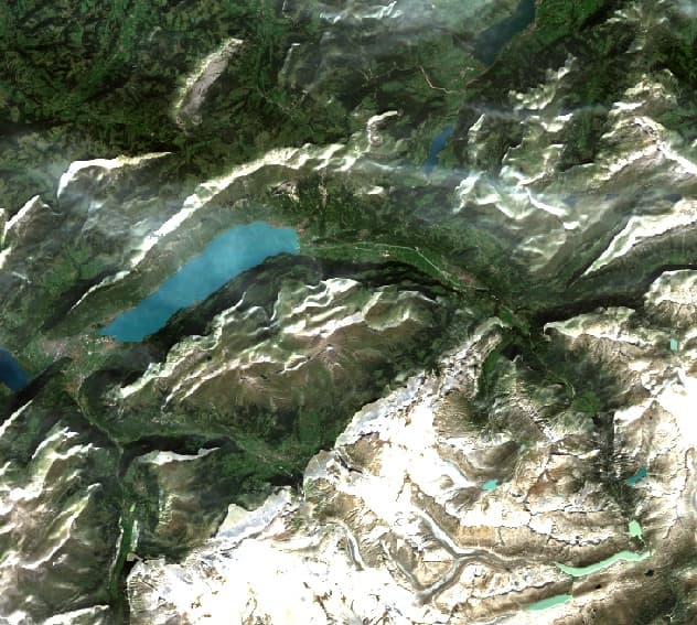
See below a subset of S2B_MSIL2A_20220913T101629_N0400_R065_T32TMS_20220913T144542 and the same area processed with Sen2Cor 2.11 without terrain correction: