Hi
I have two general questions related to how to define a safe file and the sensing start and end time in a safe file
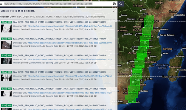
1. For many safe files, the sensing start and stop times recorded in safe file name are the same, which is definitely not correct. Is there any other metadata to provide sensor start and end time correctly? For example, when I search S2A_OPER_PRD_MSIL1C_PDMC_*_R135_V20151129T081916_20151129T081916 in sci hub, a bunch of files pop up. It means all these images spanned almost half Africa are acquired in 1 second at UTC 08:19:16.
2. How to define the along track span of a safe file (related to a datatake)? This question is closely related to the first question. We found different safe files from the same orbit overlap. How are they overlapped? Is different datatakes from the same orbit overlap? Is different datastrips from the same datatake overlap?
https://earth.esa.int/web/sentinel/user-guides/sentinel-2-msi/definitions
The above questions are related because in one safe file there may be two L1C tiles with the same tile ID (i.e., same location) but different data contents from different data strips. See below
Thanks
Hankui Zhang
South Dakota State University, US