Hi every one,
I tried to generate DEM using sentinel 1 data, But the results not good.
The max. elevation In AOI is about 30 m but the resulted is strange(reach t 130 m)
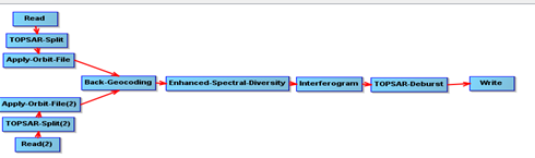
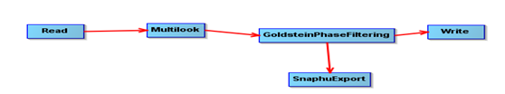
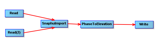
My procedures were
Any help please?
Hi every one,
I tried to generate DEM using sentinel 1 data, But the results not good.
The max. elevation In AOI is about 30 m but the resulted is strange(reach t 130 m)
My procedures were
Any help please?
where is your study area located?
Can you please share screenshots of your interferogram and coherence rasters?
Sorry for the delay,
the study area located in Egypt , port said
interferogram :
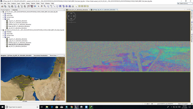
coherence
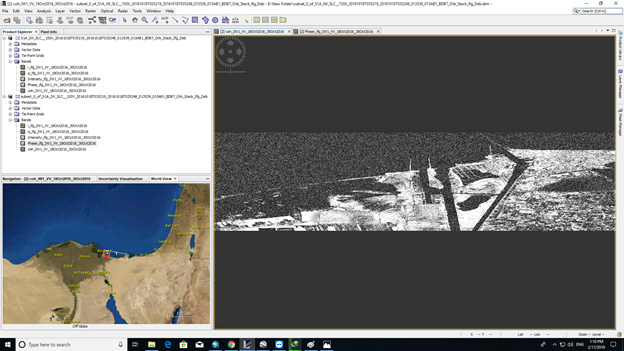
doesn’t look too bad actually.
To prevent unwrapping errors you could mask low coherence areas before running snaphu as described here: https://rus-copernicus.eu/forum/t/masking-low-coherence-areas-before-unwrapping/147
Maybe filtering or multi-looking before unwrapping could increase the quality of the interferogram and increase the chance for correct unwrapping.
Have you created a difference between SRTM and your raster to identify where the discrepancy is largest?
actually, I applied 0.3 as a coherence mask .
i will try again and come back .
Regards
Thanks a lot dear ABraun
it corrected .
were you able to solve your problem? If so, how?