Dear Colleagues SNAP Forum
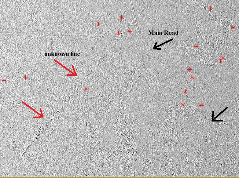
I ask about the Incidence angle for the SAR product, I saw some of the lines don’t seen in SAR Sentinel-1 GRD processed , I think it is a subsurface line (may be lineaments or relict waterway).
Any Ideas or papers about using only incidence angle images for extraction subsurface features.
Note: I knew one of the lines it is the main road, while the other I don’t know what is it?
Red star: location of Archaeological Mounds
Regard
Dear Dr.ABraun
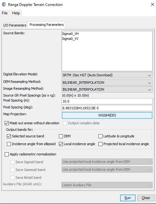
I’m very happy about your response to my topic. The screenshot belongs to the Incidence angle that created with the final Range DopplerTC for the SAR Sentinel-1GRD product, just I checked the box of (Local Incidence angle). See attachment photo. It isn’t (edge detection) Filter.
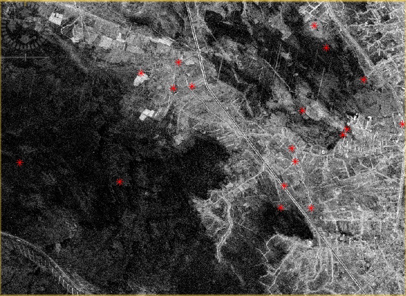
See attachments please for the (Sigma0 VVdb) band Intesity for the same location.
sorry, I misinterpreted it. The local incidence angle is calculated based on the DEM which is used for terrain correction (SRTM 1Sec in your case). So the pattern you observe is not related to SAR backscatter but to terrain attributes alone. Since SNAP8 you can compute slope and aspect for your data as well, maybe you identifdy subtle linear terrain patterns along this line in the slope representation.