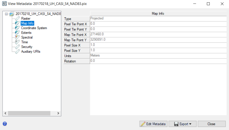
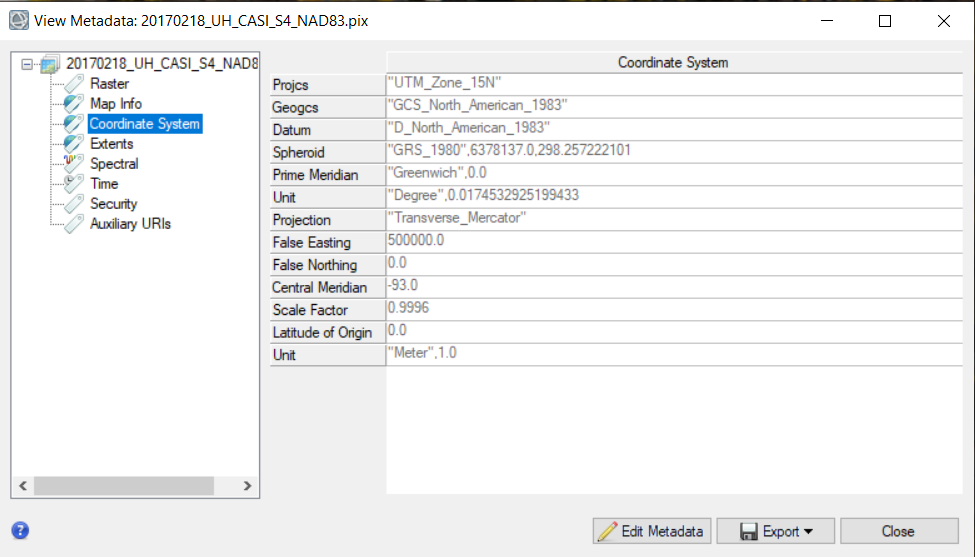
20170218_UH_CASI_S4_NAD83
May I know how to read this dataset apart from North American Datum of 1983 and acquisition date?
20170218_UH_CASI_S4_NAD83
May I know how to read this dataset apart from North American Datum of 1983 and acquisition date?
It would be helpful to explain where this data is from and what format it consits of.
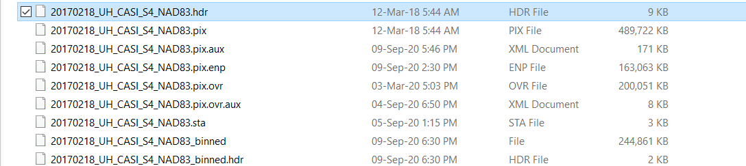
looks like the raster information is in the pix file (or in the _binned file) but I have never seen such as structure. Where is the data from?
I got a Houston dataset from that website which consists of Very High Resolution Multispectral dataset , a Hyperspectral dataset and LiDar GeoTiff Rasters, LiDar Cloud Tiles and Training sets.
Hello,
May I know how to remove this bluish path radiance which I receive after performing false colour composite on dimensionally reduced Hyperspectral data? I tried applying Dark object subtraction method from ENVI but it didn’t work out well. Kindly, let me know if I misunderstood something.
Thank You
dark object subtraction is a way to calibrate the data, but it does not remove atmospheric disturbances, such as water vapor or haze. You will probably need a more advanced cloud removal for this.
May I know what cloud removal technique can be used?
I don’t know what is available in ENVI, sorry.
What data are you using? I’m also not an expert on hyperspectral images.
@ABraun I am using a 2018 IEEE GRSS Data Fusion Contest: Data Fusion Classification Challenge (i.e. Houston). You can find the dataset at this website- http://dase.grss-ieee.org/index.php
phew, I’m afraid I cannot help much here, sorry. Maybe someone else is more experienced with pre-processing hyperspectral data.
This should go into the right direction, right? https://www.harrisgeospatial.com/docs/FLAASH.html
I merged both topics because they are dealing with the same dataset. I also changed the title, because the data is not from the Sentinel/Landsat mission.
No problem, Thank You.
UH - University of Houston
CASI- Compact Airborne Spectrographic Image
S4 - Stripe 4 i.e. which of the stripes that were acquired is contained in the examined file.