I would suggest you to read the original User Manuals of the software you use.
Just remember that in the forum some subjects may not be covered.
Regarding
ref point: requires either the availability of GNSS station with a PS point near that location or a good understanding to get a PS located in a stable point (geodetic point) or over a rock area for which you may have the knowledge to be stable (specific in-situ knowledge)
APS removal: the good answer is always it depends. As it seems you are learning I suggest you to test them all and then verify which works better for your specific use case and study area.
I suggest you dig a bit and find the best approach that you will be familiar with.
Personally, I found it easier to apply TRAIN on linear atmo-topo phase relationship on AOIs containing large topography range difference (> 1km), but this may not solve all APS on the scenes.
Very thanks for your precious feedback and for your time @mdelgado,
I already start investigating these aspects of the workflow. If I reach some interesting results I will write in the forum.
@mdelgado I recently finished my thesis using stamps in which i got good results, one problem I faced is the discontinuation of python 2 and having to use older versions of linux so, is there any chance of getting an update this year that solves these problems?
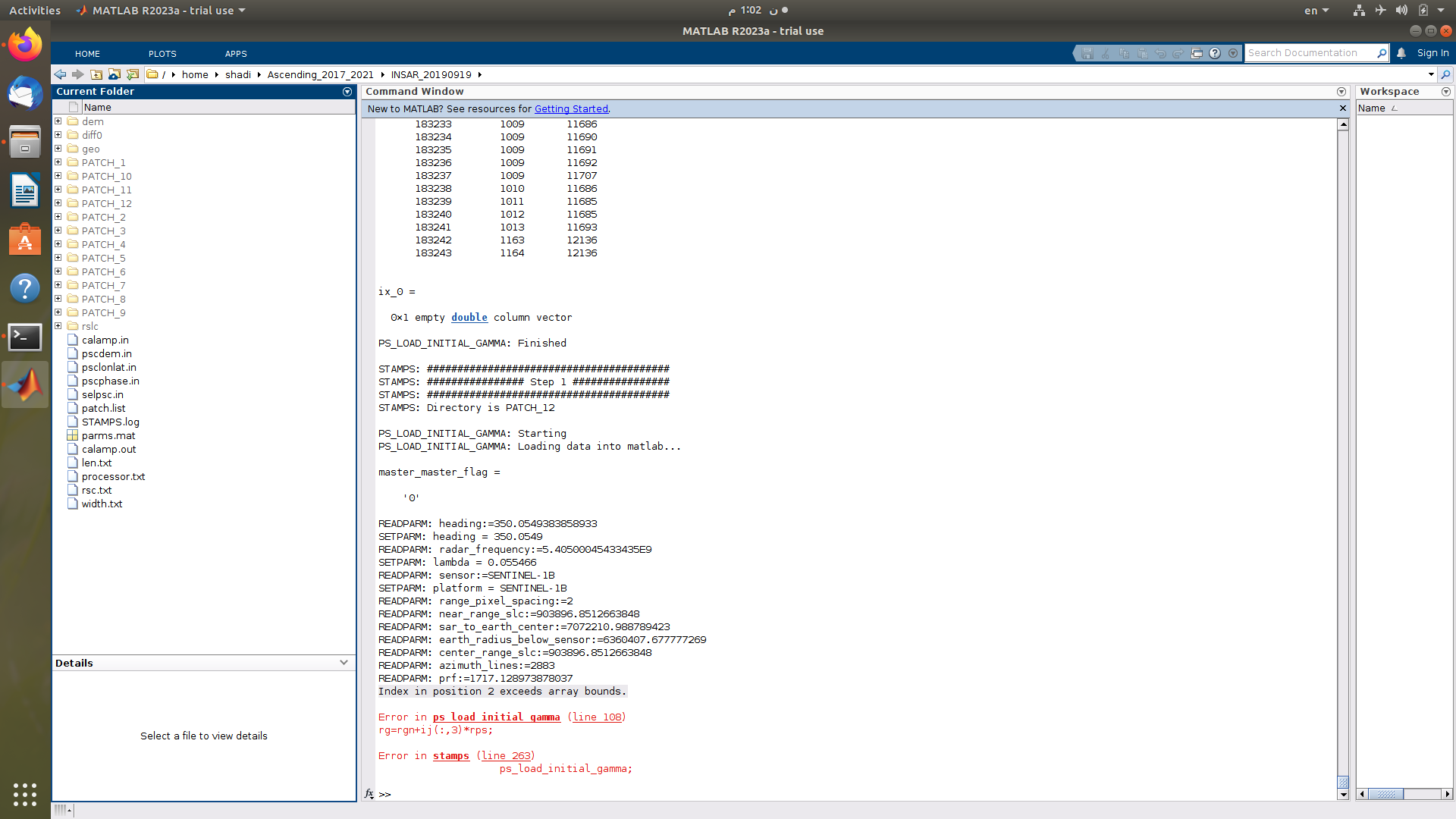
The problem always emerges with the last patch no matter how many patches I try the different values of da, What else can I do? the interferograms look noisy but they are complete, no signs of dark or empty data
@jun_lu :sorry to bother you ,how can I chang the default DEM to SRTM 1Sec HGT in order to get a better result of coregistration regarding Snap2stamps package
Sorry for delayed answer as I have repeated preprocessing with a slightly smaller subset areas making sure the AOI boundaries are still inside the pre-splitted bursts and I still have got the same error eventually. The size of the patches are as following
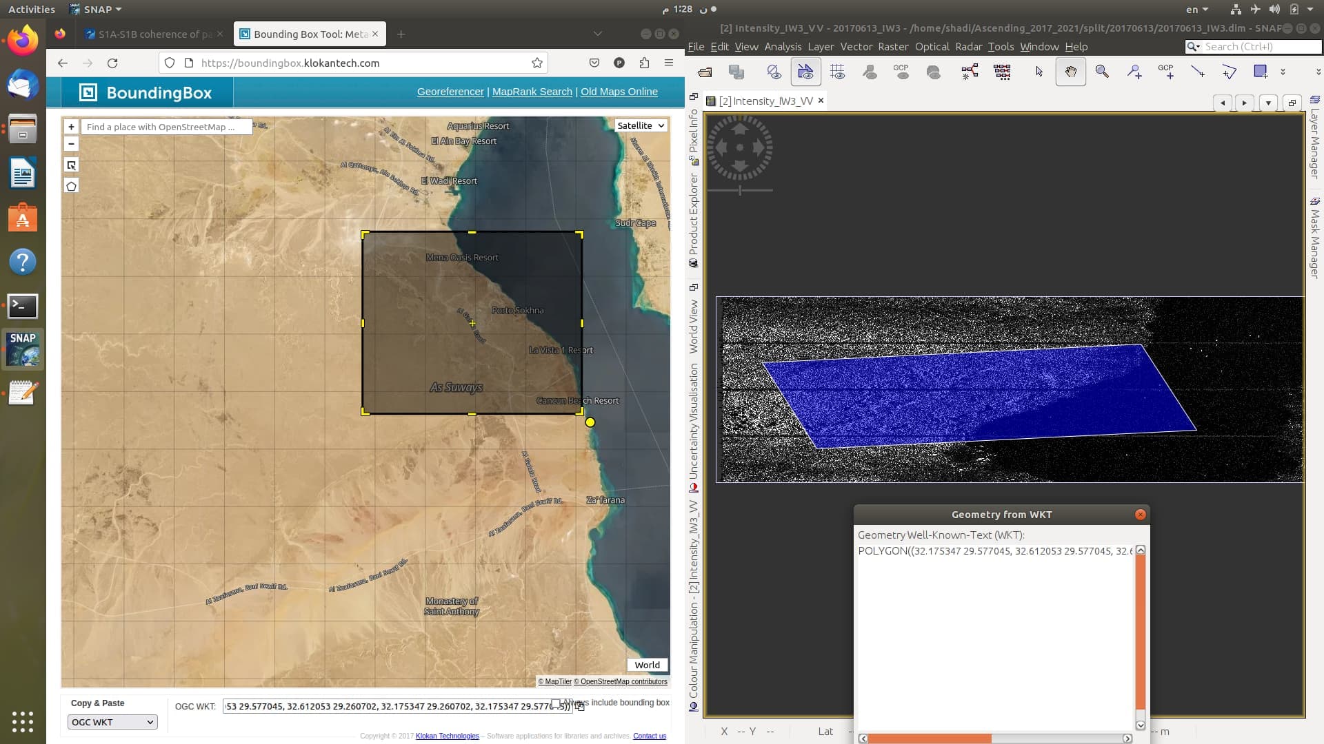
I have doubts that the inclusion of a water body inside the study area may have been causing that error but I have tried a different, older and time series with significantly lesser number of interferograms and it never had that error. Here’s what the AOI looks like
I have plotted some patches and realized the approximate location of Patch 12, it contains mostly water. what is I completely ignore this patch and continue further steps and see if any further error occurs? does ignoring a patch cause any problems after merging, I mean, the AOI would no longer be square/rectagular, so would this missing part disrupt the path-following phase unwrapping process?
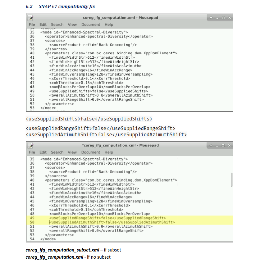
You need to modify certain lines in one of the following graph files
coreg_ifg_computation.xml (if you’re going use the entire area of the pre-split bursts)
coreg_ifg_computation_subset.xml (if you are going to subset AOI from the bursts during the interferogram creation step)
you will replace line 49 with two additional lines as explained in this screenshot
here’s what you will do
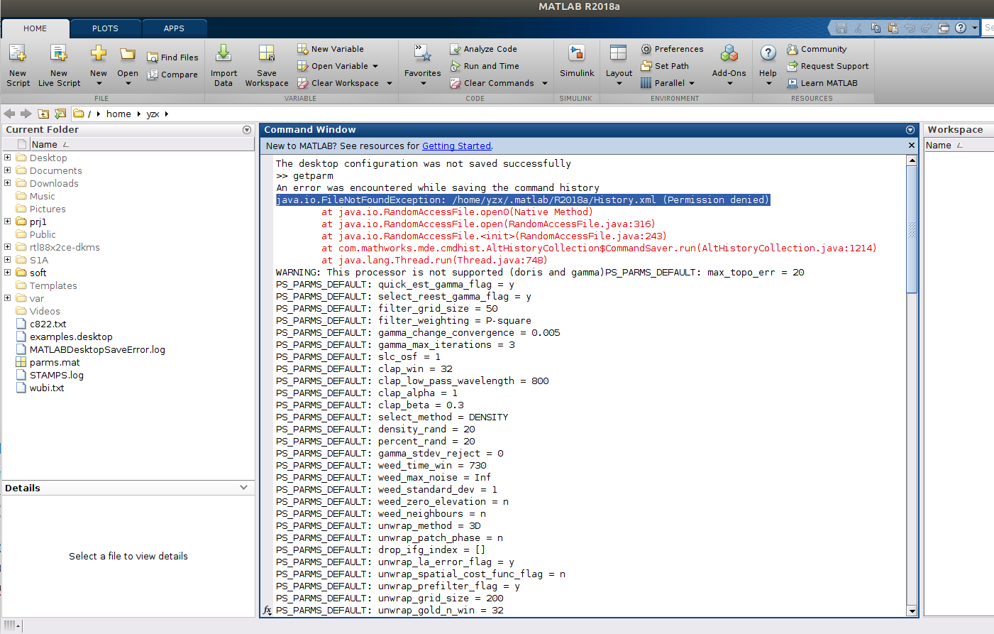
Question:java.io.FileNotFoundException: /home/yzx/.matlab/R2018a/History.xml (Permission denied)
strange!!!,I cann’t find the directory ./matlab and file History.xml after mt_prep_snap(snap9,ubuntu18.04) and set Path in Matlab when typing getparm
I have been attempting to do Psinsar using the snap2Stemp workflow. Following the steps mentioned in the manual, I got to the StaMPS export step, and as a result, a project folder contains the final output structure in four folders: rslc, diff0, geo, and dem. Please, if you could help me, I have some issues.
in order to prepare data before running data, but I have an error when I run mt_prep_snap: command not found.
I installed Stamps-4.1-beta, and I know I need to make some changes to the configuration. My question is: in which lines should I give a path in StaMPS? CONFIG.bash?
I have installed Triangle and Snaphu and made the configuration in StaMPSCONFIG.bash as mentioned in the links that you shared with me. But unfortunately,
I still face the same error when I try to run mt_prep_snap: command not found.