Hello everyone,
I am working with Sentinel 1 GRDH data, after converting it with RADAR \ Terrain Correction \ Range Doppler Terrain Correction
with the algortimo bicubic correction.
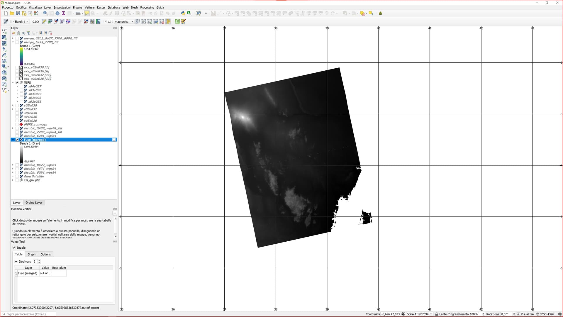
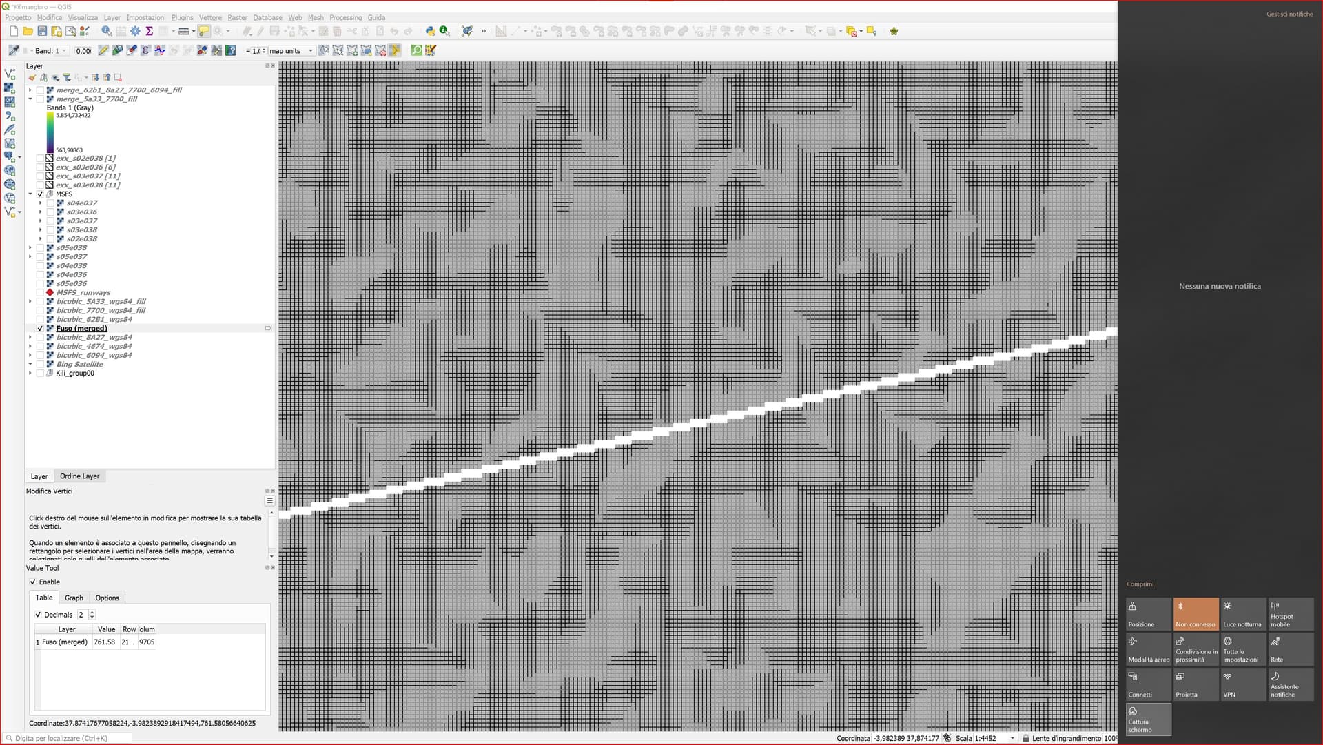
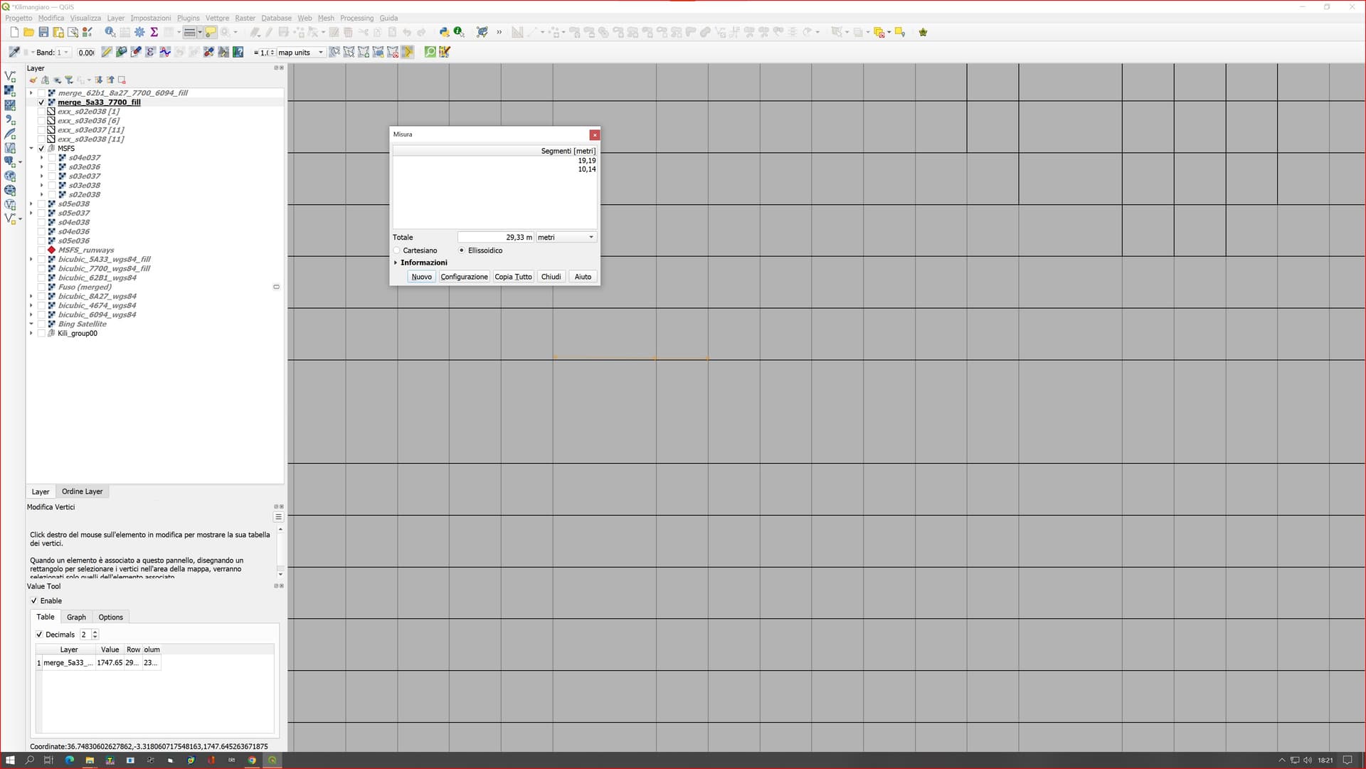
In Qgis 3.26 the .img files merge them in one and on some the result is as in the first figure. I eliminate the nodata values without problems.
My questions (as a beginner) are:
Is that knotted line due to the fact that the two tiles are not perfectly aligned?
Is there a way to get perfectly aligned tiles from the start?
Thanks you!