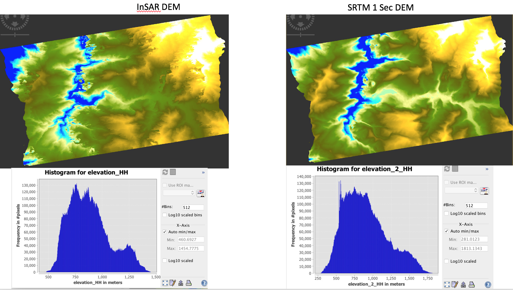
Hi ABruan, I prepared another DEM using ‘Phase to Elevation’ and shown alongside with STM 1 sec below. The altitude range is better than ‘Phase to Height’ generated DEM. Still, it looks like there is vertical shrink in DEM, I mean the lower altitude in pushed to higher value (eg 300m in SRTM in 450 in Insar DEM) and higher altitude is pulled to lower value (g 1700 m in SRTM in 1440 in Insar DEM). It looks like the altitude in both DEM matches around 800m value. Why does this happen? I once tried with Coherence mask at phase filtering step, before snaphu export, but it also wont improve the result much. The scatter plot is also bit improved, but has a shift towards x axis.
. I appreciate your kind help!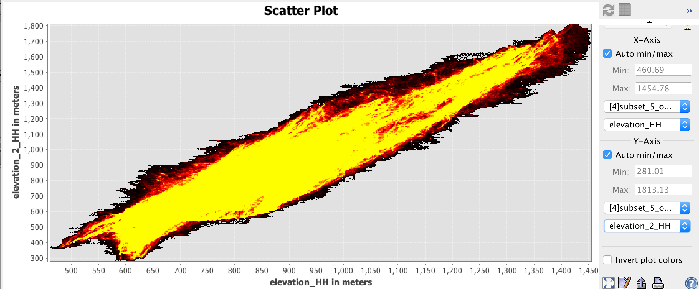
Best,
Ros